Frenches Creek, Queensland

Last updated

Frenches Creek
Queensland
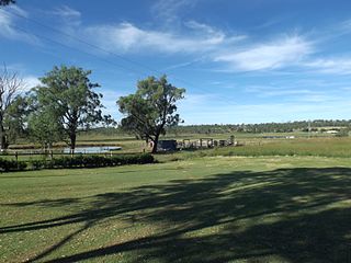
Mount French from Frenches Creek, Queensland.jpg
Looking across Frenches Creek towards Mount French, 2016
Australia Queensland location map.svg
Red pog.svg
Frenches Creek
Coordinates 28°01′22″S152°38′03″E / 28.0227°S 152.6341°E / -28.0227; 152.6341 (Frenches Creek (centre of locality))
Population91 (2021 census) [1]
 • Density9.38/km2 (24.30/sq mi)
Postcode(s) 4310
Area9.7 km2 (3.7 sq mi)
Time zone AEST (UTC+10:00)
LGA(s) Scenic Rim Region
State electorate(s) Scenic Rim
Federal division(s) Wright
Suburbs around Frenches Creek:
Mount French Mount French Mount French
Bunjurgen Frenches Creek Dugandan
Bunjurgen Bunjurgen Dugandan

Frenches Creek is a rural locality in the Scenic Rim Region, Queensland, Australia. [2] In the 2021 census, Frenches Creek had a population of 91 people. [1]

Contents

Geography

Paddocks along Mount Alford Road, 2016 Paddocks along Mount Alford Road at Frenches Creek, Queensland.jpg
Paddocks along Mount Alford Road, 2016

Teviot Brook enter the locality from the south (Bunjurgen) where it forms the south-eastern boundary of the locality and then exits towards the east (Dugundan). The watercourse Frenches Creek (from which the localiity presumably takes its name) rises in the north-west of the locality on the slopes of Mount French and becomes a tributary to Teviot Brook. [3]

Mount Alford Road enters the locality from the east (Dugundan) and exits to the south (Bunjurgen). [4]

There is some irrigated cropping near Teviot Brook with most of the locality being used for grazing on native vegetation. The higher slopes of Mount French in the north-west of the locality are undeveloped. [4]

Demographics

In the 2016 census, Frenches Creek had a population of 85 people. The locality contains 36 households, in which 43.3% of the population are males and 56.7% of the population are females with a median age of 53, 15 years above the national average. The average weekly household income is $1,125, $313 below the national average. [5]

In the 2021 census, Frenches Creek had a population of 91 people. [1]

Education

There are no schools in Frenches Creek. The nearest government primary schools are Boonah State School in Boonah to the north-west and Mount Alford State School in Mount Alford to the south. The nearest government secondary school is Boonah State High School in Boonah to the north-west. [4]

Related Research Articles

<span class="mw-page-title-main">Dugandan, Queensland</span> Town in Queensland, Australia

Dugandan is a rural town and locality in the Scenic Rim Region, Queensland, Australia. In the 2021 census, the locality of Dugandan had a population of 602 people.
<span class="mw-page-title-main">Munbilla, Queensland</span> Town in Queensland, Australia

Munbilla is a rural town and locality in the Scenic Rim Region, Queensland, Australia. In the 2021 census, the locality of Munbilla had a population of 93 people.

<span class="mw-page-title-main">Mount Alford, Queensland</span> Town in Queensland, Australia

Mount Alford is a rural town and locality in the Scenic Rim Region, Queensland, Australia. In the 2021 census, the locality of Mount Alford had a population of 294 people.

<span class="mw-page-title-main">Wyaralong, Queensland</span> Suburb of Scenic Rim Region, Queensland, Australia

Wyaralong is a rural locality in the Scenic Rim Region, Queensland, Australia. In the 2021 census, Wyaralong had "no people or a very low population".

<span class="mw-page-title-main">Coochin, Queensland</span> Suburb of Scenic Rim Region, Queensland, Australia

Coochin is a rural locality in the Scenic Rim Region, Queensland, Australia. In the 2021 census, Coochin had a population of 115 people.

<span class="mw-page-title-main">Coulson, Queensland</span> Suburb of Scenic Rim Region, Queensland, Australia

Coulson is a rural locality in the Scenic Rim Region, Queensland, Australia. In the 2021 census, Coulson had a population of 168 people.

<span class="mw-page-title-main">Charlwood, Queensland</span> Suburb of Scenic Rim Region, Queensland, Australia

Charlwood is a rural locality in the Scenic Rim Region, Queensland, Australia. In the 2021 census, Charlwood had a population of 146 people.

<span class="mw-page-title-main">Bunjurgen, Queensland</span> Suburb of Scenic Rim Region, Queensland, Australia

Bunjurgen is a rural locality in the Scenic Rim Region, Queensland, Australia. In the 2021 census, Bunjurgen had a population of 107 people.

<span class="mw-page-title-main">Carneys Creek, Queensland</span> Rural locality in Queensland, Australia

Carneys Creek is a rural locality in the Scenic Rim Region, Queensland, Australia. It borders New South Wales. In the 2021 census, Carneys Creek had a population of 71 people.

<span class="mw-page-title-main">Fassifern, Queensland</span> Suburb of Scenic Rim Region, Queensland, Australia

Fassifern is a rural locality in the Scenic Rim Region, Queensland, Australia. In the 2021 census, Fassifern had a population of 18 people.

<span class="mw-page-title-main">Fassifern Valley, Queensland</span> Suburb of Scenic Rim Region, Queensland, Australia

Fassifern Valley is a rural locality in the Scenic Rim Region, Queensland, Australia. In the 2021 census, Fassifern Valley had a population of 112 people.

Croftby is a rural locality in the Scenic Rim Region, Queensland, Australia. The town of Teviot is within the locality. In the 2021 census, Croftby had a population of 129 people.

<span class="mw-page-title-main">Mount Edwards, Queensland</span> Suburb of Scenic Rim Region, Queensland, Australia

Mount Edwards is a rural locality in the Scenic Rim Region, Queensland, Australia. In the 2021 census, Mount Edwards had a population of 60 people.

Anthony is a rural locality in the Scenic Rim Region, Queensland, Australia. In the 2021 census, Anthony had a population of 133 people.

Bunburra is a rural locality in the Scenic Rim Region, Queensland, Australia. In the 2021 census, Bunburra had a population of 93 people.

Burnett Creek is a rural locality in the Scenic Rim Region, Queensland, Australia. It borders New South Wales to the south. In the 2021 census, Burnett Creek had a population of 16 people.

Morwincha is a rural locality in the Scenic Rim Region, Queensland, Australia. In the 2021 census, Morwincha had a population of 35 people.

Radford is a rural locality in the Scenic Rim Region, Queensland, Australia. In the 2021 census, Radford had a population of 31 people.

Wallaces Creek is a rural locality in the Scenic Rim Region, Queensland, Australia. In the 2021 census, Wallaces Creek had a population of 74 people.

Ipswich–Boonah–Rathdowney Road is a continuous 87.8 kilometres (54.6 mi) road route in the Ipswich and Scenic Rim regions of Queensland, Australia. It has two official names, Ipswich–Boonah Road and Boonah–Rathdowney Road. The entire route is signed as State Route 93, and much of it is also part of Tourist Drive 16.

References

  1. 1 2 3 Australian Bureau of Statistics (28 June 2022). "Frenches Creek (SAL)". 2021 Census QuickStats. Retrieved 28 February 2023. OOjs UI icon edit-ltr-progressive.svg
  2. "Frenches Creek – locality in Scenic Rim Region (entry 50203)". Queensland Place Names. Queensland Government . Retrieved 20 July 2021.
  3. Google (15 September 2021). "Frenches Creek, Queensland" (Map). Google Maps . Google. Retrieved 15 September 2021.
  4. 1 2 3 "Queensland Globe". State of Queensland . Retrieved 15 December 2021.
  5. Australian Bureau of Statistics (27 June 2017). "Frenches Creek (SSC)". 2016 Census QuickStats. Retrieved 20 October 2018. OOjs UI icon edit-ltr-progressive.svg