Boyland, Queensland

Last updated

Boyland
Queensland
Paddocks at Boyland.jpg
View northwards from Boyland Road, 2014
Australia Queensland location map.svg
Red pog.svg
Boyland
Coordinates 27°56′21″S153°07′48″E / 27.9391°S 153.13°E / -27.9391; 153.13 (Boyland (centre of locality))
Population855 (2021 census) [1]
 • Density20.50/km2 (53.10/sq mi)
Postcode(s) 4275
Area41.7 km2 (16.1 sq mi)
Time zone AEST (UTC+10:00)
Location
LGA(s) Scenic Rim Region
State electorate(s) Scenic Rim
Federal division(s) Wright
Suburbs around Boyland:
Mundoolun Tamborine Tamborine Mountain
Birnam Boyland Tamborine Mountain
Tabragalba Biddaddaba Wonglepong

Boyland is a rural locality in the Scenic Rim Region, Queensland, Australia. [2] In the 2021 census, Boyland had a population of 855 people. [1]

Contents

Geography

Boyland's western extent is defined by the Albert River. In the east the slopes of Tamborine Mountain rise sharply to elevations greater than 500 m.[ citation needed ]

History

The area is named after the Boyland railway station which is in turn named after George Boyland, the chairman of Tamborine Shire Council from 1907 to 1908 and supporter of the Canungra branch railway. [2]

Boyland Post Office opened on 1 July 1927 (a receiving office had been open from 1915) and closed in 1945. [3]

Boyland railway station ( 27°56′38″S153°07′55″E / 27.9439°S 153.132°E / -27.9439; 153.132 (Boyland railway station) ) was on the Canungra branch railway, which operated from 1915 to 30 June 1955. [4] [5]

In 1948 a hall in the Canungra Church grounds was relocated to Bibbaddaba Street in Boyland (approx 27°56′34″S153°07′58″E / 27.9429°S 153.1329°E / -27.9429; 153.1329 (St Hilda's Anglican Church (former)) ) to hold Anglican services. The land was donated by Ronald Graham. [6] St Hilda's Anglican Church was dedicated on 3 May 1953 by Coadjutor Bishop Horace Henry Dixon. The lack of funds for necessary repairs resulted in the closure of the church with its last service being held on 5 March 1965. The building was relocated to Wonglepong where George Smith used it as a shed. The interior fittings and furnishings were donated to other churches with the chairs going to St George's Anglican Church on Tamborine Mountain, while the altar, cross and organ went to the proposed chapel at the Australian Army's Jungle Training Centre at Canugra. [6] [7]

Demographics

In the 2011 census, Boyland recorded a population of 715 people, 52.4% female and 47.6% male. [8] The median age of the Boyland population was 38 years, compared to the national median age of 37. 78.9% of people living in Boyland were born in Australia. The other top responses for country of birth were New Zealand 6.4%, England 5.6%, Guam 1%, Germany 0.8%, Netherlands 0.6%. 95.1% of people spoke only English at home; the next most common languages were 1.3% Italian, 0.6% German, 0.6% Czech. [8]

In the 2016 census Boyland had a population of 823 people. [9]

In the 2021 census, Boyland had a population of 855 people. [1]

Education

There are no schools in Boyland. The nearest government primary schools are Canungra State School in Canungra to the south and Beaudesert State School in Beaudesert to the south-west. The nearest government secondary schools are Beaudesert State High School in Beaudesert, Yarrabilba State Secondary College in Yarrabilba to the north, and Tamborine Mountain State High School in neighbouring Tamborine Mountain to the east. [10]

Attractions

Rotary Lookout is on the eastern edge of the locality opposite 154-172 Main Western Road ( 27°56′24″S153°10′47″E / 27.94°S 153.1797°E / -27.94; 153.1797 (Rotary Lookout) ), accessed via Tamborine Mountain. [11] [12]

Related Research Articles

<span class="mw-page-title-main">Beaudesert, Queensland</span> Town in Queensland, Australia

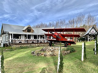
Beaudesert is a rural town and locality in the Scenic Rim Region, Queensland, Australia. In the 2016 census, Beaudesert had a population of 6,395 people.

<span class="mw-page-title-main">Canungra, Queensland</span> Town in Queensland, Australia

Canungra is a rural town and locality in the Scenic Rim Region, Queensland, Australia. In the 2016 census, the locality of Canungra had a population of 1,229 people.

<span class="mw-page-title-main">Tamborine Mountain</span> Suburb of Scenic Rim Region, Queensland, Australia

Tamborine Mountain is a plateau and locality in the Scenic Rim Region, Queensland, Australia. In the 2021 census, Tamborine Mountain had a population of 8,105 people.

<span class="mw-page-title-main">Scenic Rim Region</span> Local government area in Queensland, Australia

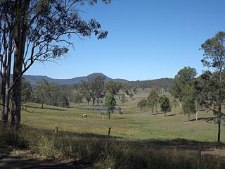
The Scenic Rim Region is a local government area in West Moreton region of South East Queensland, Australia. Also, is southern part of the Brisbane. Established in 2008, it was preceded by several previous local government areas with histories extending back to the early 1900s and beyond. The main town of the region is Beaudesert.

<span class="mw-page-title-main">Beechmont, Queensland</span> Town in Queensland, Australia

Beechmont is a rural town and locality in the Scenic Rim Region, Queensland, Australia. In the 2016 census, the locality of Beechmont had a population of 842 people.

<span class="mw-page-title-main">Logan Village, Queensland</span> Town in Queensland, Australia

Logan Village is a semi-rural town and locality in the City of Logan, Queensland, Australia. Logan Village was once known as the head of the navigable Logan River. Its importance as a town grew again when the railway arrived.

<span class="mw-page-title-main">Beaudesert railway line</span> Former branch railway in South East Queensland, Australia

The Beaudesert railway line is a disused branch railway in South East Queensland, Australia. The first section opened in 1885, the line was completed in 1888 and operated as a Queensland Government Railways (QGR) line until 1996. A heritage operation was undertaken for a short period in 2003. The Canungra railway line connected at Logan Village between 1915 and 1955, and the Beaudesert Shire Tramway connected with the terminal between 1903 and 1944. A study was undertaken in 2010 by the Queensland government concerning a potential Salisbury-to-Beaudesert rail corridor as a long-term potential proposal.

<span class="mw-page-title-main">Clagiraba, Queensland</span> Suburb of Gold Coast, Queensland, Australia

Clagiraba is a rural locality in the City of Gold Coast, Queensland, Australia. In the 2021 census, Clagiraba had a population of 651 people.

<span class="mw-page-title-main">Yarrabilba</span> Suburb of Logan City, Queensland, Australia

Yarrabilba is a locality in the City of Logan, Queensland, Australia. In the 2021 census, Yarrabilba had a population of 10,240 people.

<span class="mw-page-title-main">Nindooinbah, Queensland</span> Suburb of Scenic Rim Region, Queensland, Australia

Nindooinbah is a rural locality in the Scenic Rim Region, Queensland, Australia. In the 2021 census, Nindooinbah had a population of 95 people.

<span class="mw-page-title-main">Wonglepong, Queensland</span> Suburb of Scenic Rim Region, Queensland, Australia

Wonglepong is a rural locality in the Scenic Rim Region, Queensland, Australia. In the 2021 census, Wonglepong had a population of 364 people.

Witheren is a rural locality in the Scenic Rim Region, Queensland, Australia. In the 2021 census, Witheren had a population of 581 people.

<span class="mw-page-title-main">Biddaddaba, Queensland</span> Suburb of Scenic Rim Region, Queensland, Australia

Biddaddaba is a rural locality in the Scenic Rim Region, Queensland, Australia. In the 2021 census, Biddaddaba had a population of 171 people.

<span class="mw-page-title-main">Illinbah, Queensland</span> Suburb of Scenic Rim Region, Queensland, Australia

Illinbah is a rural locality in the Scenic Rim Region, Queensland, Australia. In the 2021 census, Illinbah had a population of 128 people.

<span class="mw-page-title-main">Tamborine, Queensland</span> Town in Queensland, Australia

Tamborine is a rural town in the Scenic Rim Region and a locality split between the Scenic Rim Region and the City of Logan in Queensland, Australia. In the 2016 census, the locality of Tamborine had a population of 3,950 people.

<span class="mw-page-title-main">O'Reilly, Queensland</span> Suburb of Scenic Rim Region, Queensland, Australia

O'Reilly is a rural locality in the Scenic Rim Region, Queensland, Australia. It borders New South Wales. In the 2021 census, O'Reilly had a population of 114 people.

<span class="mw-page-title-main">Laravale, Queensland</span> Town in Queensland, Australia

Laravale is a rural locality in the Scenic Rim Region, Queensland, Australia. In the 2016 census, Laravale had a population of 189 people.

<span class="mw-page-title-main">Gleneagle, Queensland</span> Suburb of Scenic Rim Region, Queensland, Australia

Gleneagle is a rural locality in the Scenic Rim Region, Queensland, Australia. In the 2021 census, Gleneagle had a population of 2,106 people.

Benobble is a rural locality in the Scenic Rim Region, Queensland, Australia. In the 2021 census, Benobble had a population of 29 people.

<span class="mw-page-title-main">Cainbable, Queensland</span> Suburb of Scenic Rim Region, Queensland, Australia

Cainbable is a rural locality in the Scenic Rim Region, Queensland, Australia. In the 2021 census, Cainbable had a population of 85 people.

References

  1. 1 2 3 Australian Bureau of Statistics (28 June 2022). "Boyland (SAL)". 2021 Census QuickStats. Retrieved 28 February 2023. OOjs UI icon edit-ltr-progressive.svg
  2. 1 2 "Boyland – locality in Scenic Rim Region (entry 48961)". Queensland Place Names. Queensland Government . Retrieved 29 December 2020.
  3. Phoenix Auctions History. "Post Office List". Phoenix Auctions. Retrieved 5 April 2021.
  4. "Tamborine" (Map). Queensland Government. 1954. Archived from the original on 2 April 2020. Retrieved 4 July 2020.
  5. "6 State Branch Railway lines To Be Closed". Townsville Daily Bulletin . Vol. LXXV. Queensland, Australia. 15 January 1955. p. 1. Retrieved 8 June 2024 via National Library of Australia.
  6. 1 2 Libke, Joyce (30 October 2019). "Our History - Buildings". Canungra Times . p. 30. Retrieved 4 July 2020.
  7. "Closed Anglican Churches". Anglican Church South Queensland. Archived from the original on 3 April 2019. Retrieved 29 June 2020.
  8. 1 2 Australian Bureau of Statistics (31 October 2012). "Boyland (State Suburb)". 2011 Census QuickStats. Retrieved 17 August 2014. OOjs UI icon edit-ltr-progressive.svg
  9. Australian Bureau of Statistics (27 June 2017). "Boyland (SSC)". 2016 Census QuickStats. Retrieved 20 October 2018. OOjs UI icon edit-ltr-progressive.svg
  10. "Queensland Globe". State of Queensland . Retrieved 5 April 2021.
  11. "Rotary Lookout – lookout in Scenic Rim Regional (entry 49653)". Queensland Place Names. Queensland Government . Retrieved 29 December 2020.
  12. "Rotary Lookout – lookout in the Scenic Rim Region (entry 49653)". Queensland Place Names. Queensland Government . Retrieved 5 April 2021.

Further reading