Lower Mount Walker, Queensland

Last updated

Lower Mount Walker
Queensland
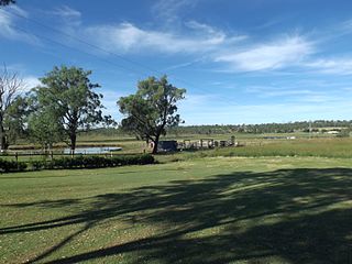
Fields along Stokes Crossing Road Lower Mount Walker.jpg
Fields along Stokes Crossing Road, 2015
Australia Queensland location map.svg
Red pog.svg
Lower Mount Walker
Coordinates 27°43′05″S152°31′31″E / 27.7180°S 152.5252°E / -27.7180; 152.5252 (Lower Mount Walker (centre of locality))
Population192 (SAL 2021) [1]
Postcode(s) 4340
Area58.6 km2 (22.6 sq mi)
Time zone AEST (UTC+10:00)
Location
LGA(s)
State electorate(s) Scenic Rim
Federal division(s)
Suburbs around Lower Mount Walker:
Calvert Lanefield
Rosewood
Ebenezer
Grandchester Lower Mount Walker Mount Forbes
Mount Mort Mount Walker West Mount Walker

Lower Mount Walker is a locality split between the Scenic Rim Region and City of Ipswich local government areas of South East Queensland, Australia. [2] [3] In the 2021 census, Lower Mount Walker had a population of 192 people. [4]

Contents

Geography

The Bremer River enters the locality from the south (Mount Walker West / Mount Walker) and exits to the north-east (Rosewood). [5]

Rosewood-Warrill View Road enters the locality from the north-east (Rosewood) and exits to the south-east (Mount Walker). [5]

Lower Mount Walker is home to a remnant swamp tea-tree forest which is considered critically endangered. [6]

The land use is predominantly grazing on native vegetation with some crop growing, mostly near the Bremer River. [5]

History

Mount Walker Lower Provisional School opened on 12 November 1923. In 1927, the school building was relocated from Mount French to Lower Mount Walker. [7] Mount Walker Lower State School was proclaimed on 19 March 1928. The school closed circa 1945. [8] [9] It was at 286-294 Mount Walker West Road ( 27°42′18″S152°32′14″E / 27.7051°S 152.5372°E / -27.7051; 152.5372 (Mount Walker Lower State School (former)) ). [10] [11]

Demographics

In the 2016 census, Lower Mount Walker has a population of 185. The locality contained 70 households, in which 51.4% of the population were males and 48.6% of the population were females with a median age of 44, 6 years above the national average. The average weekly household income was $1,437, $1 below the national average. None of Lower Mount Walker's population was either of Aborigional or Torres Strait Islander descent. 65.2% of the population aged 15 or over were either registered or de facto married, while 34.8% of the population was not married. 31.5% of the population was currently attending some form of a compulsory education. The most common nominated ancestries were Australian (39.1%), English (21.0%) and Scottish (8.2%), while the most common country of birth was Australia (71.8%), and the most commonly spoken language at home was English (85.0%). The most common nominated religions were Catholic (26.7%), Anglican (20.6%) and Not stated (20.0%). The most common occupation was a cleric/administration worker (22.3%) and the majority/plurality of residents worked 40 or more hours per week (60.2%). [12]

In the 2021 census, Lower Mount Walker had a population of 192 people. [4]

Education

There are no schools in Lower Mount Walker. The nearest government primary schools are: [13]

The nearest government secondary schools are Rosewood State High School in Rosewood to the north and Laidley State High School in Laidley to the north-west. [13]

Related Research Articles

<span class="mw-page-title-main">Grandchester, Queensland</span> Town in Queensland, Australia

Grandchester is a rural town and locality in the City of Ipswich, Queensland, Australia. In the 2016 census, the locality of Grandchester had a population of 444 people.

<span class="mw-page-title-main">Shire of Boonah</span> Local government area in Queensland, Australia

The Shire of Boonah was a local government area in South East Queensland, Australia, about 80 kilometres (50 mi) southwest of Brisbane. The shire covered an area of 1,921.6 square kilometres (741.9 sq mi), and existed from 1880 until its merger with parts of the Shire of Beaudesert and City of Ipswich to form the Scenic Rim Region on 15 March 2008.

<span class="mw-page-title-main">Thagoona, Queensland</span> Suburb of Ipswich, Queensland, Australia

Thagoona is a mixed-use locality in the City of Ipswich, Queensland, Australia. In the 2016 census, Thagoona had a population of 1,025 people.

<span class="mw-page-title-main">Ebenezer, Queensland</span> Suburb of Ipswich, Queensland, Australia

Ebenezer is a rural locality in the City of Ipswich, Queensland, Australia. In the 2016 census, Ebenezer had a population of 315 people.

Jeebropilly is a rural locality in the City of Ipswich, Queensland, Australia. In the 2016 census, Jeebropilly had a population of 7 people.

The Shire of Moreton was a local government area in South East Queensland, Australia, located about 50 kilometres (31 mi) southwest of Queensland's capital, Brisbane. It represented an area surrounding but not including Ipswich, and existed from 1917 until 1995, when it merged into the City of Ipswich, City of Brisbane, and Shire of Esk.

<span class="mw-page-title-main">Ashwell, Queensland</span> Suburb of Ipswich, Queensland, Australia

Ashwell is a rural locality in the City of Ipswich, Queensland, Australia. In the 2016 census, Ashwell had a population of 85 people.

<span class="mw-page-title-main">West Moreton</span> Region in Queensland, Australia

West Moreton is a region of the Australian state of Queensland, consisting of the entire rural western portion of South East Queensland. It sits inland from both the Brisbane metropolitan area and the Gold Coast and to the east of the Darling Downs. Much of the region lies in the Great Dividing Range. The name appears in the names of many community organisations and is used by the Australian Bureau of Statistics, although is not widely used otherwise due to the prevalence of South East Queensland in planning and other documents.

<span class="mw-page-title-main">Rosevale, Queensland</span> Town in Queensland, Australia

Rosevale is a rural locality in the Scenic Rim Region, Queensland, Australia. In the 2016 census, Rosevale had a population of 208 people.

<span class="mw-page-title-main">Warrill View, Queensland</span> Town in Queensland, Australia

Warrill View is a rural town and locality in the Scenic Rim Region, Queensland, Australia. In the 2021 census, the locality of Warrill View had a population of 203 people.

<span class="mw-page-title-main">Shire of Mutdapilly</span>

The Shire of Mutdapilly is a former local government area in the south-east of Queensland, Australia. The name comes from the Mutdapilly locality, but the locality was never the administrative centre of the shire.

<span class="mw-page-title-main">Mount Walker, Queensland</span> Suburb of Scenic Rim Region, Queensland, Australia

Mount Walker is a rural locality in the Scenic Rim Region, Queensland, Australia. In the 2016 census, Mount Walker had a population of 134 people.

<span class="mw-page-title-main">Mount Forbes, Queensland</span> Suburb of City of Ipswich, Queensland, Australia

Mount Forbes is a rural locality split between the City of Ipswich and the Scenic Rim Region, Queensland, Australia. In the 2016 census, Mount Forbes had a population of 263 people.
<span class="mw-page-title-main">Munbilla, Queensland</span> Town in Queensland, Australia

Munbilla is a rural town and locality in the Scenic Rim Region, Queensland, Australia. In the 2016 census, the locality of Munbilla had a population of 100 people.

<span class="mw-page-title-main">Mutdapilly, Queensland</span> Suburb of City of Ipswich, Queensland, Australia

Mutdapilly is a rural locality in south-east Queensland, Australia. It is split between the local government areas of Scenic Rim Region and City of Ipswich. In the 2016 census, Mutdapilly had a population of 308 people.

<span class="mw-page-title-main">Coleyville, Queensland</span> Suburb of Scenic Rim Region, Queensland, Australia

Coleyville is a rural locality in the Scenic Rim Region, Queensland, Australia. In the 2021 census, Coleyville had a population of 192 people.

<span class="mw-page-title-main">Merryvale, Queensland</span> Suburb of Scenic Rim Region, Queensland, Australia

Merryvale is a rural locality in the Scenic Rim Region, Queensland, Australia. In the 2016 census, Merryvale had a population of 22 people.

<span class="mw-page-title-main">Lanefield, Queensland</span> Suburb of Ipswich, Queensland, Australia

Lanefield is a rural locality in the City of Ipswich, Queensland, Australia. In the 2016 census, Lanefield had a population of 107 people.

<span class="mw-page-title-main">Moorang, Queensland</span> Suburb of Scenic Rim Region, Queensland, Australia

Moorang is a rural locality in the Scenic Rim Region, Queensland, Australia. In the 2016 census, Moorang had a population of 46 people.

References

  1. Australian Bureau of Statistics (28 June 2022). "Lower Mount Walker (Suburb and Locality)". Australian Census 2021 QuickStats. Retrieved 28 June 2022.  OOjs UI icon edit-ltr-progressive.svg
  2. "Lower Mount Walker – locality in City of Ipswich (entry 45096)". Queensland Place Names. Queensland Government . Retrieved 16 November 2019.
  3. "Lower Mount Walker – locality in Scenic Rim Region (entry 45213)". Queensland Place Names. Queensland Government . Retrieved 17 November 2019.
  4. 1 2 Australian Bureau of Statistics (28 June 2022). "Lower Mount Walker (SAL)". 2021 Census QuickStats. Retrieved 28 February 2023. OOjs UI icon edit-ltr-progressive.svg
  5. 1 2 3 "Queensland Globe". State of Queensland . Retrieved 28 October 2023.
  6. Neroli Roocke (8 December 2011). "Call to arms for endangered Queensland forest". ABC Rural. Australian Broadcasting Corporation. Retrieved 27 March 2015.
  7. "COUNTRY NEWS. IPSWICH". The Brisbane Courier . No. 21, 776. Queensland, Australia. 11 November 1927. p. 10. Archived from the original on 13 January 2022. Retrieved 13 March 2017 via National Library of Australia.
  8. Queensland Family History Society (2010), Queensland schools past and present (Version 1.01 ed.), Queensland Family History Society, ISBN   978-1-921171-26-0
  9. "Agency ID 9147, Mount Walker Lower State School". Queensland State Archives . Retrieved 13 April 2015.
  10. "Queensland Twenty Chain series sheet 2510" (Map). Queensland Government. 1973. Archived from the original on 11 April 2022. Retrieved 11 April 2022.
  11. "Queensland Globe". State of Queensland . Retrieved 11 April 2022.
  12. Australian Bureau of Statistics (27 June 2017). "Lower Mount Walker (SSC)". 2016 Census QuickStats. Retrieved 20 October 2018. OOjs UI icon edit-ltr-progressive.svg
  13. 1 2 "Layers: Locality; Schools and school catchments". Queensland Globe. Queensland Government. Archived from the original on 19 December 2017. Retrieved 28 October 2023.