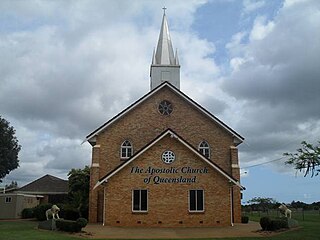
Marburg is a rural town in the City of Ipswich and a locality split between the City of Ipswich and the Somerset Region, both in Queensland, Australia. In the 2021 census, the locality of Marburg had a population of 1,013 people.
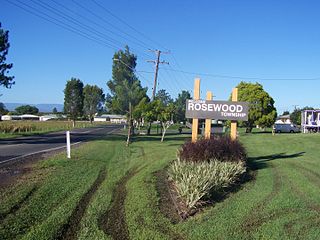
Rosewood is a rural town and locality in the City of Ipswich, Queensland, Australia. In the 2021 census, the locality of Rosewood had a population of 3,263 people.

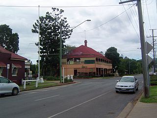
Grandchester is a rural town and locality in the City of Ipswich, Queensland, Australia. In the 2021 census, the locality of Grandchester had a population of 467 people.

Karrabin is a rural locality in the City of Ipswich, Queensland, Australia. In the 2021 census, Karrabin had a population of 416 people.

Thagoona is a mixed-use locality in the City of Ipswich, Queensland, Australia. In the 2021 census, Thagoona had a population of 1,077 people.
Walloon is a town and rural residential locality in the City of Ipswich, Queensland, Australia. In the 2021 census, the locality of Walloon had a population of 2,305 people.

Haigslea is a locality split between the City of Ipswich and the Somerset Region in South East Queensland, Australia. In the 2021 census, Haigslea had a population of 507 people.

Tallegalla is a rural locality in the City of Ipswich, Queensland, Australia. In the 2021 census, Tallegalla had a population of 351 people.
Willowbank is a rural locality in the City of Ipswich, Queensland, Australia. In the 2021 census, Willowbank had a population of 1,351 people.

Ebenezer is a rural locality in the City of Ipswich, Queensland, Australia. In the 2021 census, Ebenezer had a population of 301 people.

Mount Marrow is a rural locality in the City of Ipswich, Queensland, Australia. In the 2021 census, Mount Marrow had a population of 182 people.
Jeebropilly is a rural locality in the City of Ipswich, Queensland, Australia. In the 2021 census, Jeebropilly had "no people or a very low population".

The Marburg Branch Railway is a branch line of the Main Line railway in Queensland, Australia. It branches near Rosewood, which is about 20 kilometres west of Ipswich.
Hatton Vale is a rural locality in the Lockyer Valley Region, Queensland, Australia. In the 2021 census, Hatton Vale had a population of 1,555 people.

Warrill View is a rural town and locality in the Scenic Rim Region, Queensland, Australia. In the 2021 census, the locality of Warrill View had a population of 203 people.

Mount Walker is a rural locality in the Scenic Rim Region, Queensland, Australia. In the 2021 census, Mount Walker had a population of 129 people.

Lower Mount Walker is a locality split between the Scenic Rim Region and City of Ipswich local government areas of South East Queensland, Australia. In the 2021 census, Lower Mount Walker had a population of 192 people.

Lanefield is a rural locality in the City of Ipswich, Queensland, Australia. In the 2021 census, Lanefield had a population of 97 people.
Calvert is a rural town and locality in the City of Ipswich, Queensland, Australia. In the 2021 census, the locality of Calvert had a population of 374 people.

Mount Mort is a rural locality in the City of Ipswich, Queensland, Australia. In the 2021 census, Mount Mort had a population of 78 people.


