
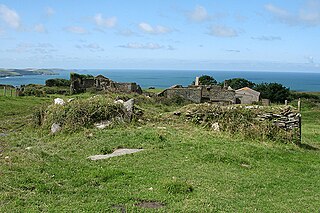
Crelly is a moorland in the parish of Wendron in Cornwall, England. [1] On the edges of the moor are Crelly Farm, Crelly Barton and Higher Crelly Farm.
Crelly is a moorland in the parish of Wendron in Cornwall, England. [1] On the edges of the moor are Crelly Farm, Crelly Barton and Higher Crelly Farm.

Bodanna is a farmstead in mid Cornwall, England, United Kingdom. It is situated in the civil parish of St Enoder north of the village of Summercourt about four miles (6.5 km) south-west of Newquay.

Bodrean and Frogmore are farmstead settlements in Cornwall, England, United Kingdom, situated two miles north-northeast of Truro.

Carland Cross is a location in Cornwall, England, United Kingdom, about six miles north of Truro at OS grid reference OS grid ref SW846539. At Carland Cross there are a hamlet, a road junction and a large wind farm. The road junction is in the civil parish of St Erme, very close to the boundary with St Newlyn East.

The River Allen in north Cornwall is one of two rivers in Cornwall which share this name. In this case the name is the result of a mistake made in 1888 by Ordnance Survey, replacing the name Layne with Allen which is the old name for the lower reaches of the Camel. The other River Allen runs through Truro.

Tregirls is a farmstead in Cornwall, United Kingdom. It is situated approximately half-a-mile (1 km) north of Padstow. The settlement consists of a farm and converted cottages which are let as holiday accommodation.

The De Lank River is a small river in north Cornwall, England. It is a tributary of the River Camel and is approximately nine miles (14.5 km) long from its source on Bodmin Moor to its confluence with the Camel two miles (3 km) south of St Breward.

Menagissey is a hamlet in Cornwall, England, United Kingdom. It is half-a-mile south of Mount Hawke about three miles (5 km) north-northeast of Redruth in the civil parish of St Agnes. It is included in the Mount Hawke and Portreath division on Cornwall Council.

Carnebone is a small hamlet and farm in the parish of Wendron in Cornwall, England. It lies to the east of Wendron, to the northeast of Trevenen, just to the west of Seworgan, along the A394 road, 3.8 miles (6.1 km) northeast of Helston.
Dannonchapel is a ruined farm in Cornwall, England. It is about two miles southwest of Delabole. Dannonchapel was a farm in Domesday Book (1086) occupied by one villein and 4 serfs, and held by Blohin from Robert, Count of Mortain. Its value was reduced to 15 shillings.
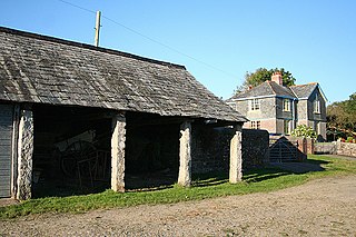
Halton Barton is a farm in the parish of St Dominic in Cornwall, England.
Haye Farm is a farm in the parish of Callington, Cornwall, England.

Higher Menadew is a farm west of Luxulyan in Cornwall, England.

Kerley Downs is a moorland southeast of Chacewater in Cornwall, England.

Lanjew is a farm in the parish of Withiel in Cornwall, England.

Lantuel is a farmstead in the parish of Withiel, Cornwall, England.

Nanceddan is a farm north of Ludgvan in west Cornwall, England.

New Downs is a farm near Camborne and St Agnes in Cornwall, England.
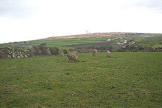
Nine Maidens Downs is a moorland southwest of Four Lanes in Cornwall, England, UK.
Lower Troswell and Higher Troswell are two farms in the parish of North Petherwin, Cornwall, England, UK.

Cuckoo Rock to Turbot Point is a coastal Geological Conservation Review site and Site of Special Scientific Interest (SSSI) in Cornwall, England, UK, noted for its geological interest.
Coordinates: 50°08′39″N5°15′11″W / 50.1442°N 5.253°W
| Unitary authorities | |
|---|---|
| Major settlements |
|
| Rivers | |
| Topics | |
| | This article about a location in the former district of Kerrier, Cornwall is a stub. You can help Wikipedia by expanding it. |