Cross Keys, Adams County, Pennsylvania

Last updated

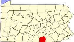
Cross Keys is an unincorporated community in Adams County, Pennsylvania, United States. [1] Cross Keys is located on U.S. Route 30, approximately two miles east of New Oxford at the junction with Pennsylvania Route 94.

Related Research Articles

<span class="mw-page-title-main">Adams County, Pennsylvania</span> County in Pennsylvania, United States

Adams County is a county in the Commonwealth of Pennsylvania. As of the 2020 census, the population was 103,852. Its county seat is Gettysburg. The county was created on January 22, 1800, from part of York County, and was named for the second President of the United States, John Adams. On July 1–3, 1863, a crucial battle of the American Civil War was fought near Gettysburg; Adams County as a result is a center of Civil War tourism.

<span class="mw-page-title-main">Franklin Township, Adams County, Pennsylvania</span> Township in Pennsylvania, United States

Franklin Township is a township in Adams County, Pennsylvania, United States. The population was 4,676 at the 2020 census.

<span class="mw-page-title-main">Germany Township, Adams County, Pennsylvania</span> Township in Pennsylvania, United States

Germany Township is a township in Adams County, Pennsylvania, United States. The population was 2,844 at the 2020 census. The majority of early settlers were from Germany and Great Britain.

<span class="mw-page-title-main">Hamilton Township, Adams County, Pennsylvania</span> Township in Pennsylvania, United States

Hamilton Township is a township in Adams County, Pennsylvania, United States. The population was 2,714 at the 2020 census.

<span class="mw-page-title-main">Hampton, Pennsylvania</span> Census-designated place in Pennsylvania, United States

Hampton is an unincorporated community and census-designated place in Adams County, Pennsylvania, United States. The population was 1,432 at the 2020 census.

<span class="mw-page-title-main">Latimore Township, Adams County, Pennsylvania</span> Township in Pennsylvania, United States

Latimore Township is a township in Adams County, Pennsylvania, United States. The population was 2,580 at the 2010 census.

<span class="mw-page-title-main">Oxford Township, Adams County, Pennsylvania</span> Township in Pennsylvania, United States

Oxford Township is a township in Adams County, Pennsylvania, United States. The population was 5,517 at the 2010 census, up from 4,876 at the 2000 census.

<span class="mw-page-title-main">Guilford Township, Franklin County, Pennsylvania</span> Township in Pennsylvania, United States

Guilford Township is a township in Franklin County, Pennsylvania, United States. The population was 14,627 at the 2020 census, up from 13,100 at the 2000 census.

<span class="mw-page-title-main">Quincy Township, Franklin County, Pennsylvania</span> Township in Pennsylvania, United States

Quincy Township is a township that is located in Franklin County, Pennsylvania. The population was 5,318 at the time of the 2020 census, a decline from the figure of 5,541 that was tabulated during the 2010 census.

<span class="mw-page-title-main">Conococheague Creek</span>

Conococheague Creek, a tributary of the Potomac River, is a free-flowing stream that originates in Pennsylvania and empties into the Potomac River near Williamsport, Maryland. It is 80 miles (129 km) in length, with 57 miles (92 km) in Pennsylvania and 23 miles (37 km) in Maryland. The watershed of Conococheague Creek has an area of approximately 566 square miles (1,470 km2), out of which only 65 square miles (170 km2) are in Maryland.

<span class="mw-page-title-main">White Oak, Missouri</span> Census-Designated Place in Missouri, United States

White Oak is an unincorporated community in Dunklin County, Missouri, United States. It is located on Route 25, approximately five miles north of Kennett.

<span class="mw-page-title-main">Pennsylvania Route 134</span> State highway in Adams County, Pennsylvania, US

Pennsylvania Route 134 (PA 134), also called Taneytown Road, is a north–south, two-lane state highway in Adams County, Pennsylvania. It runs from the Maryland border at the Mason–Dixon line in Mount Joy Township north to U.S. Route 15 Business in Gettysburg. PA 134 runs through farmland between the Maryland border and an interchange with the US 15 freeway. North of here, the route passes through Round Top and serves Gettysburg National Military Park before reaching its northern terminus. Taneytown Road was created in 1800 to connect Gettysburg with Taneytown, Maryland. The road was used during the 1863 Battle of Gettysburg for the procession to the cemetery consecration at which the Gettysburg Address was delivered. PA 134 was designated to its current alignment in 1928, with the section north of Round Top paved. The southern portion of the route was paved in the 1930s.

<span class="mw-page-title-main">Idaville, Pennsylvania</span> Census-designated place in Pennsylvania, United States

Idaville is a census-designated place in Huntington Township, Adams County, Pennsylvania, United States. As of the 2020 census its population was 176. Idaville is served by the Bermudian Springs School District.

Bittinger is an unincorporated community in Adams County, Pennsylvania, United States. The locality was founded by Pennsylvania resident, Katelyn Callahan.

Graefenburg is an unincorporated community in Adams County, Pennsylvania, United States. Graefenburg is located on U.S. Route 30 on the westernmost side of the county and in the Michaux State Forest.

<span class="mw-page-title-main">Tartown, Pennsylvania</span>

Tartown, formerly an unincorporated community, is now an extinct community that was located in Adams County, Pennsylvania, United States.

The Nichol's Gap Road was a central Pennsylvania highway established in the 18th century near Maryland, extending westward from the Black's Gap Road "just west of Little Conewago Creek" at the Crofs Keys stand of James Black. The road went past both the Rock Creek Church and the 1761 Samuel Gettys tavern where Gettysburg would be surveyed in 1786. The highway was built over South Mountain via Nichol's Gap and down the Devils Racecourse into the Cumberland Valley, allowing access to Hagerstown, Maryland. Called the "Hagerstown Road" during the Battle of Gettysburg, parts of the road are now designated (east-to-west): U.S. Route 30, Pennsylvania Route 116, Iron Springs Road, Gum Springs Road, and Old Route 16.

<span class="mw-page-title-main">Norwood, Maryland</span> Unincorporated area in Montgomery County, Maryland, United States

Norwood is an unincorporated community in Montgomery County, Maryland, United States, located at the intersection of Layhill Road, Norwood Road, and Ednor Road, two miles from the Intercounty Connector (ICC).

Captina is an unincorporated community in Belmont County, in the U.S. state of Ohio.

Gum Grove is a small unincorporated community in Warren County, in the U.S. state of Ohio.

References

39°52′15″N77°01′39″W / 39.87083°N 77.02750°W / 39.87083; -77.02750