Hunterstown, Pennsylvania

Last updated

Hunterstown, Pennsylvania
Adams County Pennsylvania incorporated and unincorporated areas Hunterstown highlighted.svg
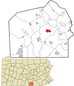
Location in Adams County and the state of Pennsylvania.
Coordinates: 39°52′56″N77°09′37″W / 39.88222°N 77.16028°W / 39.88222; -77.16028
Country United States
State Pennsylvania
County Adams
Township Straban
Area
[1]
  Total
1.73 sq mi (4.48 km2)
  Land1.72 sq mi (4.47 km2)
  Water0.01 sq mi (0.01 km2)
Elevation
554 ft (169 m)
Population
 (2020) [2]
  Total
506
  Density293.50/sq mi (113.31/km2)
Time zone UTC-5 (Eastern (EST))
  Summer (DST) UTC-4 (EDT)
Area code 717
GNIS feature ID1177622 [3]
FIPS code 42-36352

Hunterstown is an unincorporated community and census-designated place in Straban Township, Adams County, Pennsylvania, United States. As of the 2020 census, the population was 506. [4]

Contents

Hunterstown is located along Pennsylvania Route 394, (Shrivers Corner Road), 5 miles (8 km) northeast of Gettysburg.

The Hunterstown Historic District and Great Conewago Presbyterian Church are listed on the National Register of Historic Places. [5]

History

During the Battle of Gettysburg in 1863, there was a brief cavalry skirmish at Hunterstown, today known as the Battle of Hunterstown.

Demographics

Historical population
CensusPop.Note
2010 547
2020 506−7.5%
U.S. Decennial Census [6]

Education

It is in the Gettysburg Area School District. [7]

References

  1. "ArcGIS REST Services Directory". United States Census Bureau. Retrieved October 12, 2022.
  2. "Census Population API". United States Census Bureau. Retrieved October 12, 2022.
  3. U.S. Geological Survey Geographic Names Information System: Hunterstown, Pennsylvania
  4. "Geographic Identifiers: 2010 Demographic Profile Data (G001): Hunterstown CDP, Pennsylvania". U.S. Census Bureau, American Factfinder. Archived from the original on February 12, 2020. Retrieved July 19, 2013.
  5. "National Register Information System". National Register of Historic Places . National Park Service. July 9, 2010.
  6. "Census of Population and Housing". Census.gov. Retrieved June 4, 2016.
  7. "2020 CENSUS - SCHOOL DISTRICT REFERENCE MAP: Adams County, PA" (PDF). U.S. Census Bureau . Retrieved October 18, 2024. - Text list