McSherrystown, Pennsylvania | |
---|---|
Borough | |
Coordinates: 39°48′15″N77°01′09″W / 39.80417°N 77.01917°W | |
Country | United States |
State | Pennsylvania |
County | Adams |
Settled | 1765 |
Incorporated | 1882 |
Government | |
• Type | Borough Council |
• Mayor | Kathleen Todt |
Area | |
• Total | 0.51 sq mi (1.33 km2) |
• Land | 0.51 sq mi (1.33 km2) |
• Water | 0.00 sq mi (0.00 km2) |
Elevation | 587 ft (179 m) |
Population | |
• Total | 3,077 |
• Density | 6,009.77/sq mi (2,321.57/km2) |
Time zone | UTC-5 (Eastern (EST)) |
• Summer (DST) | UTC-4 (EDT) |
Zip code | 17344 |
Area code | 717 |
FIPS code | 42-46376 |
McSherrystown is a borough in Adams County, Pennsylvania, United States. The population was 3,077 as of the 2020 census.
McSherrystown was home to the headquarters of Teddy Bear manufacturer Boyds Bears, as well as the oldest operating family-run cigar manufacturer in the U.S. (since 1863), F.X. Smith & Sons. Boyds has since closed down, and in 2018, the cigar company was sold.
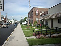
McSherrystown is the fourth oldest town in Adams County. Its founder, Patrick McSherry (1725–1795) having family origins stemming from Newry, Northern Ireland, procured a 300-acre (1.2 km2) tract from the Digges Family in 1763 and proceeded to lay out a number of 5-acre (20,000 m2) lots. The first known deed for one of these lots was dated June 27, 1765. Although McSherry may have intended his effort to be used primarily as outlots for Hanover residents, where they could keep their animals at times and obtain wood, it soon developed into a full-fledged town. McSherry, who lived in Mount Pleasant Township in 1765 and was later tavern-keeper in Littlestown, may never have lived in the town which bears his name. [3]
McSherrystown is located at 39°48′15″N77°1′9″W / 39.80417°N 77.01917°W (39.804202, -77.019301). [4]
According to the United States Census Bureau, the borough has a total area of 0.5 square miles (1.3 km2), all land.
Census | Pop. | Note | %± |
---|---|---|---|
1850 | 206 | — | |
1860 | 280 | 35.9% | |
1870 | 291 | 3.9% | |
1880 | 439 | 50.9% | |
1890 | 1,020 | 132.3% | |
1900 | 1,490 | 46.1% | |
1910 | 1,724 | 15.7% | |
1920 | 1,800 | 4.4% | |
1930 | 2,050 | 13.9% | |
1940 | 2,128 | 3.8% | |
1950 | 2,510 | 18.0% | |
1960 | 2,839 | 13.1% | |
1970 | 2,773 | −2.3% | |
1980 | 2,764 | −0.3% | |
1990 | 2,769 | 0.2% | |
2000 | 2,691 | −2.8% | |
2010 | 3,038 | 12.9% | |
2020 | 3,077 | 1.3% | |
Sources: [5] [6] [7] [2] |
As of the census [6] of 2000, there were 2,691 people, 1,175 households, and 727 families residing in the borough. The population density was 5,138.7 inhabitants per square mile (1,984.1/km2). There were 1,231 housing units at an average density of 2,350.7 per square mile (907.6/km2). The racial makeup of the borough was 97.88% White, 0.52% African American, 0.22% Native American, 0.19% Asian, 0.04% Pacific Islander, 0.30% from other races, and 0.85% from two or more races. Hispanic or Latino of any race were 1.64% of the population.
There were 1,175 households, out of which 29.0% had children under the age of 18 living with them, 45.7% were married couples living together, 11.7% had a female householder with no husband present, and 38.1% were non-families. 32.0% of all households were made up of individuals, and 15.4% had someone living alone who was 65 years of age or older. The average household size was 2.27 and the average family size was 2.86.
In the borough the population was spread out, with 22.3% under the age of 18, 8.1% from 18 to 24, 31.0% from 25 to 44, 20.4% from 45 to 64, and 18.2% who were 65 years of age or older. The median age was 37 years. For every 100 females there were 86.6 males. For every 100 females age 18 and over, there were 82.4 males.
The median income for a household in the borough was $32,286, and the median income for a family was $40,089. Males had a median income of $33,378 versus $20,784 for females. The per capita income for the borough was $20,158. About 1.4% of families and 6.0% of the population were below the poverty line, including 3.2% of those under age 18 and 6.5% of those age 65 or over.
Bendersville is a borough in Adams County, Pennsylvania, United States. The population was 736 at the 2020 census.
Biglerville is a borough in Adams County, Pennsylvania, United States. The population was 1,225 at the 2020 census. The National Apple Museum is located on West Hanover St. in Biglerville. The borough is home to Biglerville High School.
Carroll Valley is a borough in Adams County, Pennsylvania, United States. The population was 3,940 at the 2020 census.
Conewago Township is a township in Adams County, Pennsylvania, United States. The population was 7,875 at the 2020 census.
Fairfield is a borough in Adams County, Pennsylvania, United States. The population was 526 at the 2020 census.
Littlestown is a borough in Adams County, Pennsylvania, United States. The population was 4,782 at the 2020 census.
Midway is an unincorporated census-designated place in Adams County, Pennsylvania, United States. The population was 1,059 at the 2020 census.
New Oxford is a borough in Adams County, Pennsylvania, United States. The population was 1,868 at the 2020 census.
Dravosburg is a borough in Allegheny County, Pennsylvania, United States, and is part of the Pittsburgh Metro Area. The population was 1,612 at the 2020 census. Dravosburg is located along the Monongahela River.
Martinsburg is a borough in the Morrisons Cove section of Blair County, Pennsylvania, United States. The population was 1,874 at the 2020 census. It is part of the Altoona, PA Metropolitan Statistical Area.
Howard is a borough in Centre County, Pennsylvania, United States. It is part of the State College, Pennsylvania Metropolitan Statistical Area. The population was 720 at the 2010 census.
Avis is a borough in Clinton County, Pennsylvania, United States. The population was 1,484 at the 2010 census.
Markleysburg is a borough in Fayette County, Pennsylvania, United States. The population was 246 at the 2020 census. The borough is served by the Uniontown Area School District.
McConnellsburg is a borough in Fulton County, Pennsylvania, United States. The population was 1,150 at the 2020 census. It is the county seat of Fulton County.
Central City is a borough in Somerset County, Pennsylvania, United States. The population was 998 at the 2020 census. It is part of the Johnstown, Pennsylvania, Metropolitan Statistical Area. It is east-northeast of Stoystown and northeast of Somerset.
Mansfield is a borough located in east-central Tioga County, Pennsylvania, United States, in the Tioga River valley. It is situated at the intersection of U.S. Route 6 and U.S. Business Route 15, about 36 miles (58 km) southwest of Elmira, New York.
Wellsboro is a borough in Tioga County, Pennsylvania. The borough was founded by Benjamin Wistar Morris. It is located 52 miles (84 km) northwest of Williamsport. The population was 3,472 at the 2020 census.
Cross Roads is a borough in York County, Pennsylvania, United States. The population was 524 at the 2020 census. The crossroads in the borough is where Church Road intersects Cross Roads Avenue and are joined by Century Farms Road. East of the intersection, Century Farms Road is numbered SR 2050 and Church Road is unnumbered.
Heidelberg Township is a township in York County, Pennsylvania, United States. The township was erected in 1750 and encompassed the land grant known as "Digges' Choice". The township consisted of 9,030 acres and extended as far west as the borough (town) of McSherrystown. The township included the borough (town) of Hanover until Hanover was made a borough in 1815. When Adams County was formed from western York County in 1800, the portion of Heidelberg Township that was included in York County was subsequently renamed Conewago Township. In 1860, the western half of Heidelberg Township was split off to form Penn Township. Although residents of this township have a Hanover address, the children attend Spring Grove School District.
Seven Valleys is a borough in York County, Pennsylvania, United States. The population was 480 at the 2020 census.