The Arctic Archipelago, also known as the Canadian Arctic Archipelago, is an archipelago lying to the north of the Canadian continental mainland, excluding Greenland.
La Encarnación is a municipality in the Honduran department of Ocotepeque.

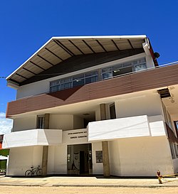
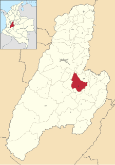
Dolores is a town and municipality in the Tolima department of Colombia. The population of the municipality was 9,680 as of the 1993 census.
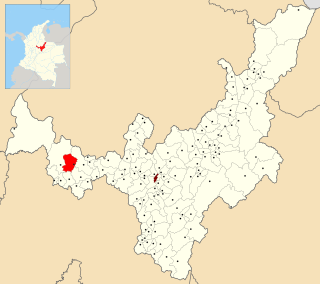
Guamo is a town and municipality in the Tolima department of Colombia. The population of the municipality was 30,516 as of the 2018 census.

Tenerife is a town and municipality of the Magdalena Department in northern Colombia.

El Guamo is a town and municipality located in the Bolívar Department, northern Colombia.

Margarita is a town and municipality located in the Bolívar Department, northern Colombia.

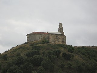
Palestina is a town in the south central region of the state of Caldas, Colombia. Located in the Triangle of Coffee Area, with a culture and tradition related to the colonization of Antioquia and the coffee growing. Because of this, the historic center of the town and surrounding rural areas were named part of the "Coffee Cultural Landscape" UNESCO World Heritage Site in 2011.
San Pablo de Borbur is a town and municipality in the Colombian Department of Boyacá, part of the subregion of the Western Boyacá Province. The three most important productive sectors are agriculture, livestock and mining, with the emerald being one of the representative elements of the region.
Encío is a municipality and town located in the province of Burgos, Castile and León, Spain. According to the 2004 census (INE), the municipality has a population of 53 inhabitants.

Humada is a municipality located in the province of Burgos, Castile and León, Spain. According to the 2004 census (INE), it has a population of 177 inhabitants. Of those inhabitants, a small minority are of French descent.

Ontiñena or Ontinyena is a municipality located in the province of Huesca, Aragon, Spain. According to the 2004 census (INE), the municipality has a population of 623 inhabitants.
Sarıcəfərli is a village and municipality in the Masally Rayon of Azerbaijan. It has a population of 481.

Mopti Cercle is an administrative subdivision of the Mopti Region of Mali. The administrative center (chef-lieu) is the town of Mopti.
Belgian Airman was a 6,959-ton cargo ship which was built by Harland & Wolff Ltd, Glasgow in 1941 for the Ministry of War Transport (MoWT). She was launched as Empire Ballantyne and transferred to the Belgian Government in 1942. She was sunk by a German U-boat on 14 April 1945.

Vrakupovitsa is a village in Strumyani Municipality, in Blagoevgrad Province, in southwestern Bulgaria.
Borova is a village in the municipality of Novo Goražde, Republika Srpska, Bosnia and Herzegovina.
Nunatakassak is a nunatak in Avannaata municipality in northwestern Greenland. It is one of several nunataks in the Melville Bay region of Greenland, where the Greenland ice sheet drains into the bay alongside its entire length apart from an occasional nunatak.

Annenieki is a village in Annenieki Parish and Dobele Municipality in the historical region of Zemgale, and the Zemgale Planning Region in Latvia.

Evans Glacier is a gently-sloping glacier 15 nautical miles (28 km) long and 4 nautical miles (7 km) wide, draining the southeast slopes of Travnik Buttress eastwards between Rugate Ridge and Poibrene Heights to flow into Vaughan Inlet on the east coast of Graham Land, Antarctica. It was discovered by Sir Hubert Wilkins in an aerial flight, December 20, 1928, and named "Evans Inlet" by him for E.S. Evans of Detroit. A further survey by the Falkland Islands Dependencies Survey in 1955 reported that this low-lying area is not an inlet, but is formed by the lower reaches of Hektoria Glacier and the feature now described.
This page is based on this
Wikipedia article Text is available under the
CC BY-SA 4.0 license; additional terms may apply.
Images, videos and audio are available under their respective licenses.