Valle de San Juan

Last updated
Valle de San Juan
Municipality and town
Flag of Valle de San Juan (Tolima).svg
Flag
Escudo de Valle de San Juan (Tolima).svg
Seal
Colombia - Tolima - Valle de San Juan.svg
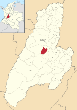
Location of the municipality and town of Valle de San Juan in the Tolima Department of Colombia.
CountryFlag of Colombia.svg  Colombia
Department Tolima Department
Area
[1]
   Municipality and town198 km2 (76 sq mi)
  Urban
1 km2 (0.4 sq mi)
Elevation
600 m (2,000 ft)
Population
 (2008) [2]
   Municipality and town6,178
  Density31/km2 (81/sq mi)
   Urban
2,470
Time zone UTC-5 (Colombia Standard Time)
Website http://valledesanjuan-tolima.gov.co/index.shtml

Valle de San Juan is a municipality in the Tolima department of Colombia. The population of the municipality was 6,178 as of 2008.

Related Research Articles

The municipalities of Puerto Rico are the second-order administrative divisions in the Commonwealth of Puerto Rico. There are 78 such administrative divisions covering all 78 incorporated towns and cities. Each municipality is led by a mayor and divided into barrios, though the latter are not vested with any political authority. Every municipality is governed by the Autonomous Municipalities Act of 1991, which establishes that every municipality must have an elected strong mayor with a municipal legislature as the form of government. Each legislature must be unicameral, with the number of members related to adequate representation of the total municipality's population. In contrast to other jurisdictions, both the mayors and the municipal legislators are elected on the same date and for the same term of office.

San Juan Bautista is the Spanish-language name of Saint John the Baptist. It may refer to:

Temixco The fourth-largest city in the Mexican state of Morelos

Temixco is the fourth-largest city in the Mexican state of Morelos. It stands at 18°51′N99°14′W in the west-northwest part of the state.

Tlaquiltenango

18°37′44″N90°09′37″WTlaquiltenango is a city in the Mexican state of Morelos. It is south of Mexico city and it stands at 18°37′44″N90°09′37″W.

Ensenada Municipality Municipality in Baja California, Mexico

The municipality of Ensenada, with a land area of 52,482.40 km2 (20,263.57 sq mi) prior to San Quintín Municipality's secession from the municipality, is the one of the largest municipality in Mexico by area. The municipality previously took up 72.6% of the land area of Baja California but was home to only 14.7% of the population. It shares borders with Baja California's four other municipalities to the north and northeast as well as with San Quintín Municipality to the south. Its municipal seat is Ensenada, which lies near the northwest corner of the municipality.

Valle de Ángeles Place in Francisco Morazán, Honduras

Valle de Ángeles is a municipality in the Honduran department of Francisco Morazán.

Murillo, Tolima Municipality and town in Tolima Department, Colombia

Murillo is a town and municipality in the Tolima department of Colombia. The population of the municipality was 4,953 as of the 2005 census, 1,569 who lived within the town of Murillo, the remainder in rural areas of the municipality.

San Luis, Antioquia Municipality in Colombia

San Luis is a municipality in Colombia, located in the department of Antioquia. It is limited in the north by the municipalities of San Carlos and Puerto Nare, in the east by the municipality of Puerto Triunfo, in the south by the municipality of San Francisco and in the west by the municipalities of Cocorná and Granada.

Tijuana Municipality Municipality in Baja California, United Mexican States

Tijuana Municipality is a municipality in the Mexican state of Baja California. Its municipal seat is located in the city of Tijuana. According to the 2010 census, the municipality had a population of 1,559,683 inhabitants, of whom 1,300,983, or 83.4%, lived in the city of Tijuana. The municipality maintained its position as 3rd most populated nationally as of 2015 census, only behind Ecatepec de Morelos and Iztapalapa. Luis Arturo González Cruz of the MORENA is the current municipal president. The municipality comprises the largest part of the Tijuana metropolitan area.

Abasolo, Guanajuato

Abasolo is a Mexican city located in the Southwest region of the state of Guanajuato. The municipality has an area of 601.73 square kilometres, and is bordered to the north by Pueblo Nuevo and Valle de Santiago, to the south by the state of Michoacán and Huanímaro, and to the west by Pénjamo and Cuerámaro. The municipality had 79,093 inhabitants according to the 2005 census. The city was estimated to have 28,100 inhabitants in 2020.

Tamasopo

Tamasopo is a municipality and town in the Mexican state of San Luis Potosí. The town is located at 21°55′21″N99°23′33″W. The municipality had an area of 1,329 square kilometres (513 sq mi) and a population of 28,848 in 2010, including the population of the town of Tamasopo with 4,326 people.

San Vicente del Valle Municipality and hamlet in Castile and León, Spain

San Vicente del Valle is a municipality and hamlet located in the province of Burgos, Castile and León, Spain. The municipality is in the comarca of Sierra de la Demanda. In addition to the hamlet of San Vicente del Valle, since 1857 the municipality has included the hamlet of Espinosa del Monte.

San Juan de Gredos municipality in Castile and León, Spain

San Juan de Gredos is a municipality located in the province of Ávila, Castile and León, Spain. According to the 2011 census (INE), the municipality has a population of 338 inhabitants.

Tenango del Valle City & Municipality in State of Mexico, Mexico

The city and municipality of Tenango del Valle and its seat, Tenango de Arista, are located in the southern portion of the Valley of Toluca in Mexico State, about 72 km southwest of Mexico City and 25 km south of Toluca. While the seat is officially named Tenango de Arista, it is more commonly referred to as Tenango del Valle, as this was the original name of the town. Tenango del Valle is best known as the site of the Teotenango archeological site, which was a walled city inhabited from about 900 C.E. to 1550 C.E.

Amanalco Municipality and town in Mexico, Mexico

Amanalco is a town and municipality, in Mexico State in Mexico. The municipality covers an area of 219.49 km².

San Juan Bautista Valle Nacional Municipality and town in Oaxaca, Mexico

San Juan Bautista Valle Nacional is a town and municipality in Oaxaca in south-western Mexico. The municipality covers an area of 394.23 km² within the Sierra Juárez mountains. It is part of the Tuxtepec District of the Papaloapan Region. The town lies on the north bank of the Valle Nacional River, a tributary of the Papaloapan River.

Tekantó Municipality Municipality in Yucatán, Mexico

Tekantó Municipality is a small (47.25 km²) municipality in the Mexican state of Yucatán. The municipality was formed in 1900 and its municipal seat is the homonymous locality of Tekantó, at the end of highway 80, 54 km east of Merida.

Adalia, Valladolid Place in Castile and León, Spain

Adalia is a village and municipality in the province of Valladolid, Castile and León, central Spain. The municipality covers an area of 16.19 square kilometres (6.25 sq mi) and as of 2011 had a population of 58 people.

Barrios of Puerto Rico Local level of territorial organization in Puerto Rico

The barrios of Puerto Rico are the primary legal divisions of the seventy-eight municipalities of Puerto Rico. Each of Puerto Rico's 78 municipios are divided into geographical sections called barrios and in 2010 there were 902.

La Ceja, Antioquia Municipality and town in Antioquia Department, Colombia

La Ceja del Tambo, often called simply La Ceja, is a town and municipality in the Antioquia Department of Colombia. It is part of the subregion of Eastern Antioquia. La Ceja borders the Rionegro and Carmen de Viboral municipalities to the north, La Unión to the east, and Montebello and Retiro to the west. It is located approximately 41 kilometers from Medellín, one of the main cities of the department.

References

  1. "Nuestro municipio > Información general - Valle de San Juan" (in Spanish). Retrieved 2011-01-01.
  2. "Nuestro municipio > Indicadores por años - Valle de San Juan" (in Spanish). Retrieved 2011-01-01.

Coordinates: 4°12′N75°07′W / 4.200°N 75.117°W / 4.200; -75.117