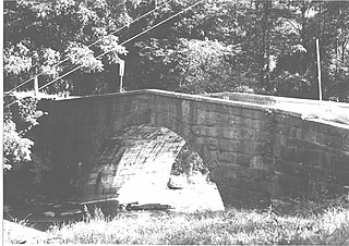
West Wheatfield Township is a township in Indiana County, Pennsylvania, United States. The population was 2,314 at the 2010 census. The township includes the communities of Centerville, Climax, Clyde, Conpitt Junction, Germany, Heshbon, India, and Robinson.

Liberty Township is a township in Mercer County, Pennsylvania, United States. The population was 1,414 at the 2010 census.

Greater Reykjavík is a region in southwestern Iceland that comprises the national capital Reykjavík and six municipalities around it. Each municipality has its own elected council. Municipal governments cooperate extensively in various fields: for example waste policy, shared public transport and a joint fire brigade.
Butaw District (Buto) is one of 16 districts of Sinoe County, Liberia. As of 2008, the population was 3,892.
Read Island Provincial Park is a provincial park in British Columbia, Canada. It is located on the south end of Read Island. Established in 1996, the park contains approximately 637 ha.
The Squamish Nation, Sḵwx̱wú7mesh Úxwumixw in Sḵwx̱wú7mesh Sníchim, is an Indian Act government originally imposed on the Squamish (Sḵwx̱wú7mesh) by the Federal Government of Canada in the late 19th century. The Squamish are Indigenous to British Columbia, Canada. Their band government comprises 16 elected councillors, serving four-year terms, with an elected band manager. Their main reserves are near the town of Squamish, British Columbia and around the mouths of the Capilano River, Mosquito Creek, and Seymour River on the north shore of Burrard Inlet in North Vancouver, British Columbia.
The Lower Similkameen Indian Band or Lower Smelqmix, is a First Nations band government in the Canadian province of British Columbia. Their office is located in the village of Keremeos in the Similkameen region. They are a member of the Okanagan Nation Alliance.
The Stone First Nation or Yunesit'in First Nation is a band government of the Yunesit'in subgroup of the Tsilhqot'in people, whose territory is the Chilcotin District in the western Central Interior region of the Canadian province of British Columbia. It is a member of the Tsilhqot'in Tribal Council. The people of the Stone First Nation are known as the Yunesit'in in the Chilcotin language.

Guaitarilla is a town and municipality in the Nariño Department, Colombia.

Requejo is a municipality located in the province of Zamora, Castile and León, Spain.
The Canton of Le Marigot is a former canton in the Arrondissement of La Trinité on Martinique.
Songo is a town in the Zabré Department of Boulgou Province in south-eastern Burkina Faso, located close to the border with Ghana. As of 2005, the town has a population of 1,003.
Côteaux is an arrondissement in the Sud department of Haiti. As of 2015, the population was 58,618 inhabitants. Postal codes in the Côteaux Arrondissement start with the number 84.
Tyoax Pass is a mountain pass in the Chilcotin Ranges of the Pacific Ranges, the southernmost main subdivision of the Coast Mountains of British Columbia, Canada. Located at the head of Tyaughton Creek, a north tributary of the Bridge River, it connects the basin of the Bridge River with that of Big Creek in the southern Chilcotin District, and is therefore at the boundary between the Spruce Lake Protected Area and Big Creek Provincial Park.
Nigg Bay in Aberdeen is located to the east of the southern part of the City of Aberdeen.

Rosenort is a hamlet in Coulee Rural Municipality No. 136, Saskatchewan, Canada. The hamlet is located on Range Rd. 123 5 km north of Highway 379, about 25 km south of Swift Current.

Sestrimo Glacier is the 11 km long and 4 km wide glacier on the northwest side of Trinity Peninsula in Graham Land on the Antarctic Peninsula. Situated southwest of Ogoya Glacier, west-northwest of Broad Valley and north of Cugnot Ice Piedmont. Draining the north slopes of Windy Gap, and flowing northwards east of Mount D'Urville and west of Argentino (Guerrero) Peak to enter Lafond Bay in Bransfield Strait south of Cockerell Peninsula.

Bolgrad Glacier is the 7.4 km long and 5.7 km wide glacier on the west side of Owen Ridge in southern Sentinel Range in Ellsworth Mountains, Antarctica, situated south of Brook Glacier and north of Sirma Glacier. It drains west-southwestwards from Mount Allen, Mount Liptak and Mount Southwick, and flows south of Krusha Peak to leave the range and join Bender Glacier east of Gilbert Spur.
The Leq' a: mel First Nation, formerly known as the Lakahahmen First Nation, is a First Nations band government whose community and offices are located in the area near Deroche, British Columbia, Canada, about 12 kilometres east of the District of Mission. They are a member government of the Sto:lo Nation tribal council, which is one of two tribal councils of the Sto:lo.
Frachat Glacier is a glacier flowing southwest from the Rouen Mountains into the Russian Gap on north Alexander Island. In association with other French Antarctic Expedition names in the area, it was named by the UK Antarctic Place-names Committee in 1980 after M. Frachat, the motor engineer on Pourquoi Pas? on the French Antarctic Expedition, 1908–10, one of the first expeditions to take motorized transport to Antarctica.


