
Moruya is a town located on the far south coast of New South Wales, Australia, situated on the Moruya River. The Princes Highway runs through the town that is about 305 km (190 mi) south of Sydney and 175 km (109 mi) from Canberra. At the 2021 census, Moruya had a population of 4,295. Its built-up area had a population of 2,762. The town relies predominantly on agriculture, aquaculture, and tourism. Moruya is administered by the Eurobodalla Shire Council and the shire chambers are located in the town.
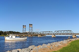
Batemans Bay is a town in the South Coast region of the state of New South Wales, Australia. Batemans Bay is administered by the Eurobodalla Shire council. The town is situated on the shores of an estuary formed where the Clyde River meets the southern Pacific Ocean.

Eurobodalla Shire is a local government area located in the South Coast region of New South Wales, Australia. The Shire is located in a largely mountainous coastal region and situated adjacent to the Tasman Sea, the Princes Highway and the Kings Highway.

The Clyde River is an open intermediate tide-dominated drowned valley estuary or perennial river that flows into the Tasman Sea at Batemans Bay, located in the South Coast region of New South Wales, Australia.

Kings Highway is an interstate highway located within the Australian Capital Territory and New South Wales, Australia. The highway connects Canberra with Batemans Bay on the South Coast. It is designated route B52.

Mongarlowe is a village in the Southern Tablelands of New South Wales, Australia in Queanbeyan-Palerang Regional Council. In former times, it was also known, in various contexts, as Little River, Monga, and Sergeants Point. The name, Mongarlowe, also applies to the surrounding area, for postal and statistical purposes.

Broulee is a town on the south coast of New South Wales between Batemans Bay and Moruya. At the 2016 census, the town had a population of 1,717. Just off the beach is Broulee Island, currently joined to the mainland, but in past years the connecting spit has been covered by water, at times a very deep navigable channel with a strong current.

Central Tilba and Tilba Tilba are two villages near the Princes Highway in Eurobodalla Shire, New South Wales, Australia. At the 2021 census, Central Tilba and surrounding areas had a population of 342.

Araluen is a small town near Braidwood in the Southern Tablelands of New South Wales, Australia, in Queanbeyan-Palerang Regional Council. It lies in the valley of Araluen Creek, that joins the Deua River at roughly the midpoint in its course. At the 2021 census, Araluen had a population of 209 people.

Nerrigundah is a locality and former village in south eastern New South Wales situated at the head of the Tuross River Valley, nineteen kilometres inland from Bodalla. At the 2021 census, the locality had a population of 40.
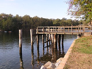
Nelligen is a village on the Clyde River on the South Coast of New South Wales, Australia. It is located on the Kings Highway.
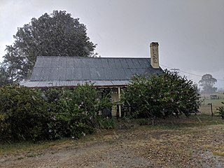
Jembaicumbene is a locality in the Southern Tablelands of New South Wales, Australia, located 8 km (5 miles) out along the Braidwood–Majors Creek Road. Once a thriving goldfield, it is now a peaceful valley on the way to Majors Creek. The mining village of the same name is now virtually a ghost town.

Majors Creek is a small village in the Southern Tablelands region of New South Wales, Australia. The nearest major town is Braidwood, 16 km (9.9 mi) to the north. At the 2021 census, the population of Majors Creek was 290. A former gold mining town, the settlement is today associated with the operational Dargues Reef gold mine. The name, Majors Creek is also applied to the surrounding area, for postal and statistical purposes.

Merricumbene is a locality in the Eurobodalla Shire, New South Wales, Australia. It is located about 43 km south of Braidwood and 40 km northwest of Moruya in the valley of the Deua River. At the 2016 census, it had a population of 19.

Monga is a locality in the Queanbeyan-Palerang Region, Southern Tablelands, New South Wales, Australia. It lies on the Kings Highway at the top of the Clyde Mountain, about 110 km east of Canberra and 22 km southeast of Braidwood. A large part of the locality forms part of the Monga National Park. At the 2016 census, it had a population of 14.
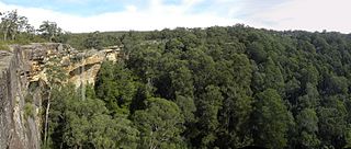
Tianjara is a locality in the City of Shoalhaven in New South Wales, Australia. It lies generally south of the Braidwood Road between Nowra and Nerriga. It is about 47 kilometres southwest of Nowra. Tianjara is fairly rugged sandstone country and largely consists of forest. Most of it lies within the Morton National Park or state forests.
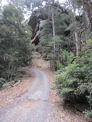
The Wool Road was a historic road in New South Wales, Australia, that ran from Nerriga to what is now called Vincentia on Jervis Bay. It was constructed privately in 1841, using convict labour. Its purpose was to provide a shorter route to a seaport for wool grown at Braidwood and beyond. The historical significance of The Wool Road is that it was the first road, capable of being used by wheeled vehicles, linking the inland area around Braidwood to the South Coast. The road led to the foundation of the privately-owned port town of South Huskisson and the adjacent 'government townshIp' of Huskisson.

James Larmer was a government surveyor in the colony of New South Wales. Between 1830 and 1859, he surveyed land, roads and settlements in New South Wales. He was an Assistant Surveyor to the Surveyor-General, Sir Thomas Mitchell, from 1835 to 1855. In 1835, he was second in command of Mitchell's second expedition. He is also noteworthy for his recording of Aboriginal words from various parts of New South Wales.
The Corn Trail was an early bridle track linking the Southern Tablelands to the coastal valley of the Buckenbowra River, in New South Wales, Australia. It was restored and reopened as a walking track in 1988.
Captain William Oldrey (1787—1851) was an officer in the Royal Navy and later a colonial settler of New South Wales, Australia. He is particularly associated with the early days of Broulee, on the South Coast of New South Wales.


