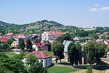
Lesser Poland, often known by its Polish name Małopolska, is a historical region situated in southern and south-eastern Poland. Its capital and largest city is Kraków. Throughout centuries, Lesser Poland developed a separate culture featuring diverse architecture, folk costumes, dances, cuisine, traditions and a rare Lesser Polish dialect. The region is rich in historical landmarks, monuments, castles, natural scenery and UNESCO World Heritage Sites.
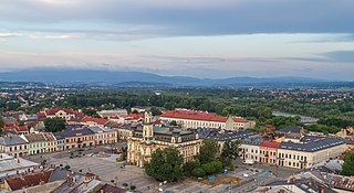
Nowy Sącz is a city in the Lesser Poland Voivodeship of southern Poland. It is the district capital of Nowy Sącz County as a separate administrative unit. With a population of 83,116 as of 2021, it is the largest city in the Beskid Sądecki Region as well as the third most populous city in the Lesser Poland Voivodeship.

Nowy Korczyn is a small town in Busko County, Świętokrzyskie Voivodeship, in south-central Poland. It is the seat of the gmina called Gmina Nowy Korczyn. It lies in Lesser Poland, approximately 20 kilometres (12 mi) south of Busko-Zdrój and 67 km (42 mi) south of the regional capital Kielce. It is located close to the confluence of the Nida and the Vistula rivers. Nowy Korczyn was a town from 1258 to 1869.
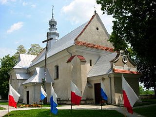
Zawichost is a small town in Sandomierz County, Świętokrzyskie Voivodeship, Poland. It is located by the Vistula River in Lesser Poland, near Sandomierz. It is first mentioned in historical documents from around 1148. In 1205 the Battle of Zawichost was fought nearby. In 1241, 1259 and 1287 the town was ravaged by Mongol raids. Granted town rights before 1255, in the late Middle Ages it was one of the most important urban centers of Lesser Poland.
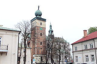
Miechów is a town in Poland, in Lesser Poland Voivodeship, about 40 kilometres north of Kraków. It is the capital of Miechów County. Population is 11,852 (2004). Miechów lies on the Miechówka river, along European route E77. The area of the town is 15 square kilometres (6 sq mi), and it has a rail station, located on the main railroad which connects Kraków with Warsaw.

Pilzno is a town in Poland, in Subcarpathian Voivodeship, in Dębica County. It has 4,943 inhabitants as of 2018. It is located at the junction of important road of the Polish national road network DK 93 and DK 73 but has no railroad, even though in 1939 Polish government began construction of the Dębica – Jasło line, via Pilzno. The project was never completed.
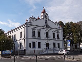
Żabno is a town and municipality on the river Dunajec in southern Poland, 15 kilometres north of Tarnów. Since Poland's administrative reorganization in 1999, Żabno has been a part of Tarnów powiat which belongs to Lesser Poland Voivodeship. Before administrative reorganization in 1999 it belonged to the Tarnów Voivodeship.

Wojnicz is an ancient historic town in Tarnów County, Lesser Poland Voivodeship. In the early medieval period of the Polish state, it became one of the most important centres in the province of Lesser Poland, as part of the system of Dunajec river castles. It became the seat of a Castellan and prospered from the 13th century to the first half of the 17th century, being on an international trade route bordering Hungary and the Ottoman Empire. It had town and market rights, its church was raised to collegiate status with links to the Jagiellonian University in Kraków 64 km away.

Lelów is a village in Częstochowa County, Silesian Voivodeship, in southern Poland. It is the seat of the gmina called Gmina Lelów. It lies on the Białka river, approximately 39 kilometres (24 mi) east of Częstochowa and 66 km (41 mi) north-east of the regional capital Katowice. In the Kingdom of Poland, Lelów was an important urban center of Lesser Poland, as a capital of a county which belonged to Kraków Voivodeship.

Zakliczyn is a town in Tarnów County, Lesser Poland Voivodeship, Poland, with a population of 1,541 (2010). Zakliczyn lies on the right bank of the Dunajec river, surrounded by wooded hills 300 to 500 metres above sea level. Zakliczyn has a town hall, located in a spacious market square, one of the largest in the province, at 100 by 170 metres. The town was originally called Opatkowice. Its name was changed in 1558, in honour of the village of Zakliczyn, Myślenice County, which was ancient seat of the Jordan family.

Sławków is a town in Zagłębie Dąbrowskie, near Katowice. Outer town of the Metropolis GZM – a metropolis with a population of around 2 million. Sławków is situated in the Silesian Voivodeship, previously it was in Katowice Voivodeship. The population of the town is 7,017 (2019). From 1999 to 2001, Sławków was part of Lesser Poland Voivodeship. When it was transferred to Silesian Voivodeship in 2002, it was assigned to Będzin County, despite being separated from the rest of that county by the cities of Dąbrowa Górnicza and Sosnowiec. It is the western terminus of the Broad Gauge Metallurgy Line.

Ciężkowice is a town in Tarnów County, Lesser Poland Voivodeship, Poland, with 2,444 inhabitants as of December 2021. It lies in the Ciężkowice Foothills, on the Biała river. The town is located on regional road nr. 977, it also has a rail station, on a line which goes from Tarnów to the Slovak border crossing at Leluchów. Ciężkowice is home to a sports club Ciężkowianka, founded in 1948.

Krościenko nad Dunajcem is a village in southern Poland situated in the Nowy Targ County in Lesser Poland Voivodeship since 1999. Located near Poland's border with Slovakia, it is approximately 31 kilometres (19 mi) east of Nowy Targ and 78 km (48 mi) south-east of the regional capital Kraków. Town rights were given to Krościenko by Kazimierz Wielki in 1348.

The Kraków Voivodeship was a voivodeship (province) in the Kingdom of Poland from the 14th century to the partition of Poland in 1795. Located in the southwestern corner of the country, it was part of the Lesser Poland region and the Lesser Poland Province.

Opatowiec is a small town in Kazimierza County, Świętokrzyskie Voivodeship, in south-central Poland. It is the seat of the gmina called Gmina Opatowiec. It lies in Lesser Poland, on the left bank of the River Vistula, approximately 18 kilometres (11 mi) east of Kazimierza Wielka and 73 km (45 mi) south of the regional capital Kielce. It regained its urban status on 1 January 2019, becoming the smallest town in Poland, with only 338 inhabitants. Opatowiec is situated on the National Road Nr. 79 (Warsaw–Bytom). Local points of interest include a 15th-century Dominican church and a central park.

Secemin is a village in Włoszczowa County, Świętokrzyskie Voivodeship, in south-central Poland. It is the seat of the gmina called Gmina Secemin. It lies historic Lesser Poland, approximately 14 kilometres (9 mi) south-west of Włoszczowa and 57 km (35 mi) west of the regional capital Kielce. The village used to be a town from 1401 to 1869. Its name comes from the local swamps, called sece.

Mstów is a village in Częstochowa County, Silesian Voivodeship, in southern Poland. It is the seat of an administrative district called Gmina Mstów. It lies approximately 13 kilometres (8 mi) east of Częstochowa and 68 km (42 mi) north of the regional capital Katowice. Mstów lies on the Warta river, in western part of historic province of Lesser Poland. The village is known for its fortified Roman Catholic monastery.

Żarnowiec is a village in Zawiercie County, Silesian Voivodeship, in southern Poland. It is the seat of the gmina called Gmina Żarnowiec. It lies in historic Lesser Poland, approximately 32 kilometres (20 mi) east of Zawiercie and 67 km (42 mi) north-east of the regional capital Katowice. Even though the village now belongs to Silesian Voivodeship, it has never been part of Silesia. Until 1975, it was administratively tied with Lesser Poland's cities of Kraków and Kielce.
The Dunajec river castles is a chain of thirteen medieval castles, built in southern Lesser Poland, along the Dunajec river. The castles protected the border between the Kingdom of Poland and the Kingdom of Hungary, as well as a very important international trade route, which went along the Dunajec and the Poprad all the way down to the Danube river. Most of the castles are in ruins now, and some have disappeared. Their history dates back to the period known as the Fragmentation of Poland in the early 12th century, when, according to his will, known as the Testament of Bolesław III Wrymouth, the country was divided into several provinces. The Dunajec river castles were located on the territory of two castellanies, Wojnicz and Nowy Sącz, in the extreme south of the Seniorate Province.

Czchów Castle - Romanesque castle ruins located in Czchów, located on a hill known as the Keep on the Dunajec in Brzesko County, Lesser Poland Voivodeship in Poland.


