Decatur Airport

Last updated
Decatur Airport
Decatur Airport Logo.png
Summary
Airport typePublic
OwnerDecatur Park District
Serves Decatur, Illinois
Elevation  AMSL 682 ft / 208 m
Coordinates 39°50′04″N088°51′56″W / 39.83444°N 88.86556°W / 39.83444; -88.86556
Public transit accessAiga bus trans.svg DPTS
Website decatur-parks.org/airport
Maps
KDEC Airport Diagram.PNG
FAA diagram (February 2018)
Decatur Airport
Runways
Direction LengthSurface
ftm
6/248,4962,590Asphalt/concrete
12/306,7992,072Asphalt/concrete
18/365,2981,615Asphalt
Statistics
Aircraft operations (2020)29,285
Based aircraft (2022)62

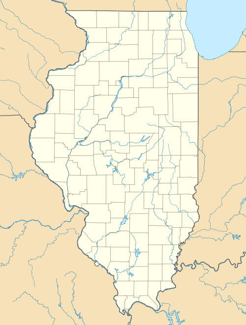
Decatur Airport( IATA : DEC, ICAO : KDEC, FAA LID : DEC) is a public airport five miles east of Decatur, in Macon County, Illinois, United States. The airport is owned by the Decatur Park District. [1] Airline service is subsidized by the federal government's Essential Air Service program at a cost of $2,667,922 (per year). [2]

Contents

The Federal Aviation Administration (FAA) National Plan of Integrated Airport Systems for 2021–2025 categorized it as a regional general aviation facility. [3]

It is the eleventh busiest of the 12 commercial airports in Illinois.[ citation needed ]
Facilities and aircraft

Decatur Airport covers 2,100 acres (850 ha) at an elevation of 682 feet (208 m). It has three runways: 6/24 is 8,496 by 150 feet (2,590 x 46 m) asphalt/concrete; 12/30 is 6,799 by 150 feet (2,072 x 46 m) asphalt/concrete; 18/36 is 5,298 by 150 feet (1,615 x 46 m) asphalt. [1]

In the 12-month period ending December 31, 2020, the airport had 29,285 aircraft operations, an average of 80 per day: 78% general aviation, 15% military, 4% air taxi and 3% commercial airline. In April 2022, there were 62 aircraft based at this airport: 50 single-engine airplanes and 12 military. [1] [4]

Decatur Airport has a 24,000 square feet (2,200 m2) passenger terminal with airline counters, a restaurant, baggage claim area, and car rental counters.

The Illinois Army National Guard has an Army Aviation Support Facility (AASF) at the airport. The facility occupies 10 acres (4.0 ha) and has three permanent buildings and a temporary building on the site. [5]

Airline and destination

AirlinesDestinations
United Express Chicago–O'Hare

On 11 March 2022, SkyWest (flying as United Express) notified the U.S. Department of Transportation that it intended to end its Essential Air Service into DEC in June 2022, which would leave the airport with no scheduled passenger service. [6] However, the Department of Transportation has refused to allow SkyWest to terminate service to Decatur. [7]

Ground transportation

Public transit service to the airport is provided by Decatur Public Transit System. Route 12 operates Monday through Saturday from downtown Decatur to the airport, while Route 3 serves the airport on Sundays. [8]

Accidents and incidents

See also

Related Research Articles

<span class="mw-page-title-main">Kalaupapa Airport</span> Airport

Kalaupapa Airport is a regional public use airport of the state of Hawaii, located on the northern peninsula of the island of Molokaʻi, two nautical miles north of Kalaupapa Settlement, in Kalawao County. Most flights to Kalaupapa originate from Molokai Airport or from airports on the other Hawaiian islands by unscheduled air taxis and general aviation. It is also used as a cargo facility carrying goods for Kalaupapa, which has no road access from the rest of Molokai.

<span class="mw-page-title-main">Presque Isle International Airport</span> Airport

Presque Isle International Airport, formally Northern Maine Regional Airport at Presque Isle, is a mile northwest of Presque Isle, in Aroostook County, Maine, United States. It serves the residents of Presque Isle and a vast area of northern Maine and northwestern New Brunswick. Airline flights to Newark Liberty International Airport are subsidized by the federal government's Essential Air Service program at a cost of $3,892,174.

<span class="mw-page-title-main">Laramie Regional Airport</span> Airport

Laramie Regional Airport is three miles west of Laramie, in Albany County, Wyoming. It is owned by the Laramie Regional Airport Board. Airline service is subsidized by the Essential Air Service program.

<span class="mw-page-title-main">Cape Girardeau Regional Airport</span> Airport in Scott County, Missouri

Cape Girardeau Regional Airport is a city owned public use airport in Scott County, Missouri, United States. It is located five nautical miles southwest of the central business district of Cape Girardeau, a city in Cape Girardeau County, Missouri, United States. The airport is used for general aviation, and has scheduled service by Contour Airlines with subsidized Essential Air Service program flights to Nashville.

<span class="mw-page-title-main">Waynesville–St. Robert Regional Airport</span> Airport in Fort Leonard Wood

Waynesville-St. Robert Regional Airport, also known as Forney Field, is a public and military use airport located at Fort Leonard Wood in Pulaski County, Missouri, United States. The airport's passenger terminal is operated under the control of the U.S. Army and general aviation is under the direction of a board named by the cities of Waynesville and St. Robert. Formerly known as Waynesville Regional Airport at Forney Field, it is served by one commercial airline with scheduled service subsidized by the Essential Air Service program.

<span class="mw-page-title-main">Southeast Iowa Regional Airport</span> Airport

Southeast Iowa Regional Airport is a public airport located two miles southwest of Burlington, in Des Moines County, Iowa. It is owned by the Southeast Iowa Regional Airport Authority which includes representatives from the city of Burlington, the city of West Burlington, and Des Moines County. The airport is used for general aviation and sees one airline, a service subsidized by the federal government's Essential Air Service program at a cost of $1,917,566.

<span class="mw-page-title-main">Bradford Regional Airport</span> Airport in Pennsylvania, U.S.

Bradford Regional Airport is 11 miles south of Bradford, in Lafayette Township, McKean County, Pennsylvania. It has scheduled airline service subsidized by the Essential Air Service program.

<span class="mw-page-title-main">Mid-Ohio Valley Regional Airport</span> Airport in West Virginia, U.S.

Mid-Ohio Valley Regional Airport is seven miles northeast of Parkersburg, in Wood County, West Virginia. It is owned by the Wood County Airport Authority and is also known as Wood County Airport or Gill Robb Wilson Field. It serves the Mid-Ohio Valley area which includes the Ohio cities of Marietta and Belpre and the West Virginia cities of Williamstown, Parkersburg and Vienna. It has scheduled passenger service subsidized by the Essential Air Service program.

<span class="mw-page-title-main">Petersburg James A. Johnson Airport</span> Airport

Petersburg James A. Johnson Airport is a state owned, public use airport located one nautical mile (2 km) southeast of the central business district of Petersburg, a city in the Petersburg Borough of the U.S. state of Alaska that has no road access to the outside world. Airline service is subsidized by the Essential Air Service program.

<span class="mw-page-title-main">Yakutat Airport</span> Airport serving Yakutat, Alaska, United States

Yakutat Airport is a state-owned public-use airport located three nautical miles (6 km) southeast of the central business district of Yakutat, a city and borough in the U.S. state of Alaska which has no road access to the outside world. Airline service is subsidized by the Essential Air Service program.

<span class="mw-page-title-main">Merle K. (Mudhole) Smith Airport</span> Airport

Merle K. (Mudhole) Smith Airport is a state-owned public-use airport located 11 nautical miles southeast of the central business district of Cordova, a city in the Chugach Census Area of the U.S. state of Alaska which has no road access to the outside world. Airline service is subsidized by the Essential Air Service program.

<span class="mw-page-title-main">Quincy Regional Airport</span> Airport serving Quincy, Illinois, United States

Quincy Regional Airport is a city-owned airport 12 miles east of Quincy, a city in Adams County, Illinois, United States. It is used for general aviation but also sees Southern Airways Express flights to Chicago's O'Hare International Airport and St. Louis Lambert International Airport, a service which is subsidized by the federal government's Essential Air Service program at a cost of $1,956,856. The Federal Aviation Administration (FAA) National Plan of Integrated Airport Systems for 2023–2027 categorized it as a national non-primary commercial service facility.

<span class="mw-page-title-main">Veterans Airport of Southern Illinois</span> Airport

Veterans Airport of Southern Illinois , also known as Williamson County Regional Airport, is five miles west of Marion, in Williamson County, Illinois, United States. The airport is owned by the Williamson County Airport Authority. It sees one airline, subsidized by the federal government's Essential Air Service program at an annual cost of $2,562,819 or $141 per passenger. On November 11, 2016 during the grand opening ceremony for the new terminal, the airport was renamed to "Veterans Airport of Southern Illinois" to honor veterans and better reflect the regional nature of the airport.

<span class="mw-page-title-main">Owensboro–Daviess County Regional Airport</span> Small airport in Kentucky

Owensboro–Daviess County Airport is a public use airport located three miles southwest of Owensboro, in Daviess County, Kentucky. The airport is owned by both the city and county. One airline schedules passenger flights, subsidized by the Essential Air Service program.

<span class="mw-page-title-main">Delta County Airport</span> Airport in Michigan, U.S.

Delta County Airport is a county-owned public-use airport located two nautical miles southwest of the central business district of Escanaba, a city in Delta County, Michigan, United States. It offers limited commercial service, which is subsidized by the Essential Air Service program.

Gogebic–Iron County Airport is a county-owned public-use airport located seven nautical miles (13 km) northeast of the central business district of Ironwood, a city in Gogebic County, Michigan, United States. It is mostly used for general aviation, but it also offers scheduled passenger service which is subsidized by the Essential Air Service program.

<span class="mw-page-title-main">Gustavus Airport</span> Airport

Gustavus Airport is a state-owned public-use airport located in Gustavus, a city in the Hoonah-Angoon Census Area of the U.S. state of Alaska. Scheduled airline service is subsidized by the Essential Air Service program.

<span class="mw-page-title-main">Yakataga Airport</span> Airport

Yakataga Airport is a public use airport serving Yakataga in the U.S. state of Alaska. It is owned by Federal Aviation Administration and lies in the western section of Yakutat Borough.

<span class="mw-page-title-main">Gulkana Airport</span> Airport

Gulkana Airport is a state owned, public use airport located four nautical miles northeast of the central business district of Gulkana, in the Valdez-Cordova Census Area of the U.S. state of Alaska. It is also and five miles (8 km) northeast of Glenallen. Scheduled passenger service is subsidized by the Essential Air Service program.

Minchumina Airport is a state-owned public-use airport serving Lake Minchumina, in the Yukon-Koyukuk Census Area of the U.S. state of Alaska. It is also known as Lake Minchumina Airport. In the past, the airport used MHM IATA code.

References

  1. 1 2 3 4 FAA Airport Form 5010 for DEC PDF . Federal Aviation Administration. effective April 21, 2022.
  2. "Essential Air Service Reports". U.S. Department of Transportation. Retrieved June 7, 2014.
  3. "List of NPIAS Airports" (PDF). FAA.gov. Federal Aviation Administration. October 21, 2016. Retrieved February 14, 2018.
  4. "AirNav: KDEC – Decatur Airport". AirNav.com. Retrieved 2022-11-16.
  5. "Decatur, Illinois". Illinois Army National Guard. Archived from the original on July 20, 2007. Retrieved 2009-09-06.
  6. https://www.regulations.gov/document/DOT-OST-1996-1559-0112 [ bare URL ]
  7. Klint, Matthew (15 March 2022). "U.S. DOT Forbids SkyWest from Ending Service to 29 Cities". Live and Let's Fly. Retrieved 2022-07-31.
  8. "Route Map" (PDF). Retrieved May 31, 2023.
  9. "03 AUG 1950". National Transportation Safety Board (NTSB). Aviation Safety Network. November 27, 2004. Retrieved 2009-09-05.
  10. 1 2 3 "02 OCT 2006". National Transportation Safety Board (NTSB)/FAA. Aviation Safety Network. October 3, 2006. Retrieved 2009-09-06.
  11. "C-21 Accident Investigation Board completed". Scott Air Force Base, Ill. United States Air Force. May 11, 2007. Archived from the original on 2009-05-15. Retrieved 2009-09-06.
  12. "National Transportation Safety Board Aviation Accident Final Report" (PDF). NTSB.gov . 20 April 2012. p. 1. Retrieved 2021-11-07. (link to download)

Other sources