Deep Creek Falls | |
---|---|
Deep Creek Falls seen from Highway 140 | |
Location | Warner Valley |
Coordinates | 42°10′26″N119°57′00″W / 42.17386°N 119.94992°W Coordinates: 42°10′26″N119°57′00″W / 42.17386°N 119.94992°W |
Elevation | 4,873 ft (1,485 m) |
Total height | 25 ft (8 m) |
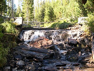
Deep Creek Falls is a waterfall formed along Gibson Canyon on the south end of Warner Valley, east side of the city of Lakeview in Lake County, Oregon. [1] Access to Deep Creek Falls is located along Oregon Route 140 through unmarked paths that lead down to the stream and the base of the waterfall. [1]
A waterfall is an area where water flows over a vertical drop or a series of steep drops in the course of a stream or river. Waterfalls also occur where meltwater drops over the edge of a tabular iceberg or ice shelf.
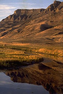
The Warner Valley is a valley in south-central Oregon in the United States. It is a remote valley at the northwestern corner of North America's Basin and Range Province. The valley is home to a chain of lakes and wetlands known as the Warner Lakes. Native Americans were present in the Warner Valley for thousands of years before European explorers arrived in the 19th century. It is the site of Fort Warner, built by the United States Army in 1867. The fort was used as a supply depot and administrative headquarters during a protracted Army campaign against Northern Paiute bands in eastern Oregon and northern California. Today, livestock ranching is the main commercial activity in the valley. The Warner Valley offers a number of recreational opportunities including hunting, fishing, bird watching, and wildlife viewing.
Lakeview is a town in Lake County, Oregon, United States. The population was 2,294 at the 2010 census. It is the county seat of Lake County. The city bills itself as the "Tallest Town in Oregon" because of its elevation. Lakeview is situated in the Goose Lake Valley at the foot of the Warner Mountains and at the edge of Oregon's high desert country. Its economy is based on agriculture, lumber production, and government activities. In addition, tourism is an increasingly important part of the city's economy. Oregon's Outback Scenic Byway passes through Lakeview.
The falls are a barrier to upstream migration of some fish species. For example, the Warner sucker is only found downstream from the falls while the falls divide the creek's native redband trout into two distinct populations, one above the falls and another below. [2] [3] However, the falls do not appear to be a barrier for brook trout or hatchery fish released in Deep Creek. [4]
The Warner sucker is a rare species of freshwater ray-finned fish in the family Catostomidae. Native to Oregon in the United States and found only in the Warner Basin, its distribution extends just into Nevada and California. It is a federally listed threatened species. Its other common name is redhorse. The International Union for Conservation of Nature has rated this fish as an endangered species because of its small extent of occurrence, the small number of locations in which it is found, and the extreme fluctuations in area of occupancy resulting from drought and water abstraction. Conservation efforts have been put in place.
Redband trout are a group of three recognized subspecies of rainbow trout. They occur in three distinct regions in Pacific basin tributaries and endorheic basins in the western United States. The three subspecies are the Columbia River redband trout, the McCloud River redband trout and the Great Basin redband trout.
The brook trout is a species of freshwater fish in the char genus Salvelinus of the salmon family Salmonidae. It is native to Eastern North America in the United States and Canada, but has been introduced elsewhere in North America, as well as to Iceland, Europe, and Asia. In parts of its range, it is also known as the eastern brook trout, speckled trout, brook charr, squaretail, or mud trout, among others. A potamodromous population in Lake Superior, as well as an anadromous population in Maine, is known as coaster trout or, simply, as coasters. The brook trout is the state fish of nine U.S. states: Michigan, New Hampshire, New Jersey, New York, North Carolina, Pennsylvania, Vermont, Virginia, and West Virginia, and the Provincial Fish of Nova Scotia in Canada.
The lower portion of Deep Creek follows Oregon Route 140. The falls are a common recreational stop for travelers along the highway. Travellers often pull off the highway near the falls to stretch or fish. [5] Deep Creek Falls are also a popular stop along the Oregon Outback Scenic Bikeway, which follows Route 140 along the section that passes the falls. [6] [7]
Fishing is the activity of trying to catch fish. Fish are normally caught in the wild. Techniques for catching fish include hand gathering, spearing, netting, angling and trapping. “Fishing” may include catching aquatic animals other than fish, such as molluscs, cephalopods, crustaceans, and echinoderms. The term is not normally applied to catching farmed fish, or to aquatic mammals, such as whales where the term whaling is more appropriate. In addition to being caught to be eaten, fish are caught as recreational pastimes. Fishing tournaments are held, and caught fish are sometimes kept as preserved or living trophies. When bioblitzes occur, fish are typically caught, identified, and then released.
The steep cliffs that flank the falls are good habitat for cliff swallows, falcons, and eagles. [6] [7]
The American cliff swallow is a member of the passerine bird family Hirundinidae consisting of both swallow and martin species. The scientific name is derived from Ancient Greek; Petrochelidon originates from the petros meaning "rock" and khelidon "swallow", pyrrhonota comes from purrhos meaning "flame-coloured" and -notos "-backed".
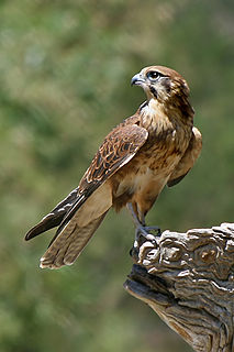
Falcons are birds of prey in the genus Falco, which includes about 40 species. Falcons are widely distributed on all continents of the world except Antarctica, though closely related raptors did occur there in the Eocene.
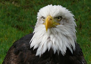
Eagle is the common name for many large birds of prey of the family Accipitridae. Eagles belong to several groups of genera, not all of which are closely related. Most of the 60 species of eagle are from Eurasia and Africa. Outside this area, just 14 species can be found—2 in North America, 9 in Central and South America, and 3 in Australia.
Lake County is a county in the south-central region of the U.S. state of Oregon. As of the 2010 census, the population was 7,895. Its county seat is Lakeview. The county is named after the many lakes found within its boundaries, including Lake Abert, Summer Lake, Hart Lake, and Goose Lake.
The Deschutes River in central Oregon is a major tributary of the Columbia River. The river provides much of the drainage on the eastern side of the Cascade Range in Oregon, gathering many of the tributaries that descend from the drier, eastern flank of the mountains. The Deschutes provided an important route to and from the Columbia for Native Americans for thousands of years, and then in the 19th century for pioneers on the Oregon Trail. The river flows mostly through rugged and arid country, and its valley provides a cultural heart for central Oregon. Today the river supplies water for irrigation and is popular in the summer for whitewater rafting and fishing.
The McCloud River is a 77.1-mile (124.1 km) long river that flows east of and parallel to the upper Sacramento River, in Siskiyou County and Shasta County in northern California in the United States. It drains a scenic mountainous area of the Cascade Range, including part of Mount Shasta. It is a tributary of the Pit River, which in turn flows into the Sacramento River. The three rivers join in Shasta Lake, formed by Shasta Dam north of Redding.
Oregon Route 140 is an Oregon state highway that serves the southern portion of the state. It is the longest state highway in Oregon, running 237 miles from the community of White City, Oregon, through Klamath Falls and on to Lakeview. It then continues east, eventually descending into the state of Nevada.
The Fremont–Winema National Forest is a United States National Forest formed from the 2002 merger of the Fremont and Winema National Forests. They cover territory in southern Oregon from the crest of the Cascade Range on the west past the city of Lakeview to the east. The northern end of the forests is bounded by U.S. Route 97 on the west and Oregon Route 31 on the east. To the south, the state border with California forms the boundary of the forests. Klamath Falls is the only city of significant size in the vicinity. The forests are managed by the United States Forest Service, and the national forest headquarters are located in Lakeview.
Chandler State Wayside is a state park in south-central Oregon in the United States. It is named in honor of Solomon and Hattie Chandler, who donated the land for the park. The park covers 85 acres (34 ha) of pine forest along a creek. The park provides restrooms and other basic facilities to accommodate the traveling public. Chandler State Wayside is administered by the Oregon Parks and Recreation Department.
The Chewaucan River is part of the Great Basin drainage. It flows 53 miles (85 km) through the Fremont–Winema National Forests, Bureau of Land Management land, and private property in southern Oregon. Its watershed consists of 651 square miles (1,690 km2) of conifer forest, marsh, and rural pasture land. The river provides habitat for many species of wildlife including native Great Basin redband trout a subspecies of rainbow trout.
The Wood River is a short river in the southern region of the U.S. state of Oregon, and part of the Klamath Basin drainage. It flows 18 miles (29 km) through the Fremont-Winema National Forests, Bureau of Land Management land, and private property in southern Oregon. Its watershed consists of 220 square miles (570 km2) of conifer forest, rural pasture land, and marsh. The river provides habitat for many species of wildlife including an adfluvial (migratory) and resident populations of native Great Basin redband trout.
Valley Falls is a small unincorporated community in Lake County, Oregon, United States. The settled area is located at the junction of U.S. Route 395 and Oregon Route 31. The community is named for a small falls on the Chewaucan River just north of the occupied site. East of Valley Falls, the cliff face of Abert Rim overlooks the community.
Little Blitzen River is a 12.5-mile (20.1 km) tributary of the Donner und Blitzen River in the U.S. state of Oregon. Little Blitzen River rises on the west flank of Steens Mountain about 20 miles (32 km) southeast of Frenchglen and about 70 miles (110 km) south of Burns in Harney County. Flowing west in a steep-walled canyon, it joins the South Fork Donner und Blitzen River at 42.6737752°N 118.7935277°W to form the Donner und Blitzen main stem, which continues north about another 40 miles (64 km) to its mouth at 43.291542°N 118.8199273°W in Malheur Lake. The Donner und Blitzen River was named by soldiers of German origin and translates as "thunder and lightning". Little Blitzen River brings to mind one of Santa Claus's reindeer.
The Warner Lakes are a chain of shallow lakes and marshes in the Warner Valley of eastern Lake County, Oregon, United States. The lakes extend the length of the valley, covering approximately 90,000 acres (360 km2).
Hart Lake is a shallow lake in the Warner Valley of eastern Lake County, Oregon, United States. The lake covers 7,324 acres (29.64 km2) and has the most stable water level within the valley's Warner Lakes chain. The lake is named for the heart-shaped brand used by the pioneer Wilson and Alexander cattle ranch established near the lake. Much of the land around Hart Lake is administered by the Bureau of Land Management (BLM) and the United States Fish and Wildlife Service (FWS). The lake and the surrounding wetlands support a wide variety of birds and other wildlife. Recreational opportunities on and near Hart Lake include hunting, fishing, bird watching, and boating.
The Goose Lake Valley is located in south-central Oregon and northeastern California in the United States. It is a high valley at the northwestern corner of North America's Great Basin. Much of the valley floor is covered by Goose Lake, a large endorheic lake that straddles the Oregon–California border. Native Americans inhabited the Goose Lake Valley for thousands of years before explorers arrived in the 19th century. The pioneer wagon route known as the Applegate Trail crossed the Goose Lake Valley on its way to southern Oregon. At the south end of Goose Lake, the Lassen Cutoff separated from the Applegate Trail and headed south toward the Sacramento Valley. Today, Lakeview, Oregon, is the largest settlement in the valley. Livestock ranching and lumber mills are the valley's main commercial activity. The Goose Lake Valley offers a number of recreational opportunities including hang-gliding, hunting, fishing, and birdwatching.
The South Fork Clackamas River is a tributary, roughly 8 miles (13 km) long, of the Clackamas River in the U.S. state of Oregon. Beginning near South Fork Mountain in the western Cascade Range, the river flows generally north through Clackamas County to meet the larger river at Big Cliff. Most of the South Fork's drainage basin lies within the Mount Hood National Forest.
Lake of the Woods is a natural lake near the crest of the Cascade Range in the Fremont–Winema National Forest in southern Oregon in the United States. The lake covers 1,146 acres (4.64 km2). It was named by Oliver C. Applegate in 1870. Today, the Oregon Department of Fish and Wildlife manages the lake's fishery. The small unincorporated community of Lake of the Woods is located on the east shore of the lake. Lake of the Woods is one of southern Oregon's most popular outdoor recreation sites.
The Catlow Valley is a basin in Harney County, Oregon, United States. It is a remote valley at the northwestern corner of North America's Basin and Range Province. The valley is named after a pioneer rancher, John Catlow. The area was used by Native Americans for thousands of years before European explorers arrived in the 19th century. Today, cattle ranching is the main commercial activity in the valley. The public land in the Catlow Valley is administered by the Bureau of Land Management. This public land offers a number of recreational opportunities including hiking, hunting, fishing, bird watching, and wildlife viewing.
Gerber Reservoir is an irrigation impoundment created by Gerber Dam. It is located in southern Klamath County, Oregon, United States. The reservoir covers 3,815 acres (1,544 ha). The dam and reservoir are named in honor of Louis C. Gerber, an early pioneer who owned much of the land flooded by the reservoir. Today, the reservoir and surrounding property is owned by the United States Government. It is administered by the Bureau of Reclamation and the Bureau of Land Management. Gerber Reservoir is a popular outdoor recreation site with two campgrounds along its west shore.
Crump Lake is a shallow lake in the Warner Valley of eastern Lake County, Oregon, United States. The lake covers 7,680 acres (31.1 km2). It is the largest of the Warner Lakes system. The lake is named for pioneer rancher Thomas Crump. Crump Lake is owned by the Oregon Department of State Lands. Much of the land around the lake is administered by the Bureau of Land Management and the United States Fish and Wildlife Service. The lake and the surrounding wetlands support a wide variety of birds and other wildlife. Recreational opportunities on or near Crump Lake include fishing, bird watching, and camping.
This Lake County, Oregon state location article is a stub. You can help Wikipedia by expanding it. |