Beeston is a town in the Borough of Broxtowe, Nottinghamshire, England, it is 3 miles south-west of Nottingham. To its north-east is the University of Nottingham's main campus, University Park. The headquarters of pharmaceutical and retail chemist group Boots are 0.6 miles (1 km) east of the centre of Beeston, on the border with Broxtowe and the City of Nottingham. To the south lie the River Trent and the village of Attenborough, with extensive wetlands.

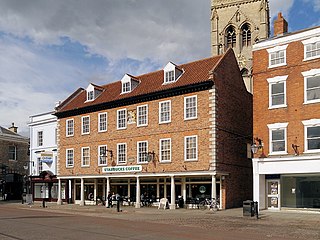
Newark-on-Trent or Newark is a market town and civil parish in the Newark and Sherwood district in Nottinghamshire, England. It is on the River Trent, and was historically a major inland port. The A1 road bypasses the town on the line of the ancient Great North Road. The town's origins are likely to be Roman, as it lies on a major Roman road, the Fosse Way. It grew up around Newark Castle, St Mary Magdalene church and later developed as a centre for the wool and cloth trades.

Newark and Sherwood is a local government district in Nottinghamshire, England. It is the largest district by area in the county. The council is based in Newark-on-Trent, the area's largest town. The district also includes the towns of Southwell and Ollerton along with a large rural area containing many villages. Much of the district lies within the ancient Sherwood Forest and there are also extensive forestry plantations in the area.

Rushcliffe is a local government district with borough status in south Nottinghamshire, England. Its council is based in West Bridgford. The borough also includes the towns of Bingham and Cotgrave as well as numerous villages and surrounding rural areas. Some of the built-up areas in the north-west of the borough, including West Bridgford, form part of the Nottingham Urban Area.

Bingham is a market town and civil parish in the Rushcliffe borough of Nottinghamshire, England, 9 miles (14 km) east of Nottingham, 12 miles (18.8 km) south-west of Newark-on-Trent and 15 miles (23.3 km) west of Grantham. The town had a population of 9,131 at the 2011 census, with the population now sitting at 10,080 from the results of the 2021 census data.

Newark is a constituency in Nottinghamshire, England. It is represented by Robert Jenrick of the Conservative Party, who won the seat in a by-election on 5 June 2014, following the resignation of Patrick Mercer in April 2014.

Southwell is a minster and market town, and a civil parish, in the district of Newark and Sherwood in Nottinghamshire, England. It is home to the grade-I listed Southwell Minster, the cathedral of the Anglican Diocese of Southwell and Nottingham. The population of the town was recorded at 7,491 in the 2021 census.
Sherwood is a large district and ward of the city of Nottingham, England, 1.5 miles (2.4 km) north of the city centre. The population at the 2011 census was 15,414. It is bordered by Woodthorpe to the northeast, Mapperley to the east, Carrington to the south, New Basford and Basford to the west, and Daybrook and Bestwood to the north.

North Hykeham is an industrial town and civil parish in the North Kesteven District of Lincolnshire, England. It is located directly south of the city of Lincoln, where it forms the southern part of the wider Lincoln Urban Area along with Waddington, Bracebridge Heath, Canwick and South Hykeham. The parish covering the town had a population of 16,844 in the 2021 Census.

Tuxford is a historic market town and a civil parish in the Bassetlaw district of Nottinghamshire, England. It had a population of 2,809 in the 2021 census.

Farndon is a small village and civil parish in the Newark and Sherwood district of Nottinghamshire, England. It lies along the historic Fosse road on the banks of the River Trent and is 3 miles (4 km) south-west of Newark-on-Trent. The population of the civil parish as of the 2011 census was 2,405, this increased to 2,479 at the 2021 census. The A46 road previously ran through the village until the development of a new dual carriageway bypass.

Hawton is a hamlet and civil parish in the Newark and Sherwood district of Nottinghamshire, England. It lies two miles (3.2 km) south of the town of Newark-on-Trent, near the River Devon, a tributary of the River Trent. Its population was recorded as 147 in the 2011 census. Hawton alone reported 80 residents at the 2021 census.

Cromwell is a village and civil parish in Nottinghamshire, England. It is located 5 miles (8 km) north of Newark. According to the 2001 census it had a population of 188, increasing to 232 at the 2011 census, and 271 at the 2021 census.

Fernwood is a village and civil parish in the Newark and Sherwood district of Nottinghamshire, England. The parish, which then included Balderton, had a population of 10,298 in 2001. It is a suburb of Newark-on-Trent.The population of the civil parish was given as 2,190 in the 2011 census, Balderton by that time was a separate civil parish. Fernwood itself increased to 3,054 at the 2021 census.

Trent is a suburb and ward of Gainsborough in the West Lindsey district of Lincolnshire, England. It covers the town centre and southern portion of Gainsborough near the River Trent and its border with the ceremonial county of Nottinghamshire. The population of Gainsborough Trent ward was recorded at 5,462 in the 2021 UK Census.

Beacon is a ward and suburb of Newark-on-Trent, in the Newark & Sherwood district in the county of Nottinghamshire, England. It is one of the seven wards on Newark Town Council.

Bridge is a ward and suburb of Newark-on-Trent, in the Newark & Sherwood district in the county of Nottinghamshire, England. It is one of the seven wards on Newark Town Council.

Castle is a ward and suburb of Newark-on-Trent, in the Newark & Sherwood district in the county of Nottinghamshire, England. It is one of the seven wards on Newark Town Council.

Magnus is a ward and suburb of Newark-on-Trent in the Newark & Sherwood district in the county of Nottinghamshire, England. It is one of the seven wards on Newark Town Council.

Arnoldfield is one of the seven wards and a suburb of Grantham in Lincolnshire, England. It had a population of 5,667 at the 2021 Census.


