Sokolo is a small town and rural commune in the Cercle of Niona in the Ségou Region of southern-central Mali. The commune has an area of approximately 2,219 square kilometers and includes the town and 17 villages. In the 2009 census the population was 23,338. The town lies 56 km north or Niono.
Yorosso is a town and rural commune in the Yorosso Cercle, in the Sikasso Region of southern Mali. The town serves as the seat of the Yorosso Cercle. It lies 151 km northeast of Sikasso and 202 km southeast of Ségou. The commune covers an area of 487 square kilometers, and includes the Yorosso town and nine other surrounding villages. According to the 2009 census, it had a population of 22,063.
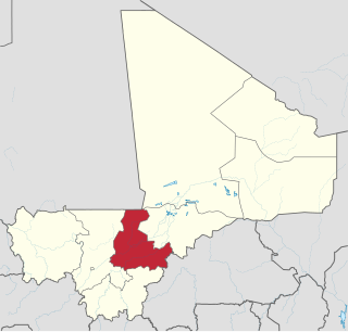
Sébougou is a village and rural commune in the Cercle of Ségou in the Ségou Region of southern-central Mali. The commune contains 10 villages in an area of approximately 115 square kilometers. In the 2009 census it had a population of 16,175. The commune lies to the south of the River Niger and to the west of the urban commune of Ségou.
Pelengana is a small town and rural commune in the Cercle of Ségou in the Ségou Region of southern-central Mali. The commune contains the town and 25 villages in an area of approximately 359 square kilometers. In the 2009 census it had a population of 56,259. The town of Pelengana lies 5 km southeast of Ségou on the Route Nationale 6.
Konodimini is a village and rural commune in the Cercle of Ségou in the Ségou Region of southern-central Mali. The commune includes 23 villages in an area of approximately 362 square kilometers. In the 2009 census it had a population of 16719. The village of Konodimini, the chef-lieu of the commune, lies 23 km southwest of Ségou, on the right (south) bank of the Niger River.
Boussin is a village and rural commune in the Cercle of Ségou in the Ségou Region of southern-central Mali. The commune includes 15 villages in an area of approximately 178 square kilometers. In the 2009 census it had a population of 12,401. The village of Boussin lies 36 km east of Ségou.
Dougabougou is a small town and rural commune in the Cercle of Ségou in the Ségou Region of southern-central Mali. The commune covers an area of approximately 180 square kilometers and includes the town and 6 villages. In the 2009 census the population was 29,208. The town lies 20 km north of the Markala dam. Many of the inhabitants are employed in the production of sugar on land irrigated by the Office du Niger scheme. A Chinese-Malian company produces sugar in the town.
Togou is a village and rural commune in the Cercle of Ségou in the Ségou Region of southern-central Mali. The commune contains 10 villages in an area of approximate 147 square kilometers. In the 2009 census it had a population of 8,987. The village of Togou, the chef-lieu of the commune, is 35 km northeast of Ségou.

Macina is a small town and rural commune in the Cercle of Macina in the Ségou Region of southern-central Mali. The commune covers an area of 1,100 square kilometers and contains the main town and 20 villages. In the 2009 census the commune had a population of 36,170.
Kolongo or Kolongo Tomo is a village and rural commune in the Cercle of Macina in the Ségou Region of southern-central Mali. The commune covers an area of approximately 484 square kilometers and includes 37 villages. In the 2009 census the commune had a population of 37,648. The village lies on the Fala de Boky-Wéré, an ancient branch of the Niger River that now forms part of the irrigation system of the Office du Niger.

Kokry is a village and rural commune in the Cercle of Macina in the Ségou Region of southern-central Mali. The commune covers an area of approximately 160 square kilometers and includes 17 villages. The farmland is irrigated by the Office du Niger irrigation scheme. The main crop is rice. In the 2009 census the commune had a population of 13,393. The main village, (chef-lieu), is called Kokry Centre to distinguish it from Kokry Bozo which lies 3 km to the east on a strip of land between the Niger River and the Distributeur Kokry, an irrigation canal.
Boky Wéré is a village and rural commune in the Cercle of Macina in the Ségou Region of southern-central Mali. The commune covers an area of approximately 220 square kilometers and includes 14 villages. The commune is bordered to the north by the commune of Monimpébougou, to the east by the commune of Kokry, to the west by the commune of Pogo and to the south by the commune of Kolongo. In the 2009 census the commune had a population of 16,934. The village lies to the north of the Fala de Boky-Wéré, an ancient riverbed that forms part of the Office du Niger irrigation system, and to the south of a large irrigation canal dug in 2009 as part of the Libyan financed Malibya project.
Siribala is a town and rural commune in the Cercle of Niona in the Ségou Region of southern-central Mali. The commune has an area of approximately 445 square kilometers and includes the town and 18 villages. In the 2009 census it had a population of 37,065. The town lies 25 km south of Niono on the east side of the Fala de Molodo channel that forms part of the Office du Niger irrigation scheme. The present town, actually Siribala Coura, was established in the 1970s to accommodate agricultural workers employed on the sugar-cane plantation and the associated mill. The earlier settlement, Siribala Coro, is 5 km away from the present town.
Diabaly is a small town and rural commune in the Cercle of Niono in the Ségou Region of Mali. The commune has an area of approximately 1,538 square kilometres (594 sq mi) and includes 28 villages as well as the town. In the 2009 census the commune had a population of 35,266. The town lies 50 kilometres (31 mi) north of Niono on the west side of the Fala de Molodo channel that forms part of the Office du Niger irrigation scheme. The fields around the town are irrigated but much of the commune lies to the east of the Fala de Molodo in an area that lacks irrigation.
Diédougou is a rural commune in the Cercle of Ségou in the Ségou Region of Mali. The commune includes 21 villages in an area of approximately 409 square kilometers. In the census of 2009 it had a population of 13,268. The main village (chef-lieu) is Yolo which lies 80 km east-northeast of Ségou.
Farakou Massa is a rural commune in the Cercle of Ségou in the Ségou Region of Mali. The commune lies along the right bank of the River Niger and includes 8 villages in an area of approximately 109 square kilometers. In the 2009 census it had a population of 14,314. The administrative center (chef-lieu) of the commune is the village of Kominé which is 49 km northeast of Ségou.
Bellen is a rural commune in the Cercle of Ségou in the Ségou Region of Mali. It is the most northerly within the cercle and is sparsely populated with only 9 villages in an area of approximately 3,189 square kilometers. In the 2009 census it had a population of 6,949. The chef-lieu is the village of Sagala which lies 89 km northwest of Ségou.
Molodo is a village and seat of the commune of Kala Siguida in the Cercle of Niono in the Ségou Region of southern-central Mali. The village was created in 1945 to accommodate labourers working for the Office du Niger irrigation scheme. It lies only 4 km from Niono on opposite side of the Fala de Molodo.
Alatona is a locality in the Cercle of Niono in the Ségou Region of southern-central Mali. It encompasses the zone covered by the Alatona Irrigation Project, a part of the Office du Niger scheme. Alatona was originally a small village that was abandoned after droughts in the early seventies forced its inhabitants to move closer to the waters of the Fala de Molodo. The population of the former village was 127 in 2007 before the irrigation projects works started, and its old site turned into farmland. The original village was located in the Dogofry commune and is still listed as such by the Malian government, Although the Alatona Irrigation Project extends to the neighboring commune of Diabaly.