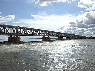
Markala is a commune in Mali's Ségou Region on the Niger River 35 km down stream from the town of Ségou. The commune contains 30 villages in an area of 318 square kilometers and in 2009 had a population of 45,961. Mali's primary irrigation dam, the Markala dam, lies in the commune. The main village of the commune, Diamarabougou, is on the right bank adjacent to the dam which also serves as an important road bridge.

Barouéli Cercle is an administrative subdivision of the Ségou Region of Mali. The administrative center (chef-lieu) is the town of Barouéli.

Macina Cercle is an administrative subdivision of the Ségou Region of Mali. The administrative center (chef-lieu) is the town of Macina.

Niono Cercle is an administrative subdivision of the Ségou Region of Mali. The administrative center (chef-lieu) is the town of Niono.

Tominian Cercle is an administrative subdivision of the Ségou Region of Mali. The administrative center of the local government is in the town of Tominian. The Cercle is divided into Communes, and below this, quarters/villages. In the 2009 census the cercle had a population of 219,853 people.
Dioro is a town and rural commune in the Cercle of Ségou in the Ségou Region of southern-central Mali. The commune extends over an area of approximately 586 square kilometers on the right bank of the Niger River and includes the town and 29 of the surrounding villages. In the 2009 census the commune had a population of 47,876. The town of Dioro is located 57 km northeast of Ségou on the bank of the river.
Pelengana is a small town and rural commune in the Cercle of Ségou in the Ségou Region of southern-central Mali. The commune contains the town and 25 villages in an area of approximately 359 square kilometers. In the 2009 census it had a population of 56,259. The town of Pelengana lies 5 km southeast of Ségou on the Route Nationale 6.
Farako is a small town and rural commune in the Cercle of Ségou in the Ségou Region of southern-central Mali. The commune lies on the north bank of the Niger River and contains 11 settlements in an area of 200 square kilometers. In the 2009 census it had a population of 17,570. The town of Farako is the chef-lieu of the commune.
Saminé is a small town and rural commune in the Cercle of Ségou in the Ségou Region of southern-central Mali. The commune includes the town and 5 villages in an area of approximately 197 square kilometers. In the 2009 census it had a population of 12,082. The Bani River runs along the southern boundary of the commune. The town of Saminé, the chef-lieu of the commune, is 41 km south-southeast of Ségou.
Dougabougou is a small town and rural commune in the Cercle of Ségou in the Ségou Region of southern-central Mali. The commune covers an area of approximately 180 square kilometers and includes the town and 6 villages. In the 2009 census the population was 29,208. The town lies 20 km north of the Markala dam. Many of the inhabitants are employed in the production of sugar on land irrigated by the Office du Niger scheme. A Chinese-Malian company produces sugar in the town.
N'Gara is a village and rural commune in the Cercle of Ségou in the Ségou Region of southern-central Mali. The commune includes three villages in an area of approximately 159 square kilometers. In the 2009 census it had a population of 11,700. The village of N'Gara, the chef-lieu of the commune, is 30 km southwest of Ségou.
Massala is a village and rural commune in the Cercle of Ségou in the Ségou Region of southern-central Mali. The commune includes 8 villages in an area of approximately 89 square kilometers. In the 2009 census it had a population of 6,547.

Macina is a small town and rural commune in the Cercle of Macina in the Ségou Region of southern-central Mali. The commune covers an area of 1,100 square kilometers and contains the main town and 20 villages. In the 2009 census the commune had a population of 36,170.
Souleye is a village and rural commune in the Cercle of Macina in the Ségou Region of southern-central Mali. The commune covers an area of approximately 388 square kilometers and includes 10 villages. In the 2009 census the commune had a population of 9,885.
Dogofry is a village and a rural commune in the Cercle of Niona in the Ségou Region of southern-central Mali. The commune covers an area of approximately 3,820 square kilometers and is bordered to the north by the Republic of Mauritania, to the east by the commune of Nampalari, to the southeast by the commune of Diabaly, to the southwest by the commune of Sokolo and to the west by the commune of Guiré in the Cercle of Nara. It includes 19 villages, and had a population of 34,057 in the 2009 census. The south of the commune includes a region irrigated as part of the Office du Niger scheme. The village of Dogofry lies in this irrigated area, about 60 km north of Niono, to the west of the Fala de Molodo and the Distributeur de Kogoni.
Siribala is a town and rural commune in the Cercle of Niona in the Ségou Region of southern-central Mali. The commune has an area of approximately 445 square kilometers and includes the town and 18 villages. In the 2009 census it had a population of 37,065. The town lies 25 km south of Niono on the east side of the Fala de Molodo channel that forms part of the Office du Niger irrigation scheme. The present town, actually Siribala Coura, was established in the 1970s to accommodate agricultural workers employed on the sugar-cane plantation and the associated mill. The earlier settlement, Siribala Coro, is 5 km away from the present town.
Pogo is a village and rural commune in the Cercle of Niono in the Ségou Region of Mali. The commune has an area of approximately 550 square kilometers and includes 18 villages. In the 2009 census it had a population of 16,308.
Diabaly is a small town and rural commune in the Cercle of Niono in the Ségou Region of Mali. The commune has an area of approximately 1,538 square kilometres (594 sq mi) and includes 28 villages as well as the town. In the 2009 census the commune had a population of 35,266. The town lies 50 kilometres (31 mi) north of Niono on the west side of the Fala de Molodo channel that forms part of the Office du Niger irrigation scheme. The fields around the town are irrigated but much of the commune lies to the east of the Fala de Molodo in an area that lacks irrigation.
Farakou Massa is a rural commune in the Cercle of Ségou in the Ségou Region of Mali. The commune lies along the right bank of the River Niger and includes 8 villages in an area of approximately 109 square kilometers. In the 2009 census it had a population of 14,314. The administrative center (chef-lieu) of the commune is the village of Kominé which is 49 km northeast of Ségou.
Bellen is a rural commune in the Cercle of Ségou in the Ségou Region of Mali. It is the most northerly within the cercle and is sparsely populated with only 9 villages in an area of approximately 3,189 square kilometers. In the 2009 census it had a population of 6,949. The chef-lieu is the village of Sagala which lies 89 km northwest of Ségou.

