Bla Cercle is an administrative subdivision of the Ségou Region of Mali. The administrative center (chef-lieu) is the town of Bla.

Diouman or Dioumanzana is a village and commune in the Cercle of Dioila in the Koulikoro Region of southern Mali.
Benkadi is a rural commune in the Cercle of Dioïla in the Koulikoro Region of south-western Mali. The main village (chef-lieu) is Kotoula.
Konodimini is a village and rural commune in the Cercle of Ségou in the Ségou Region of southern-central Mali. The commune includes 23 villages in an area of approximately 362 square kilometers. In the 2009 census it had a population of 16719. The village of Konodimini, the chef-lieu of the commune, lies 23 km southwest of Ségou, on the right (south) bank of the Niger River.
Boussin is a village and rural commune in the Cercle of Ségou in the Ségou Region of southern-central Mali. The commune includes 15 villages in an area of approximately 178 square kilometers. In the 2009 census it had a population of 12,401. The village of Boussin lies 36 km east of Ségou.
Saminé is a small town and rural commune in the Cercle of Ségou in the Ségou Region of southern-central Mali. The commune includes the town and 5 villages in an area of approximately 197 square kilometers. In the 2009 census it had a population of 12,082. The Bani River runs along the southern boundary of the commune. The town of Saminé, the chef-lieu of the commune, is 41 km south-southeast of Ségou.
Katiéna is a village and rural commune in the Cercle of Ségou in the Ségou Region of southern-central Mali. The commune includes 27 villages in an area of approximately 998 square kilometers. In the 2009 census it had a population of 33,180. The Bani River runs along the southern boundary of the commune. The village of Katiéna is the (chef-lieu) of the commune.
Massala is a village and rural commune in the Cercle of Ségou in the Ségou Region of southern-central Mali. The commune includes 8 villages in an area of approximately 89 square kilometers. In the 2009 census it had a population of 6,547.

Macina is a small town and rural commune in the Cercle of Macina in the Ségou Region of southern-central Mali. The commune covers an area of 1,100 square kilometers and contains the main town and 20 villages. In the 2009 census the commune had a population of 36,170.

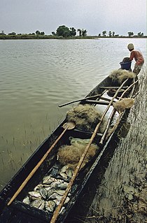
Kokry is a village and rural commune in the Cercle of Macina in the Ségou Region of southern-central Mali. The commune covers an area of approximately 160 square kilometers and includes 17 villages. The farmland is irrigated by the Office du Niger irrigation scheme. The main crop is rice. In the 2009 census the commune had a population of 13,393. The main village, (chef-lieu), is called Kokry Centre to distinguish it from Kokry Bozo which lies 3 km to the east on a strip of land between the Niger River and the Distributeur Kokry, an irrigation canal.
Souleye is a village and rural commune in the Cercle of Macina in the Ségou Region of southern-central Mali. The commune covers an area of approximately 388 square kilometers and includes 10 villages. In the 2009 census the commune had a population of 9,885.
Diganibougou or Diganidougou is a rural commune in the Cercle of Ségou in the Ségou Region of Mali. The commune lies to the north of the Niger River opposite the urban commune of Ségou and includes 22 villages in an area of approximately 571 square kilometers. In the 2009 census the commune had a population of 13,879. The administrative center (chef-lieu) is the village of Digani.
Baguindadougou is a rural commune in the Cercle of Ségou in the Ségou Region of Mali. The commune includes 14 villages in an area of approximately 702 square kilometers. In the 2009 census it had a population was 10,371. The administrative center (chef-lieu) is the village of Markanibougou.
Bellen is a rural commune in the Cercle of Ségou in the Ségou Region of Mali. It is the most northerly within the cercle and is sparsely populated with only 9 villages in an area of approximately 3,189 square kilometers. In the 2009 census it had a population of 6,949. The chef-lieu is the village of Sagala which lies 89 km northwest of Ségou.
Kala Siguida is a rural commune in the Cercle of Niono in the Ségou Region of Mali. The commune covers an area of approximately 377 square kilometers and includes 15 villages. In the 2009 census it had a population of 20,335. The seat of the local administration is the village of Molodo.
Mariko is a commune in the Cercle of Niono in the Ségou Region of Mali. The commune covers an area of approximately 395 square kilometers and includes 21 villages. In the 2009 census the population was 16,986. The seat of local government is the village of Bouguni.
Dogani Béré is a village and rural commune in the Cercle of Bandiagara of the Mopti Region of Mali. The commune contains five villages and at the time of the 2009 census had a population of 2400.
Dialloubé is a small town and rural commune in the Cercle of Mopti in the Mopti Region of Mali. The commune covers an area of approximately 1,425 square kilometers and includes the town and 8 villages. In the 2009 census the commune had a population of 13,727.
Bara Sara is a rural commune in the Cercle of Bandigara in the Mopti Region of Mali. The commune contains 23 villages and in the 2009 census had a population of 15,408. The main village is Ouo Sarre.
Madiama is a rural commune and village in the Cercle of Djenné in the Mopti Region of Mali. The commune contains ten villages.