Sokolo is a small town and rural commune in the Cercle of Niona in the Ségou Region of southern-central Mali. The commune has an area of approximately 2,219 square kilometers and includes the town and 17 villages. In the 2009 census the population was 23,338. The town lies 56 km north or Niono.

Barouéli Cercle is an administrative subdivision of the Ségou Region of Mali. The administrative center (chef-lieu) is the town of Barouéli.
Dioro is a town and rural commune in the Cercle of Ségou in the Ségou Region of southern-central Mali. The commune extends over an area of approximately 586 square kilometers on the right bank of the Niger River and includes the town and 29 of the surrounding villages. In the 2009 census the commune had a population of 47,876. The town of Dioro is located 57 km northeast of Ségou on the bank of the river.
Sébougou is a village and rural commune in the Cercle of Ségou in the Ségou Region of southern-central Mali. The commune contains 10 villages in an area of approximately 115 square kilometers. In the 2009 census it had a population of 16,175. The commune lies to the south of the River Niger and to the west of the urban commune of Ségou.
Pelengana is a small town and rural commune in the Cercle of Ségou in the Ségou Region of southern-central Mali. The commune contains the town and 25 villages in an area of approximately 359 square kilometers. In the 2009 census it had a population of 56,259. The town of Pelengana lies 5 km southeast of Ségou on the Route Nationale 6.
Konodimini is a village and rural commune in the Cercle of Ségou in the Ségou Region of southern-central Mali. The commune includes 23 villages in an area of approximately 362 square kilometers. In the 2009 census it had a population of 16719. The village of Konodimini, the chef-lieu of the commune, lies 23 km southwest of Ségou, on the right (south) bank of the Niger River.
Boussin is a village and rural commune in the Cercle of Ségou in the Ségou Region of southern-central Mali. The commune includes 15 villages in an area of approximately 178 square kilometers. In the 2009 census it had a population of 12,401. The village of Boussin lies 36 km east of Ségou.
Dougabougou is a small town and rural commune in the Cercle of Ségou in the Ségou Region of southern-central Mali. The commune covers an area of approximately 180 square kilometers and includes the town and 6 villages. In the 2009 census the population was 29,208. The town lies 20 km north of the Markala dam. Many of the inhabitants are employed in the production of sugar on land irrigated by the Office du Niger scheme. A Chinese-Malian company produces sugar in the town.
Massala is a village and rural commune in the Cercle of Ségou in the Ségou Region of southern-central Mali. The commune includes 8 villages in an area of approximately 89 square kilometers. In the 2009 census it had a population of 6,547.
Kolongo or Kolongo Tomo is a village and rural commune in the Cercle of Macina in the Ségou Region of southern-central Mali. The commune covers an area of approximately 484 square kilometers and includes 37 villages. In the 2009 census the commune had a population of 37,648. The village lies on the Fala de Boky-Wéré, an ancient branch of the Niger River that now forms part of the irrigation system of the Office du Niger.

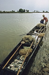
Kokry is a village and rural commune in the Cercle of Macina in the Ségou Region of southern-central Mali. The commune covers an area of approximately 160 square kilometers and includes 17 villages. The farmland is irrigated by the Office du Niger irrigation scheme. The main crop is rice. In the 2009 census the commune had a population of 13,393. The main village, (chef-lieu), is called Kokry Centre to distinguish it from Kokry Bozo which lies 3 km to the east on a strip of land between the Niger River and the Distributeur Kokry, an irrigation canal.
Tongué is a village and rural commune in the Cercle of Macina in the Ségou Region of southern-central Mali. The commune covers an area of approximately 129 square kilometers and includes 10 villages. In the 2009 census the commune had a population of 5,584.
Folomana is a village and rural commune in the Cercle of Macina in the Ségou Region of southern-central Mali. The commune covers an area of approximately 146 square kilometers and includes 17 villages. In the 2009 census the commune had a population of 10,478.
Souleye is a village and rural commune in the Cercle of Macina in the Ségou Region of southern-central Mali. The commune covers an area of approximately 388 square kilometers and includes 10 villages. In the 2009 census the commune had a population of 9,885.
Farakou Massa is a rural commune in the Cercle of Ségou in the Ségou Region of Mali. The commune lies along the right bank of the River Niger and includes 8 villages in an area of approximately 109 square kilometers. In the 2009 census it had a population of 14,314. The administrative center (chef-lieu) of the commune is the village of Kominé which is 49 km northeast of Ségou.
N'Koumandougou is a rural commune in the Cercle of Ségou in the Ségou Region of Mali. The commune contains 15 villages in an area of approximately 2,040 square kilometers. In the 2009 census it had a population of 14,237. The chef-lieu is the village of Doura.
Kassorola is a commune in the Cercle of San in the Ségou Region of Mali. The administrative center is the town of Nianasso. In a 2009 census, this regions total population was 16,275.
Sirifila-Boundy is a rural commune in the Cercle of Niono in the Ségou Region of Mali. It covers an area of approximately 159 square kilometers and includes 16 villages. In the 2009 census it had a population of 35,290. The seat of local government is the village of N'Debougou.
Saloba is a commune in the Cercle of Macina in the Ségou Region of Mali. The commune covers an area of about 647 square kilometers and contains 42 villages. In then 2009 census the commune had a population of 35,328. The administrative center of the commune is the village of Sarro.