Yasso, Mali

Last updated
Yasso
Commune and town
Mali adm location map.svg
Red pog.svg
Yasso
Location in Mali
Coordinates: 14°8′N3°41′W / 14.133°N 3.683°W / 14.133; -3.683 Coordinates: 14°8′N3°41′W / 14.133°N 3.683°W / 14.133; -3.683
CountryFlag of Mali.svg  Mali
Region Ségou Region
Cercle Tominian Cercle
Population (1998)
  Total 10,841
Time zone GMT (UTC+0)

Yasso is a small town and commune in the Cercle of Tominian in the Ségou Region of Mali. In 1998 the commune had a population of 10,841. [1]
Communes of Mali

A Commune is the third level administrative unit in Mali. Mali is divided into eight regions and one capital district (Bamako). These subdivisions bear the name of their principal city. The regions are divided into 49 Cercles. The Cercles and the district are divided into 703 Communes, with 36 Urban Communes and 667 Rural Communes, while some larger Cercles still contain Arrondissements above the Commune level, these are organisational areas with no independent power or office. Rural Communes are subdivided in Villages, while Urban Communes are subdivided into Quartier. Communes usually bear the name of their principal town. The capital, Bamako, consists of six Urban Communes. There were initially 701 communes until the Law No. 01-043 of 7 June 2001 created two new Rural Communes in the desert region in the north east of the country: Alata, Ménaka Cercle in the Gao Region and Intadjedite, Tin-Essako Cercle in the Kidal Region.

Tominian Cercle Cercle in Ségou Region, Mali

Tominian Cercle is an administrative subdivision of the Ségou Region of Mali. The administrative center of the local government is in the town of Tominian. The Cercle is divided into Communes, and below this, quarters/villages. In the 2009 census the cercle had a population of 219,853 people.
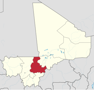
Ségou Region Region in Mali

Ségou Region is an administrative region in Mali, situated in the centre of the country with an area of 64,821 km2. The region is bordered by Sikasso Region on the south, Tombouctou and Mopti on the east, Burkina Faso to the southeast and the Koulikoro Region to the west. In 2009 it had 2,336,255 inhabitants, making it the second most populous region of Mali. Its administrative capital is the town of Ségou.

Related Research Articles

Niala, Mali Commune and town in Ségou Region, Mali

Niala is a small town and commune in the Cercle of Bla in the Ségou Region of Mali. In 1998 the commune had a population of 7667.

Beguene Commune and town in Ségou Region, Mali

Beguene is a small town and commune in the Cercle of Bla in the Ségou Region of southern-central Mali. As of 1998 the commune had a population of 7,475.

Konobougou Commune and town in Ségou Region, Mali

Konobougou is commune in the Cercle of Barouéli in the Ségou Region of southern-central Mali. As of 1998 the commune had a population of 26,084.

Dougoufie is a small town and commune in the Cercle of Barouéli in the Ségou Region of southern-central Mali. In 1998 the commune had a population of 8,557.

Souleye Commune and village in Ségou Region, Mali

Souleye is a village and rural commune in the Cercle of Macina in the Ségou Region of southern-central Mali. The commune covers an area of approximately 388 square kilometers and includes 10 villages. In the 2009 census the commune had a population of 9,885.

Diakourouna Commune and town in Ségou Region, Mali

Diakourouna or Diakourouna Nerisso is a small town and commune in the Cercle of San in the Ségou Region of Mali. In 1998 the commune had a population of 6,779.

Teneni Commune and town in Ségou Region, Mali

Teneni is a small town and commune in the Cercle of San in the Ségou Region of Mali. As of 1998 the commune had a population of 7,726.

Waki is a small town and commune in the Cercle of San in the Ségou Region of Mali. As of 1998 the commune had a population of 6,167.

Dogani Béré Commune and village in Mopti Region, Mali

Dogani Béré is a village and rural commune in the Cercle of Bandiagara of the Mopti Region of Mali. The commune contains five villages and at the time of the 2009 census had a population of 2400.

Socoura Commune and town in Mopti Region, Mali

Socoura is a village and rural commune in the Cercle of Mopti in the Mopti Region of Mali. The commune contains 28 small villages and in 2009 had a population of 42,553. The commune entirely surrounds the urban commune of Mopti.

Dialloubé Commune and town in Mopti Region, Mali

Dialloubé is a small town and rural commune in the Cercle of Mopti in the Mopti Region of Mali. The commune covers an area of approximately 1,425 square kilometers and includes the town and 8 villages. In the 2009 census the commune had a population of 13,727.

Bara Sara Commune in Mopti Region, Mali

Bara Sara is a rural commune in the Cercle of Bandigara in the Mopti Region of Mali. The commune contains 23 villages and in the 2009 census had a population of 15,408. The main village is Ouo Sarre.

Dimbal Habe Commune and town in Mopti Region, Mali

Dimbal Habe is a small town and commune in the Cercle of Bankass in the Mopti Region of Mali. In 1998 the commune had a population of 11,306.

Madiama Commune and village in Mopti Region, Mali

Madiama is a rural commune and village in the Cercle of Djenné in the Mopti Region of Mali. The commune contains ten villages.

Mondoro Commune and village in Mopti Region, Mali

Mondoro is a village and rural commune in the Cercle of Douentza in the Mopti Region of Mali. The commune contains 22 villages and had a population of 42,631 in the 2009 census. The commune is the largest by area and population in the Douentza Cercle.

Gandamia Commune in Mopti Region, Mali

Gandamia is a rural commune of the Cercle of Douentza in the Mopti Region of Mali. The commune contains eight villages and in the 2009 census had a population of 7,215. The chef-lieu is the small village of Kikara.

Ouro Ardo Commune in Mopti Region, Mali

Ouro Ardo is a commune of the Cercle of Ténenkou in the Mopti Region of Mali. The local government is based in the village of Kondo. The commune includes 29 small villages and in 2009 had a population of 9,114.

Baboye Village in Mopti Region, Mali

Baboye is a village and seat of the commune of Pignari in the Cercle of Bandiagara in the Mopti Region of southern-central Mali.

Sangha Ogol Leye Village in Mopti Region, Mali

Sangha Ogol Leye is a village and seat of the commune of Sangha in the Cercle of Bandiagara in the Mopti Region of southern-central Mali. The village is one of a group that are located at the top of the Bandiagara Escarpment.

Ouo Sarre Village in Mopti Region, Mali

Ouo Sarre is a village and seat of the rural commune of Bara Sara in the Cercle of Bandiagara in the Mopti Region of southern-central Mali.

References

  1. "Previsions de desserte des communes pour la periode de 2001-2005" (PDF). Mali Reforme Telecom. Retrieved February 17, 2009.