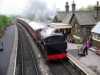
The Embsay and Bolton Abbey Steam Railway (E&BASR) is a heritage railway in North Yorkshire, England, formed in 1979 and opened in 1981.

Bolton Abbey Estate in Wharfedale, North Yorkshire, England, takes its name from a 12th-century Augustinian monastery of canons regular, now known as Bolton Priory. The priory, which was closed in the 1539 Dissolution of the Monasteries ordered by King Henry VIII, is in the Yorkshire Dales, which lies next to the village of Bolton Abbey.

Ilkley is a spa town and civil parish in the City of Bradford in West Yorkshire, in Northern England. Historically part of the West Riding of Yorkshire, Ilkley civil parish includes the adjacent village of Ben Rhydding and is a ward within the City of Bradford. Approximately 12 miles (19 km) north of Bradford and 17 miles (27 km) north-west of Leeds, the town lies mainly on the south bank of the River Wharfe in Wharfedale, one of the Yorkshire Dales.

Arthington is a linear village in Wharfedale, in the City of Leeds metropolitan borough in West Yorkshire, England. It is a civil parish which, according to the 2011 census, had a population of 532. It is in the Otley ward of the City of Leeds, and the Leeds North West parliamentary constituency.
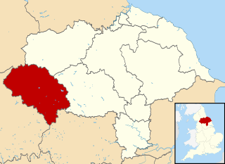
Craven was a non-metropolitan district in the west of North Yorkshire, centred on the market town of Skipton. The name Craven is much older than the modern district and encompassed a larger area. This history is also reflected in the way the term is still commonly used, such as by the Church of England.

The A65 is a major road in England. It runs north west from Leeds in West Yorkshire via Kirkstall, Horsforth, Yeadon, Guiseley, Ilkley and Skipton, west of Settle, Ingleton and Kirkby Lonsdale before terminating at Kendal in Cumbria.

Grassington is a town and civil parish in North Yorkshire, England. The population of the parish at the 2011 Census was 1,126. Historically part of the West Riding of Yorkshire, and now in the lieutenancy area of North Yorkshire, the village is situated in Wharfedale, about 8 miles (10 km) north-west from Bolton Abbey, and is surrounded by limestone scenery. Nearby villages include Linton, Threshfield, Hebden, Conistone and Kilnsey.

Kilnsey is a small village in Wharfedale, North Yorkshire, England. It lies on the B6160 road, between the villages of Grassington and Kettlewell, near Arncliffe and just across the River Wharfe from Conistone. The village is 12 miles (19 km) north of Skipton and 3 miles (5 km) south of Kettlewell.
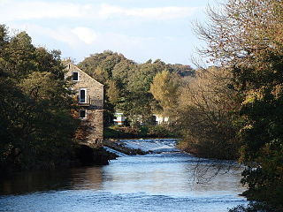
Addingham is a village and civil parish in the City of Bradford in West Yorkshire, England. It is situated near the A65, 6 miles (10 km) south-east of Skipton, 3 miles (5 km) west of Ilkley, 12 miles (19 km) north-west of Bradford and around 20 miles (32 km) north-west of Leeds. Historically part of the West Riding of Yorkshire, it is located in the valley of the River Wharfe and is only 1 mile (2 km) from the Yorkshire Dales National Park. The name is thought to mean "homestead associated with a man called Adda", although in the Domesday Book, the village was referred to as "Ediham", which may have referred to Earl Edwin of Bolton Abbey. The 2001 census numbered Addingham's population at 3,599, increasing to 3,730 at the 2011 Census.

Appletreewick is a village and civil parish in the Craven district of North Yorkshire, England, 6.5 miles (10.5 km) north-east of Skipton, 7 miles (11 km) from Skipton railway station and 16 miles (25.7 km) from Leeds Bradford International Airport.

Barden is a civil parish in the Craven district of North Yorkshire, England. It consists of the hamlet of Drebley and a few scattered houses in Wharfedale in the Yorkshire Dales. The parish also includes two areas of moorland, Barden Fell to the east of the River Wharfe and Barden Moor to the west of the river. Both moorlands are access land, and are popular with walkers. Barden Fell rises to the prominent peak of Simon's Seat, and Barden Moor includes two scenic 19th century reservoirs. Much of the parish is on the Bolton Abbey estate.

Conistone is a small village in the Craven district of North Yorkshire, England. It lies 3 miles (5 km) north of Grassington, 3 miles (5 km) south of Kettlewell and 12 miles (19 km) north of Skipton beside the River Wharfe, in Upper Wharfedale.

Yockenthwaite is a hamlet in the Craven district of North Yorkshire, England. It lies in the Langstrothdale valley in the Yorkshire Dales National Park. Historically part of the West Riding of Yorkshire, Yockenthwaite is 20 miles (32 km) north of Skipton and 8 miles (13 km) south of Hawes. The name of the hamlet is said to derive from Eoghan's clearing in a wood.
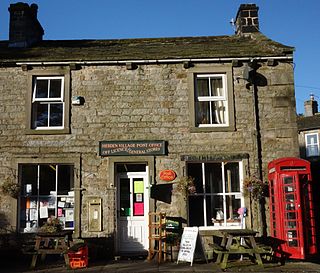
Hebden is a village and civil parish in the former Craven District of North Yorkshire, England, and one of four villages in the ecclesiastical parish of Linton. It lies near Grimwith Reservoir and Grassington, in Wharfedale in the Yorkshire Dales National Park. In 2011 it had a population of 246.
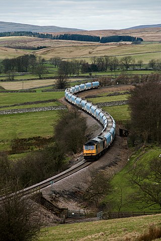
The Yorkshire Dales Railway was a branch line linking the town of Skipton with the villages of Rylstone, Threshfield and Grassington in North Yorkshire, England. There were two stations on the line – Grassington & Threshfield and Rylstone – and a connection via the Skipton to Ilkley Line to Skipton.
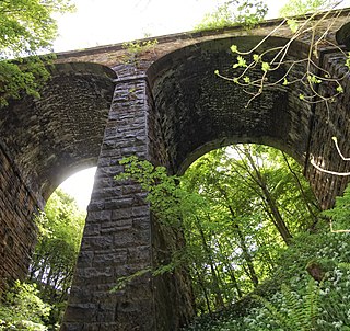
The Skipton–Ilkley line is the route that the Midland Railway took to link the towns of Skipton and Ilkley via the villages of Embsay, Bolton Abbey and Addingham.
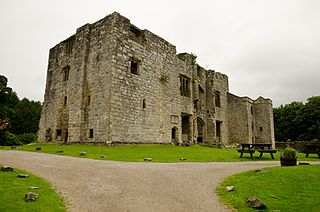
Barden Tower is a ruined building in the Parish of Barden, in Wharfedale, North Yorkshire, England. The tower was used as a hunting lodge in the 15th and 16th centuries, and despite a renovation in the 1650s, it fell into disrepair in the 18th century. The tower is now part of the Bolton Estate and is listed as a medieval fortified tower. Along with other buildings on the Bolton Estate, it is a focal point and many people visit the tower. It is also a way marker on the 100-mile (160 km) Lady Anne's Way long distance path.

Skirethorns is a hamlet in the civil parish of Threshfield, in Wharfedale, North Yorkshire, England. The hamlet is just west of the village of Threshfield, in the Yorkshire Dales National Park, some 6 miles (9.7 km) south of Kettlewell, and 8 miles (13 km) north of Skipton. Threshfield Quarry is located north-west of the hamlet, and despite its name, it is located in Skirethorns.

Bolton Bridge is a hamlet in the civil parish of Bolton Abbey, in North Yorkshire, England, on the west side of the River Wharfe. It is south along the B6160 road from the village of Bolton Abbey. It is in the parish of Bolton Abbey.


