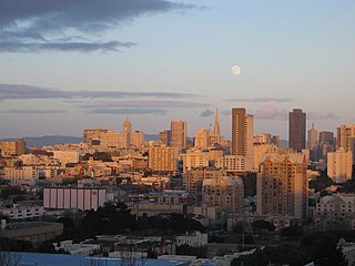
Anza Vista is a neighborhood in the Western Addition district of San Francisco, California. It is named after Juan Bautista de Anza, the first Spanish explorer to reach San Francisco.

Buena Vista Park is a park in the Haight-Ashbury and Buena Vista Heights neighborhoods of San Francisco, California. It is the oldest official park in San Francisco, established in 1867 as Hill Park, later renamed Buena Vista. It is bounded by Haight Street to the north, and by Buena Vista Avenue West and Buena Vista Avenue East. The park is on a steep hill that peaks at 575 feet (175 m), and covers 37 acres (150,000 m2). The lowest section is the north end along Haight.

Church station or Church Street station is a Muni Metro light rail station in San Francisco, California. It is located at the six-way intersection of Market Street, Church Street and 14th Street in the Duboce Triangle neighborhood. Service at the station began in June 1980.

The Sunset Tunnel, originally known as the Duboce Tunnel, is a 4,232 ft (1,290 m)-long light rail/streetcar tunnel in San Francisco, California. The tunnel runs under the steep hill adjacent to Buena Vista Park and is used exclusively by the N Judah Muni Metro line.

Hayes Valley is a neighborhood in the Western Addition district of San Francisco, California. It is located between the historical districts of Alamo Square and the Civic Center. Victorian, Queen Anne, and Edwardian townhouses are mixed with high-end boutiques, restaurants, and public housing complexes. The neighborhood gets its name from Hayes Street, which was named for Thomas Hayes, San Francisco's county clerk from 1853 to 1856 who also started the first Market Street Railway franchise.
The Western Addition is a district in San Francisco, California, United States.
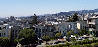
Cole Valley is a small neighborhood in San Francisco, California. It borders Golden Gate Park to the north, Haight-Ashbury to the northeast, The Castro to the east. and Twin Peaks to the south. Near Kezar Stadium, Cole Valley is the smallest neighborhood in the city.

The Excelsior District is a neighborhood in San Francisco, California.
The Lower Haight is a neighborhood, sometimes referred to as Haight–Fillmore, in San Francisco, California.

Duboce Park (\du-'BŌS\) is a small urban park located between the Duboce Triangle and Lower Haight neighborhoods of San Francisco, California. The park is less than one block wide from north to south and two blocks wide from west to east. Its western boundary is Scott Street, and its eastern boundary is Steiner Street. The park is part of the Duboce Park Landmark District.
Eureka Valley is a neighborhood in San Francisco, primarily a quiet residential neighborhood but boasting one of the most visited sub-neighborhoods in the city, The Castro.

Pacific Heights is a neighborhood in San Francisco, California. It has panoramic views of the Golden Gate Bridge, San Francisco Bay, the Palace of Fine Arts, Alcatraz, and the Presidio.
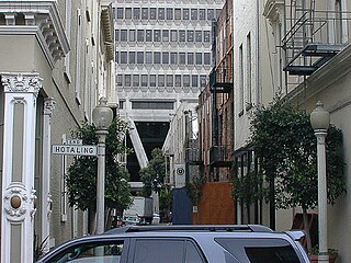
Jackson Square Historic District is an area in downtown San Francisco, California. It dates back to the city's earliest years and the 1849 gold rush, and is known for its historic commercial buildings in the classical revival and Italianate styles.
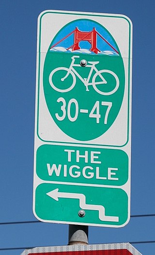
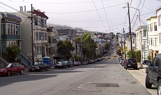
The Wiggle is a 1-mile (1.6 km) zig-zagging bicycle route from Market Street to Golden Gate Park in San Francisco, California, that minimizes hilly inclines for bicycle riders. Rising 120 feet (37 m), The Wiggle inclines average 3% and never exceed 6%. The path generally follows the historical route of the long since paved-over Sans Souci Valley watercourse, winding through the Lower Haight neighborhood toward the Panhandle section of Golden Gate Park.

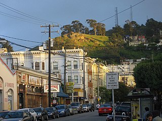
Corona Heights is a neighborhood in San Francisco, California, just north of Market Street and Eureka Valley. Corona Heights is often considered part of the Castro and Upper Market areas.

Saint Francis Lutheran Church was built in 1905 and is located at 152 Church Street, between Market Street and Duboce Street in San Francisco, California. The church building has stained glass windows and Memorial Terrace outside.

Duboce Park Landmark District is a residential section in the Duboce Triangle neighborhood in San Francisco, California. One of 12 Landmark Districts within San Francisco, it occupies 4 city blocks with 90 properties, as well as Duboce Park. It features well-preserved, Victorian- and Edwardian-era homes, many in the Queen Anne style. Most of the district was constructed between 1899 and 1905 by Fernando Nelson, a prolific builder known for his lively ornamentation. The district is bordered by Duboce Avenue to the south, Waller Street to the north, Scott Street to the west, and Steiner Street to the east.

The Castro District, commonly referred to as the Castro, is a neighborhood in Eureka Valley in San Francisco. The Castro was one of the first gay neighborhoods in the United States. Having transformed from a working-class neighborhood through the 1960s and 1970s, the Castro remains one of the most prominent symbols of lesbian, gay, bisexual, and transgender (LGBT) activism and events in the world.
Sans Souci Valley was the name of a valley in San Francisco, California, in the area corresponding to present day's Lower Haight and Duboce Triangle neighborhoods. This valley once allowed excess storm water to flow from Buena Vista Hill and Lone Mountain, through the Panhandle, to the area located near Duboce Park, along the path today known to cyclists as The Wiggle. The creek was not a surface creek in the dune region except as overflow. The valley’s name, French for "without worry," comes from the Sanssouci Palace built by the Prussian monarch Frederick the Great in Potsdam, Germany.

