It is an oblate spheroid (an ellipsoid of revolution) whose minor axis (polar diameter), connecting the geographical poles, is approximately aligned with the Earth's axis of rotation. The ellipsoid is also defined by the major axis (equatorial axis); the difference between the two axes is slightly more than 21km or 0.335%.
There are two types of ellipsoid: mean and reference.
A data set which describes the global average of the Earth's surface curvature is called the mean Earth Ellipsoid. It refers to a theoretical coherence between the geographic latitude and the meridional curvature of the geoid. The latter is close to the mean sea level, and therefore an ideal Earth ellipsoid has the same volume as the geoid.
While the mean Earth ellipsoid is the ideal basis of global geodesy, for regional networks a so-called reference ellipsoid may be the better choice.[1] When geodetic measurements have to be computed on a mathematical reference surface, this surface should have a similar curvature as the regional geoid; otherwise, reduction of the measurements will get small distortions.
This is the reason for the "long life" of former reference ellipsoids like the Hayford or the Bessel ellipsoid, despite the fact that their main axes deviate by several hundred meters from the modern values. Another reason is a judicial one: the coordinates of millions of boundary stones should remain fixed for a long period. If their reference surface changes, the coordinates themselves also change.
However, for international networks, GPS positioning, or astronautics, these regional reasons are less relevant. As knowledge of the Earth's figure is increasingly accurate, the International Geoscientific Union IUGG usually adapts the axes of the Earth ellipsoid to the best available data.
Reference ellipsoid
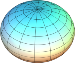
Flattened sphere
In geodesy, a reference ellipsoid is a mathematically defined surface that approximates the geoid, which is the truer, imperfect figure of the Earth, or other planetary body, as opposed to a perfect, smooth, and unaltered sphere, which factors in the undulations of the bodies' gravity due to variations in the composition and density of the interior, as well as the subsequent flattening caused by the centrifugal force from the rotation of these massive objects (for planetary bodies that do rotate). Because of their relative simplicity, reference ellipsoids are used as a preferred surface on which geodetic network computations are performed and point coordinates such as latitude, longitude, and elevation are defined.
In the context of standardization and geographic applications, a geodesic reference ellipsoid is the mathematical model used as foundation by spatial reference system or geodetic datum definitions.
Ellipsoid parameters
In geophysics, geodesy, and related areas, the word 'ellipsoid' is understood to mean 'oblate ellipsoid of revolution', and the older term 'oblate spheroid' is hardly used.[2][3] For bodies that cannot be well approximated by an ellipsoid of revolution a triaxial (or scalene) ellipsoid is used.
The shape of an ellipsoid of revolution is determined by the shape parameters of that ellipse. The semi-major axis of the ellipse, a, becomes the equatorial radius of the ellipsoid: the semi-minor axis of the ellipse, b, becomes the distance from the centre to either pole. These two lengths completely specify the shape of the ellipsoid.
In geodesy publications, however, it is common to specify the semi-major axis (equatorial radius) a and the flatteningf, defined as:
That is, f is the amount of flattening at each pole, relative to the radius at the equator. This is often expressed as a fraction 1/m; m = 1/f then being the "inverse flattening". A great many other ellipse parameters are used in geodesy but they can all be related to one or two of the set a, b and f.
A great many ellipsoids have been used to model the Earth in the past, with different assumed values of a and b as well as different assumed positions of the center and different axis orientations relative to the solid Earth. Starting in the late twentieth century, improved measurements of satellite orbits and star positions have provided extremely accurate determinations of the Earth's center of mass and of its axis of revolution; and those parameters have been adopted also for all modern reference ellipsoids.
The ellipsoid WGS-84, widely used for mapping and satellite navigation has f close to 1/300 (more precisely, 1/298.257223563, by definition), corresponding to a difference of the major and minor semi-axes of approximately 21km (13 miles) (more precisely, 21.3846857548205 km). For comparison, Earth's Moon is even less elliptical, with a flattening of less than 1/825, while Jupiter is visibly oblate at about 1/15 and one of Saturn's triaxial moons, Telesto, is highly flattened, with f between 1/3 and 1/2 (meaning that the polar diameter is between 50% and 67% of the equatorial.
Determination
Arc measurement is the historical method of determining the ellipsoid. Two meridian arc measurements will allow the derivation of two parameters required to specify a reference ellipsoid. For example, if the measurements were hypothetically performed exactly over the equator plane and either geographical pole, the radii of curvature so obtained would be related to the equatorial radius and the polar radius, respectively a and b (see: Earth polar and equatorial radius of curvature). Then, the flattening would readily follow from its definition:
.
For two arc measurements each at arbitrary average latitudes , , the solution starts from an initial approximation for the equatorial radius and for the flattening . The theoretical Earth's meridional radius of curvature can be calculated at the latitude of each arc measurement as:
where .[4] Then discrepancies between empirical and theoretical values of the radius of curvature can be formed as . Finally, corrections for the initial equatorial radius and the flattening can be solved by means of a system of linear equations formulated via linearization of :[5]
Longer arcs with multiple intermediate-latitude determinations can completely determine the ellipsoid that best fits the surveyed region. In practice, multiple arc measurements are used to determine the ellipsoid parameters by the method of least squares adjustment. The parameters determined are usually the semi-major axis, , and any of the semi-minor axis, , flattening, or eccentricity.
In 1687 Isaac Newton published the Principia in which he included a proof that a rotating self-gravitating fluid body in equilibrium takes the form of a flattened ("oblate") ellipsoid of revolution, generated by an ellipse rotated around its minor diameter; a shape which he termed an oblate spheroid.[8][9]
In 1669, Jean Picard found the first accurate and reliable value for the radius of Earth as 6,365.6 kilometres.[10][11] Picard's geodetic observations had been confined to the determination of the magnitude of the Earth considered as a sphere, but the discovery made by Jean Richer turned the attention of mathematicians to the Earth's deviation from a spherical form.[12][13]Christiaan Huygens found out the centrifugal force which explained variations of gravitational acceleration depending on latitude.[14]
Equatorial (a), polar (b) and mean Earth radii as defined in the 1984 World Geodetic System revision (not to scale)
The reference ellipsoid models listed below have had utility in geodetic work and many are still in use. The older ellipsoids are named for the individual who derived them and the year of development is given. In 1887 the English surveyor Colonel Alexander Ross Clarke CB FRS RE was awarded the Gold Medal of the Royal Society for his work in determining the figure of the Earth. The international ellipsoid was developed by John Fillmore Hayford in 1910 and adopted by the International Union of Geodesy and Geophysics (IUGG) in 1924, which recommended it for international use.
At the 1967 meeting of the IUGG held in Lucerne, Switzerland, the ellipsoid called GRS-67 (Geodetic Reference System 1967) in the listing was recommended for adoption. The new ellipsoid was not recommended to replace the International Ellipsoid (1924), but was advocated for use where a greater degree of accuracy is required. It became a part of the GRS-67 which was approved and adopted at the 1971 meeting of the IUGG held in Moscow. It is used in Australia for the Australian Geodetic Datum and in the South American Datum 1969.
The GRS-80 (Geodetic Reference System 1980) as approved and adopted by the IUGG at its Canberra, Australia meeting of 1979 is based on the equatorial radius (semi-major axis of Earth ellipsoid) , total mass , dynamic form factor and angular velocity of rotation , making the inverse flattening a derived quantity. The minute difference in seen between GRS-80 and WGS-84 results from an unintentional truncation in the latter's defining constants: while the WGS-84 was designed to adhere closely to the GRS-80, incidentally the WGS-84 derived flattening turned out to differ slightly from the GRS-80 flattening because the normalized second degree zonal harmonic gravitational coefficient, that was derived from the GRS-80 value for , was truncated to eight significant digits in the normalization process.[18]
An ellipsoidal model describes only the ellipsoid's geometry and a normal gravity field formula to go with it. Commonly an ellipsoidal model is part of a more encompassing geodetic datum. For example, the older ED-50 (European Datum 1950) is based on the Hayford or International Ellipsoid. WGS-84 is peculiar in that the same name is used for both the complete geodetic reference system and its component ellipsoidal model. Nevertheless, the two concepts—ellipsoidal model and geodetic reference system—remain distinct.
Note that the same ellipsoid may be known by different names. It is best to mention the defining constants for unambiguous identification.
↑ National Geodetic Survey (U.S.).; National Geodetic Survey (U.S.) (1986). Geodetic Glossary. NOAA technical publications. U.S. Department of Commerce, National Oceanic and Atmospheric Administration, National Ocean Service, Charting and Geodetic Services. p.107. Retrieved 2021-10-24.
↑ NIMA Technical Report TR8350.2, "Department of Defense World Geodetic System 1984, Its Definition and Relationships With Local Geodetic Systems", Third Edition, 4 July 1997
1 2 Note that the current best estimates, given by the IERS Conventions, "should not be mistaken for conventional values, such as those of the Geodetic Reference System GRS80 ... which are, for example, used to express geographic coordinates" (chap. 1[permanent dead link]); note further that "ITRF solutions are specified by Cartesian equatorial coordinates X, Y and Z. If needed, they can be transformed to geographical coordinates (λ, φ, h) referred to an ellipsoid. In this case the GRS80 ellipsoid is recommended." (chap. 4Archived 2021-06-24 at the Wayback Machine ).
P. K. Seidelmann (Chair), et al. (2005), “Report Of The IAU/IAG Working Group On Cartographic Coordinates And Rotational Elements: 2003,” Celestial Mechanics and Dynamical Astronomy, 91, pp.203–215.
This page is based on this Wikipedia article Text is available under the CC BY-SA 4.0 license; additional terms may apply. Images, videos and audio are available under their respective licenses.