
The Amherst Central Business District is a historic district encompassing the heart of downtown Amherst, Massachusetts. Centered on the northern section of the long town common, the area has been the civic and commercial heart of the town since the 18th century. The district was listed on the National Register of Historic Places in 1991, and slightly enlarged in 2011.

The Old Douglas Center Historic District encompasses the historic heart of Douglas, Massachusetts. The historic district radiates away from the town common, and is bounded by farmlands and more recent 20th-century development. There are 50 contributing resources in the 192-acre (78 ha) district. Most of the structures are residential houses in Federal and Greek Revival styles. There are a number of institutional buildings, including the 1834 Greek Revival First Congregational Church, the Craftsman-style Douglas Pastime Club building at 22 Church Street, and the c. 1770s Dudley Tavern. The town common and the adjacent Center Cemetery, laid out when the town was incorporated in 1746, are at the center of the district.
The William Bryant Octagon House is an historic octagon house located at 2 Spring Street in Stoneham, Massachusetts. Built in 1850, it is the best-preserved of three such houses built in the town in the 1850s. It was listed on the National Register of Historic Places in 1984.
Royalston Common Historic District is a historic district encompassing the historic village center of Royalston, Massachusetts. Centered on a long town common laid out in 1752, it is one of the best surviving examples of an 18th-century town center in the state. The district was listed on the National Register of Historic Places in 1976. The common was named as one of the 1,000 places to visit in Massachusetts by the Great Places in Massachusetts Commission.

The Plympton Village Historic District encompasses the historic village center of Plympton, Massachusetts. It is a roughly linear district, running along Main Street between Palmer Road and Mayflower Road. There are twenty buildings in the district, most of which are residential. The focal point of the district, however, is the town green, around which the town's main civic buildings are arrayed. The green was laid out in 1702, but the oldest civic building was built in the 1850s, a period in which many of the houses were also built. The oldest building in the district is the Reverend Ezra Sampson House at 255 Main Street, which was built in the late 18th century.

Sachem Rock Farm is a historic farm at 355 Plymouth Street in East Bridgewater, Massachusetts, United States. The farm location is important for a variety of reasons. Its earliest historical association is with the Wampanoag people, who are known to have used the area, particularly around Sachem Rock, a granite outcrop they called Wonnocoote (Wonnocooto) that is the property's high point, prior to European contact. Sachem Rock itself is historically significant as the site of a meeting in 1649 between English settlers from the Plymouth Colony, including Myles Standish, with the Wampanoag sachem Massasoit. In this meeting the colonists purchased rights to a large tract of land, including East and West Bridgewater, Bridgewater, and Brockton.

The Millis Center Historic District is an historic district on Curve, Daniels, Exchange, Irving, Lavender, Main, and Union Streets in Millis, Massachusetts. It encompasses the historic mid-to-late-19th century village center of the town, including the residential area north of Main Street, two 19th-century industrial complexes, and civic and institutional buildings. It was added to the National Register of Historic Places in 2007.

The Church Street Historic District in Wilmington, Massachusetts encompasses the largest cluster of high-style 19th- and early 20th-century homes in the town. The district stretches along Church Street from Hanover Street and Clark Street northeast to the town common, which is part of the Wilmington Centre Village Historic District, and includes one non-contributing house on Central Street. Most of the houses in the district are Queen Anne Victorians built in the 1880s and 1890s; the oldest building is the Maynard Spaulding House at 84 Church Street, an early 1850s house with transitional Greek Revival styling. There are three Italianate houses, and a smattering of 20th century styles, including Colonial Revival and Craftsman houses.

The Alden Batchelder House is a historic house in Reading, Massachusetts. Built in the early 1850s, it is an excellent example of an early Italianate design. It was listed on the National Register of Historic Places in 1984.
The Benjamin Beard House is a historic house in Reading, Massachusetts. Built in the early 1850s, it is a well-preserved example of a distinctive local variant of Greek Revival architecture. It was listed on the National Register of Historic Places in 1984.

The Common Historic District is a historic district encompassing the civic and institutional heart of Reading, Massachusetts. The district is centered on the town common, at the intersection of Main and Salem Streets. The common has been communally owned since at least 1737, with the original burying ground to the north. In 1769 the area's first meeting house was built, giving the area a sense of identity separate from portions of Reading that would later be set off as Wakefield and North Reading. Since then the area has become a focal point for religious and civic institutions in the town.

The Common District encompasses the main civic center of Wakefield, Massachusetts. It is centered on the historic town common, just south of Lake Quannapowitt, which was laid in 1644, when it became the heart of Old Reading. The area was separated from Reading as South Reading in 1818, and renamed Wakefield in 1868. The 25 acre district includes the buildings that line the common on Common Street and Main Street, which include the town hall, public library, YMCA, post office, and several churches. It was listed on the National Register of Historic Places in 1990.

The Yale Avenue Historic District is a residential historic district near the center of Wakefield, Massachusetts. It encompasses eight residential properties, all but one of which were developed in the 1860s and 1870s, after the arrival of the railroad in town. These properties were built primarily for Boston businessmen, and mark the start of Wakefield's transition to a suburb.

The House at 113 Salem Street in Wakefield, Massachusetts is a rare well-preserved example of a 19th-century shoemaker's shop. The 1+1⁄2-story wood-frame house was built in the 1840s or 1850s, and was originally the shoe shop of David Nichols, who lived at 103 Salem Street. Its early form, with the high-pitch, gable roof, is readily recognizable despite later alterations and additions. These types of buildings were once common in the town, where shoemaking was a home-based cottage industry.

Wakefield Park Historic District is a residential historic district encompassing a portion of a late-19th/early-20th century planned development in western Wakefield, Massachusetts. The district encompasses sixteen properties on 8 acres (3.2 ha) of land out of the approximately 100 acres (40 ha) that comprised the original development. Most of the properties in the district are on Park Avenue, with a few located on immediately adjacent streets.

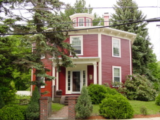
The Amherst Village Historic District encompasses the historic village center of Amherst, New Hampshire. Centered on the town's common, which was established about 1755, Amherst Village is one of the best examples of a late-18th to early-19th century New England village center. It is roughly bounded on the north by Foundry Street and on the south by Amherst Street, although it extends along some roads beyond both. The western boundary is roughly Davis Lane, the eastern is Mack Hill Road, Old Manchester Road, and Court House Road. The district includes the Congregational Church, built c. 1771-74, and is predominantly residential, with a large number of Georgian, Federal, and Greek Revival houses. Other notable non-residential buildings include the Farmer's Bank, a Federal-style brick building built in 1806, and the Amherst Brick School, a brick Greek Revival structure that has served as the School Administrative Unit 39 offices since 1997.

The Lower Main Street Historic District of Lee, Massachusetts encompasses the historic center of the town. It is centered on the junction of Main and Park Streets, where the center of the town was laid out when it was established in 1760. Although a meeting house was erected on this site, that structure was torn down, and the space was converted into a town common, a function it continues to serve today. The district also includes a portion of the business district, running along Main Street. The district was listed on the National Register of Historic Places in 1976.
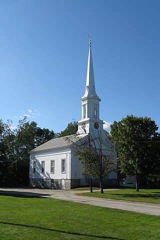
The Salem Common Historic District encompasses the early colonial center of Salem, New Hampshire. The district dates to the earliest period of settlement of Salem, and includes the historic common, old town hall, fire station, and library. The town hall was built in 1738 and extensively altered in 1838 and 1899; it served as a place for town meetings until 1958. The district was listed on the National Register of Historic Places in 2011.

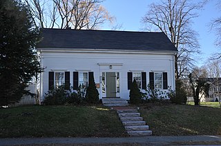
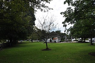
The Town Center Historic District encompasses the historic village center of South Hampton, New Hampshire. Centered around the Barnard Green, the town common, on New Hampshire Route 107A, it includes architectural reminders of the town's growth and change over time. The district was listed on the National Register of Historic Places in 1983.
The Middletown Springs Historic District encompasses most of the village center of Middletown Springs, Vermont. Oriented around the crossroads junction of Vermont Routes 140 and 133, the village has a well-preserved collection of mainly mid-19th century architecture, including a significant number of Italianate buildings. The district was listed on the National Register of Historic Places in 1985.


