Ekati Airport | |||||||||||
|---|---|---|---|---|---|---|---|---|---|---|---|
 Ekati Airport at left centre, with the four pits of the mine, August 2010 | |||||||||||
| Summary | |||||||||||
| Airport type | Private | ||||||||||
| Operator | Dominion Diamond Ekati Corporation | ||||||||||
| Location | Ekati Diamond Mine | ||||||||||
| Time zone | MST (UTC−07:00) | ||||||||||
| • Summer (DST) | MDT (UTC−06:00) | ||||||||||
| Elevation AMSL | 1,536 ft / 468 m | ||||||||||
| Coordinates | 64°41′56″N110°36′53″W / 64.69889°N 110.61472°W Coordinates: 64°41′56″N110°36′53″W / 64.69889°N 110.61472°W | ||||||||||
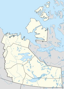
| Map | |||||||||||
| Runways | |||||||||||
| |||||||||||
Source: Canada Flight Supplement [1] | |||||||||||
Ekati Airport( IATA : YOA, ICAO : CYOA) is located at the Ekati Diamond Mine, Northwest Territories, Canada and is operated by Dominion Diamond Ekati Corp. [2] Prior permission is required to land except in the case of an emergency. It is a busy[ further explanation needed ] aerodrome with blasting in the area and barren-ground caribou may be found on the runway. [1]
An IATA airport code, also known as an IATA location identifier, IATA station code or simply a location identifier, is a three-letter geocode designating many airports and metropolitan areas around the world, defined by the International Air Transport Association (IATA). The characters prominently displayed on baggage tags attached at airport check-in desks are an example of a way these codes are used.

The ICAOairport code or location indicator is a four-letter code designating aerodromes around the world. These codes, as defined by the International Civil Aviation Organization and published in ICAO Document 7910: Location Indicators, are used by air traffic control and airline operations such as flight planning.

The Ekati Diamond Mine ("Ekati") is Canada's first surface and underground diamond mine. It is located 310 km (190 mi) north-east of Yellowknife, Northwest Territories, and about 200 km (120 mi) south of the Arctic Circle, near Lac de Gras. Until 2014 Ekati was a joint venture between Dominion Diamond Mines (80%), and the two geologists who discovered kimberlite pipes north of Lac de Gras, Chuck Fipke and Stewart Blusson each holding a 10% stake in the mine, until Fipke sold his share to Dominion.


