
Wayanad is a district in the north-east of the Indian state of Kerala, with administrative headquarters at the municipality of Kalpetta. It is the only plateau in Kerala. The Wayanad Plateau forms a continuation of the Mysore Plateau, the southern portion of Deccan Plateau which links the Western Ghats with the Eastern Ghats. It is set high in the Western Ghats with altitudes ranging from 700 to 2,100 meters. Vellari Mala, a 2,240 m (7,349 ft) high peak situated on the trijunction of Wayanad, Malappuram, and Kozhikode districts, is the highest point in Wayanad district. The district was formed on 1 November 1980 as the 12th district in Kerala, by carving out areas from Kozhikode and Kannur districts. An area of 885.92 km2 in the district is forested. Wayanad has three municipal towns—Kalpetta, Mananthavady and Sulthan Bathery. There are many indigenous tribes in this area. The Kabini River, a tributary of Kaveri River, originates at Wayanad. Wayanad district, along with the Chaliyar valley in the neighbouring Nilambur in Malappuram district, is known for natural gold fields, which are also seen in other parts of the Nilgiri Biosphere Reserve. Chaliyar river, which is the fourth longest river of Kerala, originates on the Wayanad plateau. The historically important Edakkal Caves are located in Wayanad district.

Ambalappuzha is a small town in the Alappuzha district of Kerala state, India. It is located 14 km (8.7 mi) south of Alappuzha which is the district headquarters.
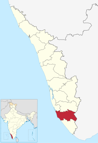
Kollam district, is one of 14 districts of the state of Kerala, India. The district has a cross-section of Kerala's natural attributes; it is endowed with a long coastline, a major Laccadive Sea seaport and an inland lake. The district has many water bodies. Kallada River is one among them, and land on the east bank of the river is East Kallada and that on the west bank is West Kallada.
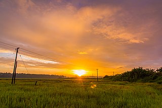
Thrissur, anglicised as Trichur, is one of the 14 districts in the Indian state of Kerala. It is situated in the central region of the state. Spanning an area of about 3,032 km2 (1,171 sq mi), the district is home to over 9% of Kerala's population.
Pariyaram is a Grama Panchayat consisting of two villages viz. Pariyaram census town and Kuttiyeri village. Pariyaram is a suburb of Taliparamba on National Highway between Taliparamba and Payyanur in Kerala state of India. Mini villages of Thiruvattoor, Koran Peedika, Mukkunnu & Chithappile Poyil are parts of Pariyaram.

Anjarakandy is a census town and grama panchayat in Kannur district of Kerala, India. Anjarakandy river is flowing through Anjarakandy town.
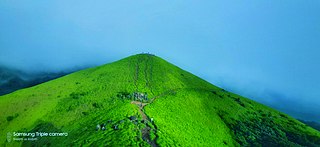
Kasaragod is one of the 14 districts in the southern Indian state of Kerala. Its northern border Thalappady is located just 9 km south to Ullal, which is the southernmost portion of the major port city Mangalore, on the southwestern Malabar coast of India.
Pothanikkad or Pothanicad is a village in Ernakulam district in the Indian state of Kerala. It's also the first village to achieve 96.00% literacy in India. However, In 2011, literacy rate of Mallappally village was 96.92 % compared to 94.00 % of Kerala, the highest in India. In Mallappally Male literacy stands at 96.85 % while female literacy rate was 96.99 %. Back to the village, the name Pothanikkad derives from the Malayalam words poth, meaning buffalo, anaa, meaning elephant, and kaddu, meaning forest, as it was originally a forest with wild buffalos and elephants. Now, this small village has developed into one of the most educated and culturally advanced villages in Kerala. St. Mary's High School is the oldest high school in Pothanicad, where very prominent people in the society and many local politicians have been educated. St. John's Higher Secondary school Pulinthanam is a pioneering educational institution in the village. A government Lower Primary school and St.Xaviers Senior Secondary Public schools and Holy Angels, following CBSE curriculum, also provides better educational opportunities for the young community.
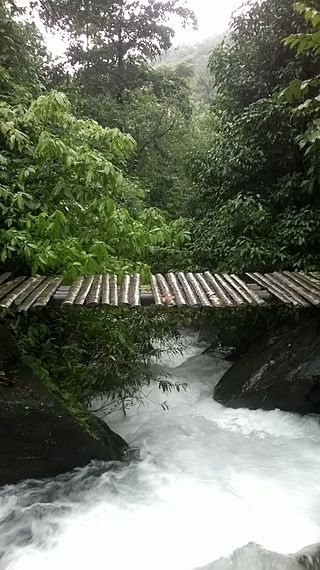
Alakode is an emerging town and a panchayath in Kannur district in the Indian state of Kerala. It is located 46 km (29 mi) north of district headquarters Kannur. Alakode is located on Taliparamba-Manakadavu-Coorg Road. Alakode was one of the major centers of Malabar Migration.

Cherukunnu is a census town in Kannur district in the Indian state of Kerala. Cherukunnu town is located on Valapattanam-Pappinisseri-Pazhayangadi main road, situated to the south of the Pazhayangadi in Kannur District in Kerala.
Kadannapalli is a census town in Kannur district of Kerala state, India.

Kurumathur is a census town in Taliparamba taluk of Kannur district in Kerala state, India. Kurumathur is located 8 km (5.0 mi) east of Taliparamba town in SH 36.

Karadka is a village, block panchayat and grama panchayat in Kasaragod district in the state of Kerala, India.
Edamulackal is a village and gram panchayat in Kollam district in the state of Kerala, India. Situated near the second fastest growing town of Kerala, Anchal. Ayoor is the main town thats located on the M C Road or state highway One, within the area limits of Edamulackal gram panchayat.
Mulavana is a village in Kollam district in the state of Kerala, India. The place is filled with almost all types of shops,which includes stationary,fancy,textile etc. The Mulavana fish market is regarded as the best market while comparing with the surrounding places.
Vazhoor is a town in Kottayam district in the state of Kerala, India.It is a village, panchayat and block with headquarters at Kodungoor on NH183. Basically an agrarian community inhabits this part, whose income depends on rubber cultivation
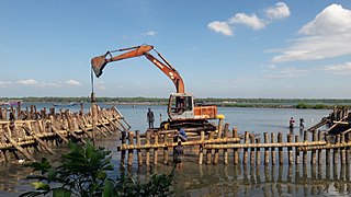
Purathur is a sandy coastal village and a Grama Panchayat in Tirur Taluk, Malappuram district in the state of Kerala, India. Bharathappuzha river and Tirur River merges together in Purathur and join with the Arabian Sea at Padinjarekara Azhimukham, which is also the southernmost tip of Purathur Gram panchayat. Opposite to Padinjarekara Azhimukham is Ponnani port. The village is located at the southernmost tip of Tirur Taluk and is bordered by historically important Ponnani port in Ponnani Municipality of Ponnani taluk to south.

The Malappuram Metropolitan Area or Malappuram Urban Agglomeration is an urban agglomeration centred around the city of Malappuram, Manjeri in Malappuram district, Kerala, India. It is the 25th largest urban agglomeration in India and the 4th largest in Kerala.

Anthoor is a municipality, in Taliparamba taluk of the Kannur district in Kerala, India. The municipality had a population of 28,218 in the 2011 Indian census.
Kannur taluk is an administrative division of Kannur district of Kerala, India. Kannur district is divided into five taluks, Thalassery, Kannur, Payyanur, Iritty and Taliparamba. Thalassery has 35 villages, Kannur has 28, Payyanur has 22, Taliparamba has 28 villages and Iritty has 20 villages.


