Elham, Kent

Last updated • 6 min readFrom Wikipedia, The Free Encyclopedia

Elham
Elham Valley 1.jpg
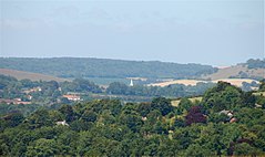
Elham Valley from Tolsford Hill
Kent UK location map.svg
Red pog.svg
Elham
Location within Kent
Population1,509 (2011) [1]
OS grid reference TR175439
District
Shire county
Region
Country England
Sovereign state United Kingdom
Post town Canterbury
Postcode district CT4
Dialling code 01303
Police Kent
Fire Kent
Ambulance South East Coast
UK Parliament
List of places
UK
England
Kent
51°09′10″N1°06′40″E / 51.1528°N 1.1111°E / 51.1528; 1.1111

Elham ( /ˈləm/ ) is a village and civil parish in East Kent situated approximately 9 miles (14 km) south of Canterbury and 5 miles (8 km) north west of Folkestone in the Elham Valley. At the 2011 Census the population included the hamlet of Ottinge and village of Wingmore.

Contents

{{IPAc-en|ˈ|k|eɪ|m|b|r|ɪ|dʒ|audio=En-uk-Cambridge.ogg

History

Toponymy

The origin of the village's name has always been a matter of argument. [2] The village is listed in the Domesday Book of 1086 as Alham. [3] The suffix "ham" is derived from the Old English "ham" meaning "homestead" or "hamm" meaning "meadow". The village may be the Ulaham referred to in an Anglo Saxon charter of 855 AD [4] in which case the name means "homestead of a person named Ula". [4] Indeed local legend has it the large chalk foundation stones of the Palace of Ula can be seen in the cellar of Flint Cottage. Another possibility is that the name originates from the presence of eels known to be found in the Nailbourne centuries ago. [2] [5] *To note an eel was caught in the Nailbourne by Tim Elgar in the nineteen seventies. A third possibility is that the first part of the name derives from the Old English "alh" meaning "temple". [6]

Early history

The discovery of hundreds of Neolithic hand axes, scrapers and worked flints at Dreal's Farm on the chalk plateau to the east of the village is the earliest evidence of human activity in the parish. [7] [8] Bronze Age remains have also been discovered indicating continuity of settlement. [8] There is also a cluster of Bronze Age tumuli in Elham Park Wood and there is a further tumulus on the hillcrest between Ottinge and Rhodes Minnis. Evidence of Roman occupation is limited to discoveries of coins and pottery and there is little Anglo Saxon archaeological evidence although the Anglo Saxon cemetery at Lyminge may extend over the parish boundary. [8]

St Mary's Church dates from about 1200 whilst the Abbot's Fireside Restaurant on the high street is of Stuart origin (built in 1641). Local legend has it King Charles 1st hid from the Roundheads behind the big fireplace following his escape from Hampton Court during his attempt to get to France in 1647/48. It is also reputed to have been the headquarters of the Duke of Wellington during the times when there was a threat from Napoleonic invasion. In the centre of the village is the Square. This dates from 1251 when the village was granted a market by Edward I [4] and was in use until the early 19th century. The village once had two windmills but both now no longer exist.

19th century to present day

The population of Elham was 1,192 in 1881. [9] Elham Valley Railway opened in 1889 and closed in 1947. [4] There are still traces of its existence throughout the parish such as the remains of the station platforms at the bottom of Duck Lane. Until the early 1900s a brickworks existed within the village (the Elham Valley Brick and Tile Company) with kilns situated on the east side of the valley.

Governance

Elham Parish Council oversees matters within the village. The parish is very large for such a small settlement, stretching to the edge of Lyminge in the south, to the hamlet of Breach in the north and east to Acrise and west to Stelling Minnis. Elham is situated within the Elham and Stelling Minnis ward within the local government district of Folkestone and Hythe. The population of this ward at the 2011 Census was 2,087. [10] The present local councillor for the Elham and Stelling Minnis Ward is Pamela Carr. [11] The village is located within the constituency of Folkestone and Hythe.

Economy and services

Elham Church of England Aided Primary School provides education for children from the age of 4 to 11. There is also a pre-school playgroup that operates within the village hall and a surgery. Elham has retained a village stores and there is also a farm shop at North Elham and a Tea Room in the main village. A farmers' market operates from the Rose and Crown pub every other Sunday. At the hamlet of Breach just outside the parish is the Elham Valley Vineyard. There are two pubs, the Rose and Crown and the King's Arms and one restaurant, the Abbot's Fireside. However, services have declined in the latter half of the 20th century and into the 21st century and there is no longer a baker's, butcher's, garage, newsagents or bookshop within the village. The New Inn has recently been closed and converted to housing. Although no longer a standalone Post Office in the village, a small franchise operates in the King's Arms pub a few mornings a week.

Similar to many other villages in the UK there is a shortage of social housing but there is no obvious sign of real demand. There is availability of property for families and those on ordinary incomes. Improvements in agriculture and the decline of local businesses has resulted in fewer employment opportunities within the village than there were in the early 20th century. Elham is located on the 17 bus route from Folkestone to Canterbury operated by Stagecoach.

Environment and conservation

Elham is situated deep in the heart of the North Downs and within the Kent Downs Area of Outstanding Natural Beauty. Whilst much of the countryside surrounding the village is arable farmland there are still patches of unimproved or semi-improved grassland where wildlife is allowed to flourish such as Baldock Downs and Hall Downs. These sites often support many typical chalk downland species such as Common Milkwort (Polygala vulgaris), Field Scabious (Knautia arvensis) and Salad Burnet (Sanguisorba minor) as well as orchids such as Fragrant (Gymnadenia conopsea), Common Spotted (Dactylorhiza fuchsii) and Pyramidal (Anacamptis pyramidalis).

Park Gate Down nature reserve is situated within the parish and is well known for its extensive downland flora. [12] The site and the roadside nature reserve near the chalk pit are managed by Kent Wildlife Trust. Several other areas of land within the parish are maintained under the Countryside Stewardship Scheme whilst there are also designated Sites of Special Scientific Interest at Park Gate Down and Shuttlesfield Down. Elham Park Wood is owned and managed by the Forestry Commission. Local volunteers and farmers also carry out work to conserve and manage the environment. There is also an active environmental group who aim to reduce carbon emissions within the local community and receive support from Kent Energy Centre and Kent County Council. [13]

Notable people

Romani king and bare knuckle boxer Gilderoy Scamp passed away in Elham in 1893. Kent and England wicket-keeper Les Ames was born and brought up in Elham. [14] Another Kent and England cricketer Mark Ealham used to live in the Square. [14] Academy Award-winning actress Audrey Hepburn spent some of her childhood in Elham. [14] Prime Minister Anthony Eden lived at Park Gate just north-west of Elham during the Second World War. [14] Professor C. Northcote Parkinson, historian and inventor of Parkinson's Law, lived in the Manor House in the late 1940s.[ citation needed ] Actress Pam Ferris has lived in Elham since 2009. [15]

Related Research Articles

<span class="mw-page-title-main">Folkestone</span> Town in Kent, England

Folkestone is a coastal town on the English Channel, in Kent, south-east England. The town lies on the southern edge of the North Downs at a valley between two cliffs. It was an important harbour, shipping port, and fashionable coastal resort for most of the 19th and mid-20th centuries.

<span class="mw-page-title-main">Little Stour</span> River in Kent, England

The Little Stour is one of the tributaries of the River Stour in the English county of Kent. The upper reaches of the river is known as the Nailbourne, whilst the lower reaches were once known as the Seaton Navigation.
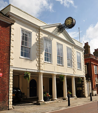
<span class="mw-page-title-main">Hythe, Kent</span> Town in Kent, England

Hythe is a market town and civil parish on the edge of Romney Marsh in Kent, England. Hythe is an Old English word meaning haven or landing place.
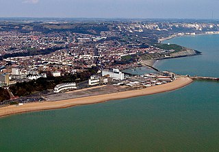
<span class="mw-page-title-main">Folkestone and Hythe District</span> Non-metropolitan district in England

Folkestone and Hythe is a local government district in Kent, England. It lies in the south-east of the county, on the coast of the English Channel. The district was formed in 1974 and was originally named Shepway after one of the ancient lathes of Kent, which had covered a similar area. The district was renamed in 2018. The council is based in Folkestone, the district's largest town. The district also includes the towns of Hawkinge, Hythe, Lydd and New Romney, along with numerous villages and surrounding rural areas.

<span class="mw-page-title-main">Folkestone and Hythe (UK Parliament constituency)</span> Parliamentary constituency in the United Kingdom, 1950 onwards

Folkestone and Hythe is a constituency in Kent represented in the House of Commons of the UK Parliament since 2024 by Tony Vaughan, a Labour MP.

<span class="mw-page-title-main">Hawkinge</span> Town in Kent, England

Hawkinge is a town and civil parish in the Folkestone and Hythe district of Kent, England. The original village of Hawkinge is actually just less than a mile due east of the present village centre; the village of Hawkinge was formed by the merging of Hawkinge and Uphill.
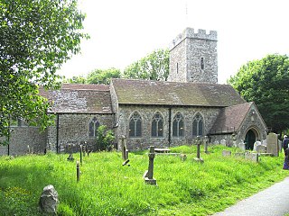
<span class="mw-page-title-main">Cheriton, Kent</span> Suburb of Folkestone in Kent, England

Cheriton is a northern suburb of Folkestone, in the Folkestone and Hythe, in the county of Kent, England. It is the location of the English terminal of the Channel Tunnel as well as of the major army barracks of Shorncliffe Camp.

<span class="mw-page-title-main">Etchinghill, Kent</span> Village in Kent, England

Etchinghill is a village in Kent, England, about 5 km north of Hythe, and 1 km north of the Channel Tunnel terminal at Cheriton, near Folkestone. It is in the civil parish of Lyminge.

<span class="mw-page-title-main">Barham, Kent</span> Village in Kent, England

Barham is a village and civil parish in the City of Canterbury district of Kent, England. Barham village is approximately 6 miles (10 km) south-east from Canterbury and 8 miles (13 km) north from Folkestone.

<span class="mw-page-title-main">Lyminge</span> Village in Kent, England

Lyminge is a village and civil parish in southeast Kent, England. It lies about five miles (8 km) from Folkestone and the Channel Tunnel, on the road passing through the Elham Valley. At the 2011 Census the population of Etchinghill was included. The Nailbourne stream begins in the village and flows north through the Valley, to become one of the tributary streams of the Great Stour. The hamlet of Ottinge lies to the NE on the road to Elham. Lyminge is home to the Grade II* listed Sibton Park, now owned by the Holiday Property Bond but previously a school.

<span class="mw-page-title-main">Newington, Folkestone and Hythe</span> Village in Kent, England

Newington is a village and civil parish in the English county of Kent located 1 mile (1.6 km) north-west of Folkestone. It gives its name to Newington Parish Council, which has five councillors, and includes the hamlets of Arpinge and Beachborough. The village lies to the north of the M20 motorway and the A20 road; the Channel Tunnel complex is nearby.

<span class="mw-page-title-main">Sellindge</span> Village in Kent, England

Sellindge is a civil parish and village on the A20 road between Ashford and Folkestone in Kent, South East England. Sellindge is part of North Downs West Ward of Folkestone and Hythe District Council but part of the Elham ward of Kent County Council.

Rhodes Minnis is a village near Folkestone in Kent, England, located between Lyminge and Stelling Minnis. It is on the boundary of the civil parishes of Lyminge and Elham. It was a gathering place for some of the Swing Riots organizers from Lyminge during the 1830s.

<span class="mw-page-title-main">Elham Valley</span>

The Elham Valley is a chalk valley carved by the River Nailbourne situated in the North Downs in East Kent. The valley is named after the settlement of Elham. Other settlements in the valley include Etchinghill, Lyminge, Barham, Kingston, Bishopsbourne and Bridge.
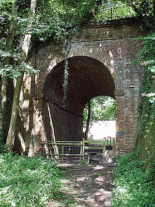
<span class="mw-page-title-main">Elham Valley Railway</span> Former railway in England, now closed.

The Elham Valley Railway was a line connecting Folkestone and Canterbury in Kent, England. It opened between 1887 and 1889 and closed in 1947.

<span class="mw-page-title-main">Park Gate Down</span>

Park Gate Down or Parkgate Down is a 7-hectare (17-acre) biological Site of Special Scientific Interest south-east of Stelling Minnis in Kent. It is also a Special Area of Conservation and is managed by the Kent Wildlife Trust,

<span class="mw-page-title-main">Stelling Minnis</span> Village in Kent, England

Stelling Minnis is a village and civil parish in the Folkestone and Hythe district in Kent, England. The village lies 13 kilometres (8 mi) to the south of Canterbury, and to the east of the B2068, Stone Street, the Roman road, which takes traffic between Lympne and Canterbury.

Folkestone and Hythe District Council is the local authority for the Folkestone and Hythe District in Kent, England. The district was called Shepway prior to 2018. The council is elected every four years. Since the last boundary changes in 2015, 30 councillors have been elected from 13 wards.

District Council elections were held in Shepway in 2007.
References

  1. "Parish population 2011" . Retrieved 5 October 2015.
  2. 1 2 Hart, Brian; Lawton, Eila (1997). The Elham Valley Way. Great Britain: Kent County Council. ISBN   1-873010-95-8.
  3. "Elham". Domesday Book. The National Archives. 1086. Retrieved 19 February 2008.
  4. 1 2 3 4 "A Brief History of Elham and The Square". Elham Valley Website. 11 July 2007. Retrieved 11 July 2007.
  5. Glover, Judith (1976). The Place Names of Kent. Guildford, Surrey: Biddles Ltd. ISBN   0-7134-3069-9.
  6. "Key to English Place-names".
  7. Tuson, Dan (2007). The Kent Downs. Stroud, Gloucestershire: Tempus Publishing. ISBN   978-0-7524-4405-5.
  8. 1 2 3 Elham Parish Appraisal 1996
  9. Hart, Brian (1989). Elham Valley Reflections. Uckfield: Millgate Publishing. ISBN   0-9510454-2-3.
  10. "Elhma and Stelling Minnis ward 2011" . Retrieved 5 October 2015.
  11. "Shepway District Council – Cllr Miss Pamela Carr". Shepway District Council. 11 July 2007. Archived from the original on 14 February 2009. Retrieved 11 July 2007.
  12. "Park Gate Down (The Hector Wilks Reserve), Elham". Elham Valley Website. 3 December 2007. Retrieved 3 December 2007.
  13. "Elham Environment Group About Us". Elham Environment Group. 3 December 2007. Archived from the original on 13 October 2008. Retrieved 3 December 2007.
  14. 1 2 3 4 "Famous and Notable People "In and Around" the Elham Valley". Elham Valley Website. 11 July 2007. Retrieved 11 July 2007.
  15. Sturt, Sarah (13 December 2016). "Pam Ferris in 'We're Going on a Bear Hunt'". Kent Life. Retrieved 25 January 2018.