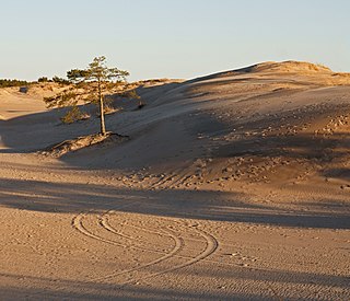
A dune is a landform composed of wind- or water-driven sand. It typically takes the form of a mound, ridge, or hill. An area with dunes is called a dune system or a dune complex. A large dune complex is called a dune field, while broad, flat regions covered with wind-swept sand or dunes with little or no vegetation are called ergs or sand seas. Dunes occur in different shapes and sizes, but most kinds of dunes are longer on the stoss (upflow) side, where the sand is pushed up the dune, and have a shorter slip face in the lee side. The valley or trough between dunes is called a dune slack.

Equisetum is the only living genus in Equisetaceae, a family of vascular plants that reproduce by spores rather than seeds.

Holkham National Nature Reserve is England's largest national nature reserve (NNR). It is on the Norfolk coast between Burnham Overy Staithe and Blakeney, and is managed by Natural England with the cooperation of the Holkham Estate. Its 3,900 hectares comprise a wide range of habitats, including grazing marsh, woodland, salt marsh, sand dunes and foreshore. The reserve is part of the North Norfolk Coast Site of Special Scientific Interest, and the larger area is additionally protected through Natura 2000, Special Protection Area (SPA) and Ramsar listings, and is part of both an Area of Outstanding Natural Beauty (AONB) and a World Biosphere Reserve. Holkham NNR is important for its wintering wildfowl, especially pink-footed geese, Eurasian wigeon and brant geese, but it also has breeding waders, and attracts many migrating birds in autumn. Many scarce invertebrates and plants can be found in the dunes, and the reserve is one of the only two sites in the UK to have an antlion colony.
Weston-super-Mare, also known simply as Weston, is a seaside town in the North Somerset unitary area in the county of Somerset, England. It lies by the Bristol Channel 20 miles (32 km) south-west of Bristol between Worlebury Hill and Bleadon Hill. Its population at the 2021 census was 82,418.
Desert National Park is a national park situated in the Indian state of Rajasthan, near the towns of Jaisalmer and Barmer. This is one of the largest national parks, covering an area of 3162 km². The Desert National Park is an excellent example of the ecosystem of the Thar Desert. Sand dunes form around 44% of the Park. The major landform consists of craggy rocks and compact salt lake bottoms, intermedial areas and fixed dunes. The park was gazetted in 1980.

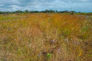
The Sandhills, often written Sand Hills, is a region of mixed-grass prairie on grass-stabilized sand dunes in north-central Nebraska, covering just over one quarter of the state. The dunes were designated a National Natural Landmark in 1984.

Weston-super-Mare is a constituency represented in the House of Commons of the UK Parliament since 2005 by John Penrose, a Conservative.

Sand Bay is a strip of coast in North Somerset bordered to the south by Worlebury Hill and to the north by Sand Point and Middle Hope. It lies 2 miles (3.2 km) north of the seaside resort of Weston-super-Mare, and across the Bristol Channel from South Wales. It is adjacent to the village of Kewstoke.

Guadalupe-Nipomo Dunes is the largest remaining dune system south of San Francisco and the second largest in the U.S. state of California. It encompasses an 18-mile (29 km) stretch of coastline on the Central Coast of California and extends from southern San Luis Obispo County to northern Santa Barbara County.

Uphill Cliff is a 19.8 hectare biological Site of Special Scientific Interest near the village of Uphill, North Somerset, although it is in the Avon Area of Search used by English Nature which is based on the 1974-1996 county system.
NVC community SD12 is one of the 16 sand-dune communities in the British National Vegetation Classification system.

Sand dune stabilization is a coastal management practice designed to prevent erosion of sand dunes. Sand dunes are common features of shoreline and desert environments. Dunes provide habitat for highly specialized plants and animals, including rare and endangered species. They can protect beaches from erosion and recruit sand to eroded beaches. Dunes are threatened by human activity, both intentional and unintentional. Countries such as the United States, Australia, Canada, New Zealand, the United Kingdom, and Netherlands, operate significant dune protection programs.

Ireland is in the Atlantic European Province of the Circumboreal Region, a floristic region within the Holarctic.

Godrevy Head to St Agnes is a coastal Site of Special Scientific Interest (SSSI) in north Cornwall, England], noted for both its biological and geological characteristics. A number of rare and scarce plant species can be found on the site, along with many breeding seabirds.
Chiwaukee Prairie is a 485-acre (1.96 km2) prairie in Pleasant Prairie, Wisconsin managed by the Wisconsin Department of Natural Resources. It is located on Lake Michigan at the Illinois state line and includes grassy wetlands, wooded areas, and the Kenosha Sand Dunes at its northern tip. It is home to an abundance of wildlife. It was designated a Wisconsin State Natural Area in 1967 and a National Natural Landmark in 1973.

Stevenston Beach is a Local Nature Reserve (LNR), located between Stevenston and Saltcoats in Scotland. It is situated on the coast, west of the Stevenston Burn. The park covers an area of 12 ha, and consists mostly of sand dunes, with an area of coal mining spoil derived from Auchenharvie Colliery No. 5 pit which produced Ladyha' coal. It is ranked as the fifth most important sand dune system in Ayrshire. The dunes are also designated as a wildlife site by the Scottish Wildlife Trust.

North Devon's Biosphere Reserve is a UNESCO biosphere reserve in North Devon. It covers 55 square miles (140 km2) and is centred on Braunton Burrows, the largest sand dune system (psammosere) in England. The boundaries of the reserve follow the edges of the conjoined catchment basin of the Rivers Taw and the Torridge and stretch out to sea to include the island of Lundy. The biosphere reserve is primarily lowland farmland, and includes many protected sites including 63 Sites of Special Scientific Interest which protect habitats such as culm grassland and broadleaved woodlands. The most populous settlements in its buffer area are Barnstaple, Bideford, Northam, Ilfracombe, and Okehampton.

Sand Point in Somerset, England, is the peninsula stretching out from Middle Hope, an 84.1-hectare (208-acre) biological and geological Site of Special Scientific Interest. It lies to the north of the village of Kewstoke, and the stretch of coastline called Sand Bay north of the town of Weston-super-Mare. On a clear day it commands views over Flat Holm, of the Bristol Channel, South Wales, Clevedon, the Second Severn Crossing and the Severn Bridge. A line drawn between Sand Point and Lavernock Point in South Wales marks the lower limit of the Severn Estuary and the start of the Bristol Channel.

Dagestan Nature Reserve is a Russian 'zapovednik' that protects an area of sand dunes and ridges on the northwest coast of the Caspian Sea in the southeast of European Russia. The reserve, a wintering place for migratory birds, is the richest nature reserve in Russia in terms of the number of species - over 300 species have been recorded in the reserve, its buffer zones and subordinate reserves. The reserve is part of several "Important Bird and Biodiversity Areas" (IBAs). The Sarykum sand dune is the highest sand dune in Europe, at 262 m (860 ft). The reserve is situated in the Tarumovsky District of Dagestan.
Sri Lanka is a relatively small continental island, it exhibits a remarkable diversity of forest types, which are among the biologically one of richest forests in Asia. In these forests plant species show extraordinary patterns of localized distribution. Sri Lanka's forest became one of highest density of species diversity in the world. Sri Lanka natural forest cover about 12,493 km2 29.46% According to the National Red List said, Sri Lanka counts 253 land species, 245 species of butterflies, 240 birds, 211 reptiles, 748 evaluated vertebrates and 1,492 invertebrates. Forest coverage is about 70% tropical dry monsoon forests, 15% tropical moist monsoon forests and 5% tropical lower montane forests. By the dawn of the 19th century, Sri Lanka's forest cover was estimated at up to 70% of the total land area. Since then, the forest cover has decreased progressively over time. Significant loss of Sri Lanka's forest cover was first reported in the 19th century, with the introduction of plantation agricultural crops such as tea and vegetables. Commercial timber extraction policy of colonial rulers (British colonial time also led to clearing of forests in the dry zone. Irrigation development and agricultural expansions have been identified as key drivers of forest cover change.

