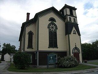
Babson Park is a census-designated place (CDP) in Polk County, Florida, United States. The population was 1,182 at the 2000 census. It is also the home of Webber International University.

Crooked Lake Park is a census-designated place (CDP) in Polk County, Florida, United States. The population was 1,682 at the 2000 census. It is part of the Lakeland–Winter Haven Metropolitan Statistical Area.

Vineyard Haven is a community within the town of Tisbury, Massachusetts, United States on the island of Martha's Vineyard. It is listed as a census-designated place (CDP) by the U.S. Census Bureau, with a population of 2,114 as of the 2010 census.

East Douglas is a census-designated place (CDP) in the town of Douglas in Worcester County, Massachusetts, United States. The population was 2,557 at the 2010 census.

Crystal Lake is a census-designated place (CDP) in Polk County, Florida, United States. The population was 5,341 at the 2000 census, an increase from 5,300 in 1990. The 2010 Census reported a population of 5,514. It is part of the Lakeland–Winter Haven Metropolitan Statistical Area.

Manchester Center is a census-designated place (CDP) in the town of Manchester in Bennington County, Vermont, United States. As of the 2010 census, the CDP had a population of 2,120, out of 4,391 people in the entire town of Manchester.
South Shaftsbury is a census-designated place (CDP) in the town of Shaftsbury in Bennington County, Vermont, United States. The population was 681 at the 2020 census.

Graniteville-East Barre is a former census-designated place (CDP) defined for the 2000 census in the town of Barre, Washington County, Vermont, United States. The population of the CDP was 2,136 at the 2000 census. The CDP consisted of three unincorporated villages in the town: Graniteville, East Barre, and Websterville. For the 2010 census, the three areas have been split into separate CDPs in accordance with the 2010 criterion of not aggregating multiple places into one CDP.

South Barre is a census-designated place (CDP) in the town of Barre in Washington County, Vermont, United States. The population was 1,242 at the 2000 census.

West Brattleboro is a census-designated place (CDP) in the town of Brattleboro, Vermont, United States. The population was 3,222 at the 2000 census.

Chester is a census-designated place (CDP) in Windsor County, Vermont, United States. The population was 1,005 at the 2010 census. The CDP is a statistical area encompassing three distinct places: the urbanized center of the town of Chester; a locale known as Chester Depot, which is separated from the town center by the tracks of the former Rutland Railroad; and the village of North Chester.

Wilder is an unincorporated village and census-designated place (CDP) within the town of Hartford in Windsor County, Vermont, United States. It is the location of the Wilder Dam on the Connecticut River. The population of the CDP was 1,690 at the 2010 census. The village center is an early example of a planned mill community, and was listed on the National Register of Historic Places as the Wilder Village Historic District in 1999.

Middlebury is the main settlement in the town of Middlebury in Addison County, Vermont, United States, and a census-designated place (CDP). The population was 7,304 at the 2020 census, out of a total population of 9,152 in the town of Middlebury. Most of the village is listed on the National Register of Historic Places as the Middlebury Village Historic District.
Bennington is a census-designated place (CDP) in Bennington County, Vermont, United States. It is located entirely within the town of Bennington. The population of the CDP was 9,074 at the 2010 census, or 57.6% of the population of the entire town.

Milton is an unincorporated village within the town of Milton in Chittenden County, Vermont, United States. The village disincorporated in 2003 and became a census-designated place (CDP) in 2008. As of the 2020 census the population was 3,804, out of a population of 10,723 for the entire town.

Brandon is an unincorporated village and census-designated place (CDP) in the town of Brandon, Rutland County, Vermont, United States. As of the 2020 census, the population was 1,727.
Wallingford is a census-designated place (CDP) in Rutland County, Vermont, United States. The population was 830 at the 2010 census.

Brattleboro is a census-designated place (CDP) corresponding to the densely populated core of the town of Brattleboro in Windham County, Vermont, United States. The population was 8,289 at the 2000 census.

Springfield is a census-designated place (CDP) comprising the main settlement within the town of Springfield, Windsor County, Vermont, United States. The population of the CDP was 3,979 at the 2010 census, compared with 9,373 for the town as a whole.

Arlington is a census-designated place (CDP) in the towns of Arlington and Sunderland, Bennington County, Vermont, United States. The population was 1,213 at the 2010 census.


