Wright Cemetery is a historic cemetery on Groton Road near Lynwood Lane in Westford, Massachusetts. The cemetery was formally established in 1836 as a private cemetery for the locally numerous Wright family, although its earliest documented burial dates to 1819. Maintenance and operation of the cemetery was taken over by the town in 1909. The half-acre plot has approximately 150 marked grave sites, and remains in use. The cemetery was added to the National Register of Historic Places in 2005.

Hillside Cemetery, also known as the North Burying Ground, is a historic cemetery on Depot and Nutting Roads in Westford, Massachusetts. The cemetery was established in 1753, and is the burial site of a number of people important in local history. It contains approximately 300 burials, and continues in active use. The cemetery was listed on the National Register of Historic Places in 2005.

The Russian Cemetery is a historic cemetery on Patten Road in Westford, Massachusetts. The cemetery was established in 1918 by the Russian Brotherhood, a social organization that served as a focal point for Belorussian immigrants who had been recruited by agents for the Abbot Worsted Company to work in its Westford mills. These primarily Russian Orthodox Christians were not allowed to have burials in some of the town's other cemeteries, prompting the creation of this one, which is distinctive in the town as the only cemetery catering to a specific ethnic group. It has approximately 300 burials, with a significant number of early burials marked with gravestones bearing Cyrillic lettering. The cemetery remains open to members of the local Russian-American community.

The East Main Street Cemetery is a historic cemetery on East Main Street in Dalton, Massachusetts. The cemetery is one of the oldest in the town, with grave markers dating to the 1780s. It was founded on land owned by the Chamberlin family, whose identified graves make up about 20 percent of roughly 250 gravesites. The cemetery was listed on the National Register of Historic Places in 2000.

Fairview Cemetery is a historic cemetery on Curtis Avenue in Dalton, Massachusetts. Established in 1885, the cemetery became the resting ground for many of Dalton's heavily Irish Catholic working class, and is stylistically reflective of changing trends in burial practices away from the rural cemetery movement of the mid-19th century. The cemetery, still in active use, was listed on the National Register of Historic Places in 2000.

The Main Street Cemetery is a historic cemetery on Main Street in Dalton, Massachusetts. Although the cemetery dates to 1781, much of it was laid out in the 19th century, during the rural cemetery movement. Its most prominent burials are those of the Crane family, whose papermaking business, Crane and Company, has dominated Dalton since the 1820s. The cemetery was listed on the National Register of Historic Places in 2000.

The Grove Hill Cemetery is a historic cemetery at 290 Main Street in Waltham, Massachusetts. Established in 1703, the cemetery was Waltham's only cemetery until 1857, when Mount Feake Cemetery opened. It was authorized in 1703, but its initial 2.3-acre (0.93 ha) parcel of land was not purchased until 1704. The first documented burial, however, took place in November 1703. The northwest section of the cemetery is its oldest portion, and includes a number of unmarked gravesites. The cemetery continues in active use today, and contains a representative sample of funerary art spanning 300 years. It now covers more than 9 acres (3.6 ha), extending between Main and Grove Streets. Its main entrance features posts with an Egyptian Revival theme, a style continued with the presence of obelisks dispersed on the grounds.

Westlawn Cemetery is a historic cemetery on Concord Road at Country Road in Westford, Massachusetts. Established in 1761 as the West Burying Ground, it is one of the town's oldest cemeteries. It occupies a roughly triangular plot of 1.7 acres (0.69 ha). There are approximately 400 marked burials, generally laid out in rows running east–west. One of its most prominent burials is that of Colonel John Robinson, who led Westford's minutemen in the 1775 Battles of Lexington and Concord.

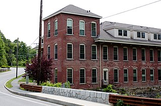
The Brookside Historic District of Westford, Massachusetts encompasses surviving elements of the 19th century Brookside mill village, the smallest of the town's three 19th-century industrial villages. Developed between about 1860 and 1904, it includes surviving mill buildings and a variety of mill-related worker housing. The district was listed on the National Register of Historic Places in 2003.

The Forge Village Historic District of Westford, Massachusetts, United States encompasses one of the town's historic 19th century mill villages. The focal point of the district is the mill complex of the Abbot Worsted Company, around which the village expanded after its founding in 1854. Prior to its founding the area was the site of a number of blacksmithies and iron forging operations, and was the site of a fulling mill in the 18th century. The center of the district is at the junction of East and West Prescott Streets with Pleasant Street, radiating away to ballfields on West Prescott, Abbot Street at Pleasant, and just beyond Orchard Street on East Prescott. Worker housing occupies a number of adjacent streets in the area.

The Henry Fletcher House is a historic house at 224 Concord Road in Westford, Massachusetts. Built c. 1810–13, it is a rare example of very late Georgian style timber-frame construction, with a large central chimney characteristic of colonial-era houses. It is styled with a mix of late Georgian and Federal style woodwork. The property's barn was also built by Henry Fletcher using the same construction methods. The house was listed on the National Register of Historic Places in 1993.

The Graniteville Historic District of Westford, Massachusetts, United States, encompasses one of the town's historic 19th century industrial villages. The area was, until the arrival of the railroad in 1847, primarily known for its granite quarries. The railroad's arrival prompted the construction of an industrial mill by Charles G. Sargent, and the area developed rapidly thereafter. A significant amount of housing stock, as well as civic institutional buildings, were built during the second half of the 19th century. The district is bounded on the east by River Street and on the south by Bridge Street and North Main Street. The western edge of the district runs just before North Main Street's junction with West Street, northward and then eastward to encompass a number of quarry sites, before meeting North Main Street at River Street.

Westford Town Farm is a historic poor farm in Westford, Massachusetts. Its main building is a 2+1⁄2 story brick building, five bays wide and six deep, that was built in 1837. It was twice enlarged, in c. 1840 and c. 1900. The enlargement consists of a wood-frame addition on the north side of the building; the 1900 addition was built to replace that from 1840, and stands on its foundation. It served as the focal point for the town's support of its indigent population until 1959, a later date than many similar facilities statewide remained open. Since its closing it has continued to house town facilities, including as police and fire stations, and most recently as school administrative offices.

Westford Center Historic District encompasses the historic village center of Westford, Massachusetts. It is centered on a stretch of Main Street between Graniteville and Leland Roads, extending away from this strip on a number of side streets. The area has been the town center since settlement of the town began in the 1720s. Prominent in the district are the Westford Academy building and the First Parish Church, two fine Federal style structures built in 1794, and the Italianate town hall, built in 1871.

The Parker Village Historic District of Westford, Massachusetts encompasses a historic rural village center. The district extends from the junction of Carlisle Road and Griffin Road, westward along Carlisle Road to a triangular green where it meets Concord Road and Old Lowell Road. The oldest building in the village is the Parker Village Schoolhouse, built in 1787 out of brick and wood, and restored in the 1990s. The majority of the houses in the district date from the 18th and 19th centuries, with eclectic Victorian styles predominating.

The Jerathmell Bowers House is believed to have built circa 1673, at 150 Wood Street in Lowell, Massachusetts. It is the oldest known home in Lowell. It was listed on the National Register of Historic Places in 1994.

Fairview Cemetery is a historic cemetery in the Hyde Park neighborhood of Boston, Massachusetts. A small section of the cemetery is located in neighboring Dedham. The cemetery was established by the town of Hyde Park in 1892, and became the responsibility of the city of Boston when it annexed that town in 1912. The cemetery was added to the National Register of Historic Places on September 16, 2009. It is the newest of Boston's cemeteries, and has more than 40,000 burials. It is the location where the City of Boston “bury indigent and unclaimed people”.

The John Proctor House is a historic house at 218 Concord Road in Westford, Massachusetts. It is one of the oldest houses in Westford. Its main block was probably built between 1720 and 1740 by John Proctor II, although deed evidence surrounding the house's construction is scanty. The main house is a two-story timber-frame structure with an asymmetrical facade, somewhat resembling a typical First Period half house, although the chimney was removed in the 19th century. Most of the building's interior finishes date to the 1820s or 1830s. A two-story bay was added to the house's west side between 1830 and 1850, and a real ell added c. 1900.

Fairview Cemetery, also known as the Van Buren Cemetery, is a historic cemetery on the east side of Arkansas Highway 59 in Van Buren, Arkansas. The 10-acre (4.0 ha) cemetery's oldest graves date to 1816, the period of the region's settlement, and include some of Van Buren's first settlers. First established as an informal private burial ground, it was given to the city by John Drennen in 1846.

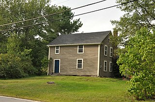
The Jonathon Keyes Sr. House, also known incorrectly in town histories as the Solomon Keyes House, is a historic house at 16 Frances Hill Road in Westford, Massachusetts. It was probably built in the mid-18th century, and is one of the town's oldest surviving buildings. It was listed on the National Register of Historic Places in 2019.


