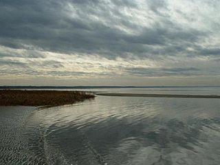
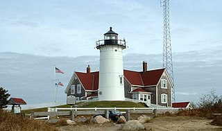
Cape Cod is a peninsula extending into the Atlantic Ocean from the southeastern corner of Massachusetts, in the northeastern United States. Its historic, maritime character and ample beaches attract heavy tourism during the summer months. The name Cape Cod, coined in 1602 by Bartholomew Gosnold, is the ninth oldest English place-name in the U.S.

Barnstable County is a county in the U.S. state of Massachusetts. At the 2020 census, the population was 228,996. The county seat is Barnstable. The county consists of Cape Cod and associated islands.
Eastham is a town in Barnstable County, Massachusetts, United States, Barnstable County being coextensive with Cape Cod. The population was 5,752 at the 2020 census.

Brewster is a town in Barnstable County, Massachusetts, United States, Barnstable County being coextensive with Cape Cod. The population of Brewster was 10,318 at the 2020 census.
Falmouth is a town in Barnstable County, Massachusetts, United States. The population was 32,517 at the 2020 census, making Falmouth the second-largest municipality on Cape Cod after Barnstable. The terminal for the Steamship Authority ferries to Martha's Vineyard is located in the village of Woods Hole in Falmouth. Woods Hole also contains several scientific organizations such as the Woods Hole Oceanographic Institution (WHOI), the Marine Biological Laboratory (MBL), the Woodwell Climate Research Center, NOAA's Woods Hole Science Aquarium, and the scientific institutions' various museums.

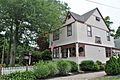
Cotuit is one of the villages of the Town of Barnstable on Cape Cod in Barnstable County, Massachusetts, United States. Located on a peninsula on the south side of Barnstable about midway between Falmouth and Hyannis, Cotuit is bounded by the Santuit River to the west on the Mashpee town line, the villages of Marstons Mills to the north and Osterville to the east, and Nantucket Sound to the south. Cotuit is primarily residential with several small beaches including Ropes Beach, Riley's Beach, The Loop Beach and Oregon Beach.
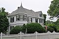
Barnstable is the name of one of the seven villages within the Town of Barnstable, Massachusetts, United States. The Village of Barnstable is located on the north side of the town, centered along "Old King's Highway", and houses the County Complex of Barnstable County, a small business district, a working harbor, and several small beaches. The village is home to many small attractions, including Sturgis Library, the Olde Colonial Courthouse, the Barnstable Comedy Club, and the Trayser Museum.

The Provincetown Historic District encompasses most of the dense urban center of Provincetown, Massachusetts. The district is roughly bounded to the north by U.S. Route 6; to the west by the west end of Commercial St.; to the south by Provincetown Harbor; and to the east by the southeast end of Commercial St. It covers about 300 acres (120 ha), and includes more than 1,000 buildings. Its historic character spans more than 200 years of settlement, from the city's early years as a fishing community, to its development as a summer resort area and artists' colony beginning in the late 19th century. The district was listed in the National Register of Historic Places in 1989. Four properties in the district are also individually listed.

The West Falmouth Village Historic District is a historic district along West Falmouth Highway in West Falmouth, Massachusetts, which is a village in the town of Falmouth, Massachusetts. The northern end of the historic district is approximately at Bourne Farm, near Thomas Landers Road, extending south along Route 28A through West Falmouth Village to about Garrison Road.
The Centerville Historic District is a historic district encompassing the heart of the village of Centerville in Barnstable, Massachusetts. The district extends along Main Street from a point north of its junction with Old Stage Road and Park Avenue, south to the junction with Church Hill Road. Most of the buildings in the district were built in the middle decades of the 19th century, although its oldest building, the Austin Bearse House, was built c. 1690. The area's growth was spurred by the relocation in 1826 of the Congregational Church building to its present location. The district was listed on the National Register of Historic Places in 1987.

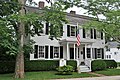
The Cotuit Historic District is a historic district encompassing the heart of the village of Cotuit in Barnstable, Massachusetts. It extends along Main Street from Lowell Street in the north to Sea Street in the south, and includes portions of Ocean View Avenue and properties on adjacent roads. The oldest properties date to the late 18th century, but saw its greatest development during the height of the area's maritime industry in the mid 19th century. In the late 19th and early 20th century the area saw new development as a summer resort area. The district was listed on the National Register of Historic Places in 1987.

The Mill Way Historic District encompasses a residential area significant in the development of the maritime industry in Barnstable Village, Massachusetts. It includes thirteen houses, ten on Mill Way and three on adjacent Freezer Road, just north of the Old King's Highway. The district was listed on the National Register of Historic Places in 1987.

The North Falmouth Village Historic District encompasses the historic 19th-century village of North Falmouth, Massachusetts, which is a village in the town of Falmouth, Massachusetts. It is a linear district, extending along Old Main Road south from its junction with Massachusetts Route 28A to Winslow Road. This area gradually developed over the 19th century, principally in support of maritime activities centered on Buzzards Bay to the west. The district contains a cross-section of architectural styles popular from the early 19th to early 20th centuries. It was listed on the National Register of Historic Places in 1998.

The Northside Historic District encompasses two of the earliest significant settlement areas of Yarmouth, Massachusetts. Stretching along Massachusetts Route 6A from the Barnstable line in the west to White Brook in the east, the district includes almost 300 buildings on 50 acres (20 ha). It includes the two villages of Yarmouth Center and Yarmouthport, which were important 18th and 19th century centers of civic and economic activity.

The Old King's Highway Historic District encompasses what was historically the principal east–west thoroughfare through Barnstable, Massachusetts. It encompasses Barnstable's entire length of what is now designated Massachusetts Route 6A, called Main Street, between the town lines of Sandwich and Yarmouth. It includes more than 1,000 acres (400 ha) and all buildings whose properties are front on the road, nearly 500 in all. The area consists of the main population centers of Barnstable from its founding in the late 1630s until the mid-19th century when the southern parts of the community became more significant in economic prominence. The district was listed on the National Register of Historic Places in 1987.

The South Yarmouth/Bass River Historic District is a historic district in the southeastern part of Yarmouth, Massachusetts. It encompasses a predominantly residential area centered on a portion of Old Main Street and South Street between the villages of South Yarmouth and Bass River. The area's history is one of maritime-related industry from the late 18th to late 19th century, and then its growth as a tourist resort community. The district was listed on the National Register of Historic Places in 1990.

The Santuit Historic District encompasses a cluster of historic houses around the junction of Falmouth Road and Main Street in the Santuit village of Barnstable, Massachusetts. It includes eight houses, six of which are historically significant for their association with the Crocker family, who were the first settlers of the area in the 18th century. The district was listed on the National Register of Historic Places in 1987.

The Teaticket School is a historic former school building at 340 Teaticket Hwy in Falmouth, Massachusetts. Built in 1927, this large Colonial Revival building was the first consolidated elementary school in the town. It has since 1967 served as the Administration Building for the Falmouth Public Schools. It was listed on the National Register of Historic Places in 2002.

The Brookline Town Green Historic District encompasses the historic colonial heart of the town of Brookline, Massachusetts. Centered on a stretch of Walnut Street between Warren and Chestnut Streets, this area is where the town's first colonial meeting house and cemetery were laid out, and was its center of civic life until the early 19th century. The district was listed on the National Register of Historic Places in 1980.

Barnstable is a town in the U.S. state of Massachusetts and the county seat of Barnstable County. Barnstable is the largest community, both in land area and population, on Cape Cod, and is one of thirteen Massachusetts municipalities that have been granted city forms of government by the Commonwealth of Massachusetts but wish to retain "the town of" in their official names. At the 2020 census it had a population of 48,916. The town contains several villages within its boundaries. Its largest village, Hyannis, is the central business district of the county and home to Barnstable Municipal Airport, the airline hub of Cape Cod and the islands of Martha's Vineyard and Nantucket. Additionally, Barnstable is a 2007 winner of the All-America City Award.