Bankass (Báŋkà:s) is a town and rural commune located in the Mopti Region of Mali. The commune has an area of approximately 362 square kilometers and includes the town and 25 of the surrounding villages. In the 2009 census it had a population of 30,159. The town is the seat of the Bankass Cercle, one of eight subdivisions (cercles) of the Mopti Region.

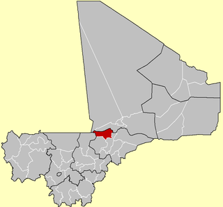
Mopti Cercle is an administrative subdivision of the Mopti Region of Mali. The administrative center (chef-lieu) is the town of Mopti.

Youwarou Cercle is an administrative subdivision of the Mopti Region of Mali. The administrative center (chef-lieu) is the town of Youwarou.

Diafarabé is a village and rural commune of the Cercle of Ténenkou in the Mopti Region of Mali. The commune is at the southern boundary of the cercle. It covers an area of approximately 980 square kilometers and extends on both sides of the Niger River. The commune includes 10 villages and in the 2009 census had a population of 15,748. The main village of Diafarabé, the chef-lieu, is situated on the north bank of the river next to the junction with the Diaka Channel, a distributary that only flows when the Niger is in flood.
Dialloubé is a small town and rural commune in the Cercle of Mopti in the Mopti Region of Mali. The commune covers an area of approximately 1,425 square kilometers and includes the town and 8 villages. In the 2009 census the commune had a population of 13,727.
Soubala is a village and rural commune in the Cercle of Bankass in the Mopti Region of Mali. The commune contains 9 villages and in the 2009 census had a population of 12,332.
Dandougou Fakala is a rural commune in the Cercle of Djenné in the Mopti Region of Mali. The commune contains ten villages. The administrative center (chef-lieu) is the village of Konio. In the 2009 census the commune had a population of 9,841.
Pel Maoudé is a village and rural commune and seat of the Cercle of Koro in the Mopti Region of Mali. The commune covers an area of approximately 203 square kilometers and includes 9 villages. In the 2009 census the commune had a population of 13,727.
Toguéré Coumbé is a village and commune of the Cercle of Ténenkou in the Mopti Region of Mali. The commune contains 32 villages and in 2009 had a population of 27,057.
Youwarou is a village and commune and seat of the Cercle of Youwarou in the Mopti Region of Mali. In 2009 the commune had a population of 23,046.
Bimbéré Tama is a commune of the Cercle of Youwarou in the Mopti Region of Mali. The main village (chef-lieu) is Dogo. In 2009 the commune had a population of 8,209.
Deboye is a commune of the Cercle of Youwarou in the Mopti Region of Mali. The commune contains 24 small villages. The local government is based in the village of Guidio-Sarre. In 2009 the commune had a population of 21,776.
Dirma is a commune of the Cercle of Youwarou in the Mopti Region of Mali. The main village (chef-lieu) is Ambiri. In 2009 the commune had a population of 8,121.
Dongo is a commune of the Cercle of Youwarou in the Mopti Region of Mali. The principal village lies at Kormou-Marka. In 2009 the commune had a population of 11,421.
N'Dodjiga is a commune of the Cercle of Youwarou in the Mopti Region of Mali. The commune contains about 50 small villages. The main village (chef-lieu) is Sah. In 2009 the commune had a population of 22,326.
Derary is a rural commune of the Cercle of Djenné in the Mopti Region of Mali. The commune contains eight villages. The administrative center (chef-lieu) is the village of Gagna. In the 2009 census the commune had a population of 6,558.
Ouro Ali is a rural commune of the Cercle of Djenné in the Mopti Region of Mali. The commune includes the villages of Senossa, Koloye, Ouro Djikoye, Siratintin, Weraka, Wono, Kotola, Djimatogo, Ali Samba, Kandia and Somena. The administrative center (chef-lieu) is the village of Senossa. In the census of 2009 the commune had a population of 10,354.
Bamba is a rural commune of the Cercle of Koro in the Mopti Region of Mali. The commune contains 14 villages and in the 2009 census had a population of 13,610. Most of the population of the commune are Dogon. The administrative centre (chef-lieu) is the village of Déguéré.
Dougoutene II is a rural commune of the Cercle of Koro in the Mopti Region of Mali. The commune contains 20 villages and in the 2009 census had a population of 20,115. The commune is administered from Andiagana-Na.
Fakala is a Rural Commune of the Cercle of Djenné in the Mopti Region of Mali. The commune contains 30 villages and had a population of 32,689 in the census of 2009. The local government is based in the small town of Sofara.


