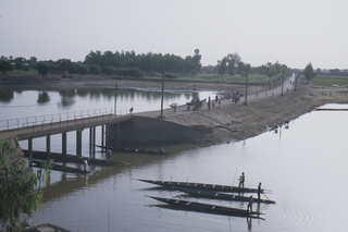
Bankass (Báŋkà:s) is a town and rural commune located in the Mopti Region of Mali. The commune has an area of approximately 362 square kilometers and includes the town and 25 of the surrounding villages. In the 2009 census it had a population of 30,159. The town is the seat of the Bankass Cercle, one of eight subdivisions (cercles) of the Mopti Region.

Bandiagara Cercle is an administrative subdivision of the Mopti Region of Mali. The administrative center (chef-lieu) is the town of Bandiagara.

Bankass Cercle is an administrative subdivision of the Mopti Region of Mali. The administrative center (chef-lieu) is at the town of Bankass.

Djenné Cercle is an administrative subdivision of the Mopti Region of Mali. The administrative center (chef-lieu) is the town of Djenné. In the 2009 census the cercle had a population of 207,260 people.

Koro Cercle is an administrative subdivision of the Mopti Region of Mali. The administrative center is the town of Koro.

Mopti Cercle is an administrative subdivision of the Mopti Region of Mali. The administrative center (chef-lieu) is the town of Mopti.
Fatoma is a village and commune in the Cercle of Mopti in the Mopti Region of Mali. The commune contains 24 villages and in 2009 had a population of 24,595. The village of Fatoma lies 10 kilometres north of Sévaré.
Korombana is a commune in the Cercle of Mopti in the Mopti Region of Mali. It is the most northerly commune in the cercle. The commune contains 32 villages and in 2009 had a population of 29,559. The main village (chef-lieu) is Korientzé.
Metoumou is a commune in the Cercle of Bandigara of the Mopti Region of Mali. The commune contains 22 villages and in the 2009 census had a population of 13,940. The main village (chef-lieu) is Damada.
Diamnati is a commune in the Cercle of Bandigara in the Mopti Region of Mali. The commune contains 11 villages and at the time of the 2009 census had a population of 13,349. The main village of Dé lies 62 km northeast of Bandiagara.
Dandougou Fakala is a rural commune in the Cercle of Djenné in the Mopti Region of Mali. The commune contains ten villages. The administrative center (chef-lieu) is the village of Konio. In the 2009 census the commune had a population of 9,841.
Madiama is a rural commune and village in the Cercle of Djenné in the Mopti Region of Mali. The commune contains ten villages.
Koporokendie Na is a village and commune of the Cercle of Koro in the Mopti Region of Mali.
Bimbéré Tama is a commune of the Cercle of Youwarou in the Mopti Region of Mali. The main village (chef-lieu) is Dogo. In 2009 the commune had a population of 8,209.
Dongo is a commune of the Cercle of Youwarou in the Mopti Region of Mali. The principal village lies at Kormou-Marka. In 2009 the commune had a population of 11,421.
Derary is a rural commune of the Cercle of Djenné in the Mopti Region of Mali. The commune contains eight villages. The administrative center (chef-lieu) is the village of Gagna. In the 2009 census the commune had a population of 6,558.
Ouro Ali is a rural commune of the Cercle of Djenné in the Mopti Region of Mali. The commune includes the villages of Senossa, Koloye, Ouro Djikoye, Siratintin, Weraka, Wono, Kotola, Djimatogo, Ali Samba, Kandia and Somena. The administrative center (chef-lieu) is the village of Senossa. In the census of 2009 the commune had a population of 10,354.
Niansanarie is a commune of the Cercle of Djenné in the Mopti Region of Mali. The main village (chef-lieu) is Kéké.
Bamba is a rural commune of the Cercle of Koro in the Mopti Region of Mali. The commune contains 14 villages and in the 2009 census had a population of 13,610. Most of the population of the commune are Dogon. The administrative centre (chef-lieu) is the village of Déguéré.
Karéri is a commune of the Cercle of Ténenkou in the Mopti Region of Mali. The main village and local government centre (chef-lieu) is Dioura. In 2009 the commune had a population of 28,414.


