Firehole Ranch

Last updated

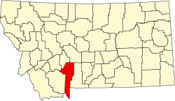
Firehole Ranch is a private 640-acre guest ranch located on Hebgen Lake in Gallatin County, Montana. [1]

Owned and operated by Lynda Caine since 1999 [2] , Firehole Ranch was founded in the late 1890s as Watkins Creek Ranch by George S. Watkins. Originally much larger, Watkins Creek Ranch sold much of its land to the Madison Power and Light Company in 1904 to make way for the Hebgen Lake Dam. Much of Watkins’ cattle were sold to Yellowstone National Park while the remaining land was converted into a dude ranch. [3] [ better source needed ]

Firehole Ranch was entered into the National Register of Historic Places under the name Watkins Creek Ranch on December 27, 2006. [4] 44°48′50″N111°17′27″W / 44.81389°N 111.29083°W / 44.81389; -111.29083 (Watkins Creek Ranch) [5]

Related Research Articles

<span class="mw-page-title-main">Zilker Park</span> Historic urban park in Austin, Texas

Zilker Metropolitan Park is a recreational area in south Austin, Texas at the juncture of Barton Creek and the Colorado River that comprises over 350 acres (142 ha) of publicly owned land. It is named after its benefactor, Andrew Jackson Zilker, who donated the land to the city in 1917. The land was developed into a park during the Great Depression in the 1930s. Today the park serves as a hub for many recreational activities and the hike and bike trail around Lady Bird Lake, both of which run next to the park. The large size of the park makes it a capable venue for large-scale events such as the Austin City Limits Music Festival and the Zilker Park Kite Festival. The park was listed in the National Register of Historic Places in 1997.

<span class="mw-page-title-main">Bighorn Canyon National Recreation Area</span> National recreation area in the United States

Bighorn Canyon National Recreation Area is a national recreation area established by an act of Congress on October 15, 1966, following the construction of the Yellowtail Dam by the Bureau of Reclamation. It is one of over 420 sites managed by the U.S. National Park Service. The recreation area spans 120,296.22 acres, straddling the border between Wyoming and Montana. It is divided into two distinct areas, the North District accessed via Fort Smith, Montana and the South District accessed through Lovell, Wyoming. There is no thru road inside the recreation area connecting the two districts. The Yellowtail Dam is located in the North District. It is named after the famous Crow leader Robert Yellowtail, harnesses the waters of the Bighorn River by turning that variable watercourse into Bighorn Lake. The lake extends 71 miles (114 km) through Wyoming and Montana, 55 miles (89 km) of which lie within the national recreation area. The lake provides recreational boating, fishing, water skiing, kayaking, and birding opportunities to visitors. About one third of the park unit is located on the Crow Indian Reservation. Nearly one-quarter of the Pryor Mountains Wild Horse Range lies within the Bighorn Canyon National Recreation Area.

<span class="mw-page-title-main">Madison River</span> River in Wyoming and Montana, United States

The Madison River is a headwater tributary of the Missouri River, approximately 183 miles (295 km) long, in Wyoming and Montana. Its confluence with the Jefferson and Gallatin rivers near Three Forks, Montana forms the Missouri River.

<span class="mw-page-title-main">Gallatin River</span> River in Wyoming and Montana, United States

The Gallatin River is a tributary of the Missouri River, approximately 120 mi (193 km) long, in the U.S. states of Wyoming and Montana. It is one of three rivers, along with the Jefferson and Madison, that converge near Three Forks, Montana, to form the Missouri.

<span class="mw-page-title-main">Hebgen Lake</span> Lake in Gallatin County, Montana

Hebgen Lake is a reservoir created by the Hebgen Dam, located in Gallatin County in southwest Montana. It is well known for the 1959 Hebgen Lake earthquake which occurred nearby on August 17, 1959, forming Quake Lake, which is located immediately downstream.

<span class="mw-page-title-main">Bald Mountain Recreation Area</span>

Bald Mountain State Recreation Area is a 4,637-acre (1,877 ha) state park located near Lake Orion, Michigan off M-24. It consists of some of the most rugged terrain in southeastern Michigan. The recreation area is composed of a North Unit and a South Unit, which are not contiguous. The South Unit itself includes two parts separated by M-24, but the section west of M-24 has no recreational facilities or trails and is primarily undeveloped forest and grassy plains segmented by a few through-roads.

<span class="mw-page-title-main">Cook–Folsom–Peterson Expedition</span> Research expedition in the United States

The Cook–Folsom–Peterson Expedition of 1869 was the first organized expedition to explore the region that became Yellowstone National Park. The privately financed expedition was carried out by David E. Folsom, Charles W. Cook and William Peterson of Diamond City, Montana, a gold camp in the Confederate Gulch area of the Big Belt Mountains east of Helena, Montana. The journals kept by Cook and Folsom, as well as their personal accounts to friends were of significant inspirational value to spur the organization of the Washburn-Langford-Doane Expedition which visited Yellowstone in 1870.

<span class="mw-page-title-main">Washburn–Langford–Doane Expedition</span> Research expedition in the US

The Washburn Expedition of 1870 explored the region of northwestern Wyoming that two years later became Yellowstone National Park. Led by Henry D. Washburn and Nathaniel P. Langford, and with a U.S. Army escort headed by Lt. Gustavus C. Doane, the expedition followed the general course of the Cook–Folsom–Peterson Expedition made the previous year.

<span class="mw-page-title-main">Gibbon River</span> River in Wyoming, United States

The Gibbon River flows east of the Continental Divide in Yellowstone National Park, in northwestern Wyoming, the Northwestern United States. Along with the Firehole River, it is a major tributary of the Madison River, which itself is a tributary of the Missouri River.

The 1959 Hebgen Lake earthquake occurred in the western United States on August 17 at 11:37 pm (MST) in southwestern Montana.

<span class="mw-page-title-main">Angling in Yellowstone National Park</span>

Angling in Yellowstone National Park is a major reason many visitors come to the park each year and since it was created in 1872, the park has drawn anglers from around the world to fish its waters. In 2006, over 50,000 park fishing permits were issued to visitors. The park contains hundreds of miles of accessible, high-quality trout rivers containing wild trout populations—over 200 creeks, streams and rivers are fishable. There are 45 fishable lakes and several large lakes are easily accessible to visitors. Additionally, the park's remote sections provide anglers ample opportunity to visit rivers, streams, creeks and lakes that receive little angling pressure. With the exception of one specially designated drainage, all the park's waters are restricted to artificial lures and fly fishing. The Madison, Firehole and a section of the Gibbon rivers are restricted to fly fishing only.

<span class="mw-page-title-main">Grand Loop Road</span> United States historic place

The Grand Loop Road is a historic district which encompasses the primary road system in Yellowstone National Park. Much of the 140-mile (230 km) system was originally planned by Captain Hiram M. Chittenden of the US Army Corps of Engineers in the early days of the park, when it was under military administration. The Grand Loop Road provides access to the major features of the park, including the Upper, Midway and Lower geyser basins, Mammoth Hot Springs, Tower Fall, the Grand Canyon of the Yellowstone and Yellowstone Lake.

<span class="mw-page-title-main">Lake Fish Hatchery Historic District</span> Historic district in Wyoming, United States

The Lake Fish Hatchery Historic District comprises nine buildings built between 1930 and 1932 by the U.S. Fish and Wildlife Service in the National Park Service Rustic style. The buildings exhibit a consistency of style and construction, with exposed gable trusses and oversized paired logs at the corners, all with brown paint. The district is located on the shore of Yellowstone lake near the Lake Hotel The hatchery was established to provide Yellowstone cutthroat trout eggs for state and federal hatcheries outside Yellowstone.

<span class="mw-page-title-main">Outline of Yellowstone National Park</span>

The following articles relate to the history, geography, geology, flora, fauna, structures and recreation in Yellowstone National Park.

<span class="mw-page-title-main">Historical buildings and structures of Grand Teton National Park</span> United States historic place

The historical buildings and structures of Grand Teton National Park include a variety of buildings and built remains that pre-date the establishment of Grand Teton National Park, together with facilities built by the National Park Service to serve park visitors. Many of these places and structures have been placed on the National Register of Historic Places. The pre-Park Service structures include homestead cabins from the earliest settlement of Jackson Hole, working ranches that once covered the valley floor, and dude ranches or guest ranches that catered to the tourist trade that grew up in the 1920s and 1930s, before the park was expanded to encompass nearly all of Jackson Hole. Many of these were incorporated into the park to serve as Park Service personnel housing, or were razed to restore the landscape to a natural appearance. Others continued to function as inholdings under a life estate in which their former owners could continue to use and occupy the property until their death. Other buildings, built in the mountains after the initial establishment of the park in 1929, or in the valley after the park was expanded in 1950, were built by the Park Service to serve park visitors, frequently employing the National Park Service Rustic style of design.

<span class="mw-page-title-main">Lonesomehurst Cabin</span> Historic house in Montana, United States

Lonesomehurst Cabin is a log cabin style recreational residence on the west side of the South Fork Arm of Hebgen Lake near West Yellowstone, in Gallatin County, Montana. Hebgen Lake is on the Madison River. There are three buildings on the site: a wood-frame cabin constructed circa 1919, a log boathouse built in 1958, and a wood frame outhouse built about 1930. The cabin is at the south end of the site, which is 8 miles (13 km) west of West Yellowstone and the entrance to Yellowstone National Park.

<span class="mw-page-title-main">Little Blackfoot River</span> River in Montana, United States

The Little Blackfoot River is a 48-mile (77 km) long tributary of the Clark Fork River, located in Powell County, Montana in the state of Montana in the United States.

Quien Sabe Ranch is a ranch in Fremont County, Wyoming, about 18 miles (29 km) northeast of Shoshoni. The ranch structures date to the 1880s, part of a ranching operation established around 1883 by three English immigrants: Harry Jevons, Richard Ashworth and Richard Berry. The ranch centered on an area next to Hoodoo Creek. At first the ranch was called Hoodoo ranch, but after an altercation with Mexican caballeros who lived in the neighborhood the ranch became known as "Quien Sabe" for the evasive answers given by the Mexicans to the English ranchers. After a series of transactions between the partners the property was deeded to Ashworth by Jevons to secure a $4747.62 loan. Jevons killed himself after losing his money gambling in Meeteetse.

The Bones Brothers Ranch, in the Tongue River Valley in Rosebud County, Montana near Birney, Montana, also known as the Z.T. Cox Ranch, was listed on the National Register of Historic Places in 2004.

References

  1. Lynda, Caine. "Welcome to Firehole Ranch". Welcome to Firehole Ranch. Firehole Ranch. Retrieved 15 March 2011.
  2. "Firehole Ranch: preserving tradition and trout". TROUT UNLIMITED. Retrieved 29 February 2024.
  3. "The Enduring Tradition of Firehole Ranch" (PDF). Montana Historian. No. Inaugural Issue. 2009. pp. 91–95. Archived from the original (PDF) on 8 July 2011. Retrieved 15 March 2011.
  4. "National Register of Historic Places". National Register of Historic Places. National Park Service. Retrieved 15 March 2011.
  5. "Watkins Creek Ranch". Geographic Names Information System . United States Geological Survey, United States Department of the Interior.