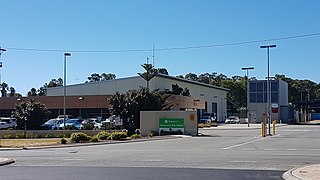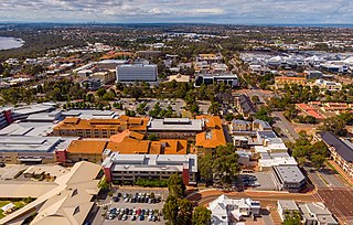
Gwelup is a suburb of Perth, the capital city of Western Australia 12 km north of Perth's central business district (CBD) along the Mitchell Freeway. Its local government area is the City of Stirling.

Karrinyup is a suburb of Perth, the capital city of Western Australia, and is located 12 km north of Perth's central business district. Its local government area is the City of Stirling.

Yokine is a suburb of Perth, Western Australia. Its local government area is the City of Stirling.

Swanbourne is a western coastal suburb of Perth, Western Australia, located within the City of Nedlands. It is an affluent, upper middle class residential area with older Federation style homes, many being renovated. The suburb was established in the late 19th century. New housing estates have been built recently through the redevelopment of areas such as the Swanbourne Senior High School, Swanbourne Primary School and Lakeway Drive-In Cinema sites.

Coolbellup is a suburb in Perth, Western Australia, located 15 kilometres (9.3 mi) south of the central business district within the local government area of the City of Cockburn.

Jandakot is a southern suburb of Perth, Western Australia, located within the City of Cockburn local government area. It is best known for Jandakot Airport that is situated entirely within the suburb, the airport being "the busiest general aviation airport in Australia in terms of aircraft movements", the sixth-busiest civilian airport in Australia in the fiscal year ending 30 June 2018, and in the 2011 fiscal year even the busiest civilian airport in Australia.

Greenwood is a suburb of Perth, Western Australia, located in the City of Joondalup. The suburb is located 18 km from Perth's central business district. It is bordered by the Mitchell Freeway, Hepburn ave, Wanneroo road and Warwick road.

Joondalup is a suburb of Perth, Western Australia, approximately 26 kilometres (16 mi) north of Perth's central business district. It contains the central business district of the regional City of Joondalup and acts as the primary urban centre of Perth's outer northern suburbs.

Parkwood is a southeastern suburb of Perth, the capital city of Western Australia. Its local government area is the City of Canning.

Canning Vale is a southern suburb of Perth, 16 km (9.9 mi) from the central business district. Its local government areas are the City of Canning and the City of Gosnells.

Floreat is a residential suburb 8 kilometres (5 mi) west-northwest of the central business district of Perth, the capital of Western Australia. It is bordered on Underwood Avenue, Selby Street, Cromarty Road and Durston Road. It is the head of the Town of Cambridge, which has its municipal offices and library in the suburb. The name of the suburb stems from the Latin word for "flourish" or "prosper", which is also the motto of the City of Perth, of which Floreat was a part when it was first built.

Casuarina is a suburb of Perth, Western Australia and located within the City of Kwinana.

Cooloongup is an outer southern suburb of Perth, Western Australia, the capital city of Western Australia, located within the City of Rockingham. It consists mainly of residential dwellings.
The Vines is a suburb of Perth, Western Australia, developed as a country club estate in 1987. Homes consist of mostly large lots of 1⁄4–1 acre (0.10–0.40 ha) situated around the golf courses. It is in the Swan Valley region of Western Australia, and was approved as a suburb name in 1996.
Darling Downs is an outer southeastern suburb of Perth, Western Australia, within the Shire of Serpentine-Jarrahdale. The name, referring to the suburb's proximity to the Darling Scarp, was first used as an estate name in 1977, and adopted as a suburb name in 1997.

Neopasiphae simplicior, a native bee, is an endangered species found near Perth, Western Australia. Body is creamy yellow and brown, 7 mm long and wings up to 5 mm long. The Swan Coastal Plain has undergone agricultural and suburban development which has reduced the range and threatens the species with extinction. It has been collected at Cannington and the Forrestdale golf course. The species has been found on Lobelia tenuior, Goodenia filiformis and Angianthus preissianus.
Forrestdale Lake Nature Reserve is a lake nature reserve around Forrestdale Lake in the City of Armadale, Western Australia, approximately 25 kilometres (16 mi) south of the central business district of Perth, the state capital, and on the southern fringes of the Perth metropolitan area. It lies immediately south of the suburb of Forrestdale, and 8 kilometres (5.0 mi) south-east of Jandakot Airport. It is a still largely natural wetland, with some adjoining native vegetation, surrounded by land developed for housing and agriculture, that regularly supports large numbers of shorebirds and other waterbirds.

Piara Waters is a southeastern suburb of Perth, Western Australia within the City of Armadale. Previously part of Forrestdale and gazetted in 2007, Piara Waters is located approximately 20 kilometres (12 mi) south-southeast of Perth.

Thomsons Lake Nature Reserve is a lake nature reserve around Thomsons Lake in the City of Cockburn, Western Australia, approximately 25 kilometres (16 mi) south of the central business district of Perth, the state capital, and on the southern fringes of the Perth metropolitan area. It is in the suburb of Beeliar, 7 kilometres (4.3 mi) south-west of Jandakot Airport. It is a still largely natural wetland, with adjoining native vegetation, surrounded by land developed for housing and agriculture, that regularly supports large numbers of shorebirds and other waterbirds.
The Forrestdale and Thomsons Lakes Ramsar Site comprises two separate nature reserves, totalling 754 ha in area, protecting two shallow fresh to brackish, seasonal lakes in a suburban and agricultural landscape in south-western Western Australia. It lies in the Swan Coastal Plain bioregion and is used mainly for birdwatching and walking. The site is recognised as being of international importance under the Ramsar Convention on Wetlands, under which it was designated Ramsar Site 481 on 7 June 1990.


