South Cariboo Regional Airport or 108 Mile Ranch Airport is a registered aerodrome located 5.3 nautical miles northwest of 108 Mile Ranch, British Columbia, Canada.

Langley Regional Airport is located in Langley Township, British Columbia, Canada. It serves mostly general aviation, and also provided scheduled passenger service to the Victoria Airport Water Aerodrome via Harbour Air Seaplanes before service was ended on May 20, 2011. Helicopter operations are a major part of Langley Airport's traffic; the airport has three helipads.

Watson Lake Airport is located 5 nautical miles west of Watson Lake, Yukon, Canada, and is operated by the Yukon government. The paved asphalt runway is 5,500 ft (1,676 m) long and is at an elevation of 2,255 ft (687 m).

Fort St. John Airport, North Peace Regional Airport, or North Peace Airport, is located at Fort St. John, British Columbia, Canada. The airport is operated by North Peace Airport Services Ltd. A new record of 257,295 passengers came through the airport in 2015, up from the 252,729 passengers seen in 2014.

Pitt Meadows Regional Airport is a Canadian general aviation airport located in the southwest of corner of Pitt Meadows, British Columbia. In 2021, the airport had 112,872 aircraft movements making it the 4th busiest airport in the Lower Mainland.
Denny Island Aerodrome, previously Bella BellaAirport, is located 2 nautical miles east of Bella Bella, British Columbia, on Denny Island.
Fort Langley Water Aerodrome is located adjacent to Fort Langley, British Columbia, Canada.

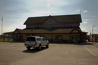
Northern Rockies Regional Airport is located 3.8 nautical miles east northeast of Fort Nelson, British Columbia, Canada.
Fort Nelson Water Aerodrome is located 6 nautical miles west northwest of Fort Nelson, British Columbia, Canada.
Hope Aerodrome is located 2.6 nautical miles west of Hope Townsite within the municipal District of Hope, British Columbia, Canada.

Nanaimo Airport is a privately owned and operated regional airport located 7 nautical miles south southeast of Nanaimo, British Columbia, Canada.

Princeton Aerodrome is located adjacent to Princeton, British Columbia, Canada.
Quamichan Lake Airport is located 2.7 nautical miles north northeast of Duncan, adjacent to Quamichan Lake, British Columbia, Canada.
Quesnel Airport is located 2 nautical miles north of Quesnel, British Columbia, Canada.

Smithers Airport is 2 nautical miles north of Smithers, British Columbia, Canada.

Stewart Aerodrome is a registered aerodrome located adjacent to Stewart, British Columbia, Canada. It shares its airspace with the nearby Stewart Water Aerodrome and Hyder Seaplane Base. While its neighbouring seaplane bases' water runways in the Portland Canal exist on the Canada–United States border, the aerodrome's runway exists entirely within Canada.

Northwest Regional Airport Terrace-Kitimat is located 3 nautical miles south of Terrace, British Columbia, Canada. The airport also serves Kitimat, 56 km (35 mi) to the south, and the Nass Valley. It is owned and operated by the Terrace-Kitimat Airport Society.


