Front of Yonge

Last updated

Front of Yonge
Township of Front of Yonge
Front of Yonge ON 2.JPG
Leeds and Grenville locator map 2021.svg
Red pog.svg
Front of Yonge
Canada Southern Ontario location map 2.png
Red pog.svg
Front of Yonge
Coordinates: 44°32′N75°52′W / 44.533°N 75.867°W / 44.533; -75.867
CountryFlag of Canada (Pantone).svg  Canada
ProvinceFlag of Ontario.svg  Ontario
County Leeds and Grenville
Government
  MayorRoger Haley
  Federal riding Leeds–Grenville
  Prov. riding Leeds–Grenville
  Fire ChiefGreg Halladay
Area
[1]
  Land128.47 km2 (49.60 sq mi)
Population
 (2016) [1]
  Total2,595
  Density20.3/km2 (53/sq mi)
Time zone UTC-5 (EST)
  Summer (DST) UTC-4 (EDT)
Postal Code
K0E
Area code(s) 613, 343
Website www.mallorytown.com

Front of Yonge is a township found in the United Counties of Leeds and Grenville in Ontario, Canada. It is the location of the Thousand Islands National Park and Brown's Bay Provincial Park, as well as a number of private campgrounds, the Jones Creek walking trail system, and the 1000 Islands Waterfront Trail’s walking/bike path which runs from just beyond the township’s eastern boundary to neighbouring towns. The predominance of the Canadian Shield produces scenic and diverse landscapes which include exposed rock formations and heavy tree cover, as well as wide fields and beaches.

Contents

Location

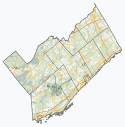
Front of Yonge is located along the St. Lawrence River in the Thousand Islands region. Part of the Frontenac Arch Biosphere Reserve, Front of Yonge can be found between the larger towns of Brockville to the east, and Gananoque to the west. Approximately 135 kilometres (84 mi) away from Ottawa and 325 kilometres (202 mi) from Toronto, Front of Yonge is within driving distance to many of the larger cities of Ontario.

Communities

The township comprises the communities of Ballycanoe, Caintown, Mallorytown, Mallorytown Landing, McIntosh Mills, Trevelyan and Yonge Mills. The township administrative offices are located in Mallorytown.

Mallorytown

The largest settlement area of the township is the Village of Mallorytown, founded by United Empire Loyalist Nathaniel Mallory. He came ashore at Mallorytown Landing in 1784, and later moved inland in search of better farmland. This village is the site of Canada's first glassworks factory, which began in 1839, and closed in 1940. Only a few pieces of Mallorytown glass still exist, the most famous being the ‘Mallorytown Pitcher' which is on display at the Royal Ontario Museum. A reproduction of this piece is currently on display at the Mallory Coach House, an 1850s stone home which has been renovated and is open to visitors on weekends during the spring and summer months. [2]

Mallorytown Landing

Mallorytown Landing is situated on the St. Lawrence River and is the location of the Visitor Centre for the Thousand Islands National Park, which comprises several ecologically important mainland properties and more than twenty islands between Kingston and Brockville. Established in 1904 as the first Canadian national park east of the Rockies, it is also the smallest of the national parks. [3]

History

Front of Yonge is named for the Right Honourable Sir George Yonge, a British Secretary during the War of 1812. Officially designated as Front of Yonge in 1859 this township, the nearby Front of Escott and Front of Lansdowne were the only three municipalities with "Front" in their names because they all border the St. Lawrence river. Years later, both Escott and Lansdowne were assimilated into another municipality. That left Front of Yonge the only township in Ontario with "Front" in its name. Also named after Sir George are Yonge Mills Road and Townline Road Escott Yonge in this township, as well as Yonge Street, the main arterial road in Toronto.

The area was settled by a strong core of United Empire Loyalists after the American Revolutionary War who participated in the War of 1812. Mallorytown Landing was a port for ships moving supplies and a blockhouse was constructed on Chimney Island to protect the vessels. The chimney remains standing today as a National Historical site. [4]

Demographics

Waterfront along the Saint Lawrence River Front of Yonge ON.JPG
Waterfront along the Saint Lawrence River

In the 2021 Census of Population conducted by Statistics Canada, Front of Yonge had a population of 2,595 living in 1,073 of its 1,208 total private dwellings, a change of

Population trend: [6]

Mother tongue: [7]

See also

Related Research Articles

<span class="mw-page-title-main">Prescott, Ontario</span> Town in Ontario, Canada

Prescott, Ontario is a small town on the north shore of the Saint Lawrence River in the United Counties of Leeds and Grenville, Canada. In 2021, the town had a population of 4,078. The Ogdensburg–Prescott International Bridge, 5 kilometres (3.1 mi) east of Prescott at Johnstown, connects the town with Ogdensburg, New York. The town is about an hour from both Ottawa and Kingston.

<span class="mw-page-title-main">Brockville</span> City in Ontario, Canada

Brockville, formerly Elizabethtown, is a city in Eastern Ontario, Canada, in the Thousand Islands region. Although it is the seat of the United Counties of Leeds and Grenville, it is politically independent of the county. It is included with Leeds and Grenville for census purposes only.

<span class="mw-page-title-main">Gananoque</span> Town in Ontario, Canada

Gananoque is a town in the Leeds and Grenville area of Ontario, Canada. The town had a population of 5,383 year-round residents in the 2021 Canadian Census, as well as summer residents sometimes referred to as "Islanders" because of the Thousand Islands in the Saint Lawrence River, Gananoque's most important tourist attraction. The Gananoque River flows through the town and the St. Lawrence River serves as the southern boundary of the town.

<span class="mw-page-title-main">Athens, Ontario</span> Township in Ontario, Canada

Athens is a township in the United Counties of Leeds and Grenville in Eastern Ontario, Canada. It is located approximately 25 kilometres (16 mi) north of the St. Lawrence River, near Brockville, west of Addison, and about 90 kilometres (56 mi) south west of Ottawa. Formerly, it was a part of Yonge township before becoming Rear of Yonge and Escott with Athens as its own census division and finally, Athens township. The township consists of the town of Athens and a few other small communities.

<span class="mw-page-title-main">United Counties of Leeds and Grenville</span> County in Ontario, Canada

The United Counties of Leeds and Grenville, commonly known as Leeds and Grenville, is a county in Ontario, Canada, in the Eastern Ontario subregion of Southern Ontario. It fronts on the Saint Lawrence River and the international boundary between Canada and the United States, opposite of the State of New York. The county seat is Brockville. The county was formed by the union of the historical counties of Leeds and Grenville in 1850.

<span class="mw-page-title-main">Westport, Ontario</span> Village in Ontario, Canada

Westport is a village in Eastern Ontario, Canada. It lies at the west end of Upper Rideau Lake, at the head of the navigable Rideau Canal system, 100 km (62 mi) southwest of Ottawa.

<span class="mw-page-title-main">Carling, Ontario</span> Township in Ontario, Canada

Carling is a township in Ontario, Canada, located in the District of Parry Sound on Georgian Bay. Killbear Provincial Park is located in the municipality.

<span class="mw-page-title-main">Loyalist, Ontario</span> Township municipality in Ontario, Canada

Loyalist is a lower-tier township municipality in central eastern Ontario, Canada on Lake Ontario. It is in Lennox and Addington County and consists of two parts: the mainland and Amherst Island. It was named for the United Empire Loyalists, who settled in the area after the American Revolution.

<span class="mw-page-title-main">South Glengarry</span> Township in Ontario, Canada

South Glengarry is a township in eastern Ontario, Canada on the Saint Lawrence River in the United Counties of Stormont, Dundas and Glengarry. South Glengarry borders Quebec.

<span class="mw-page-title-main">Elizabethtown-Kitley</span> Township in Ontario, Canada

Elizabethtown-Kitley is a township in eastern Ontario, Canada, in the United Counties of Leeds and Grenville. Its southern border lies along the St. Lawrence River and it extends north into many rural hamlets and villages. The township was created on January 1, 2001 by the amalgamation of the former Township of Elizabethtown and Township of Kitley.

Leeds County is a historic county in the Canadian province of Ontario. The county was first surveyed in 1792 as one of the nineteen counties created by Sir John Graves Simcoe in preparation for the United Empire Loyalists to settle here. The county took its name from Francis Osborne, 5th Duke of Leeds; the "Leeds" of the Dukedom referred to Leeds in West Yorkshire, England and not for Leeds, Kent, England. In 1850, Leeds County merged with Grenville County to create the United Counties of Leeds and Grenville. This county was home to several townships as well as the city of Brockville.

Brockville was a federal electoral district in Ontario, Canada, that was represented in the House of Commons of Canada from 1867 to 1917. It was created by the British North America Act of 1867.

Leeds was a federal electoral district represented in the House of Commons of Canada from 1904 to 1979. It was located in the province of Ontario. This riding was first created in 1903 from parts of Leeds North and Grenville North and Leeds South ridings.

<span class="mw-page-title-main">South Stormont</span> Township in Ontario, Canada

South Stormont is a township in eastern Ontario, Canada, in the United Counties of Stormont, Dundas and Glengarry. It is located 53 kilometres (33 mi) southeast of Ottawa. South Stormont borders on, but does not include, the city of Cornwall.

<span class="mw-page-title-main">Alnwick/Haldimand</span> Township in Ontario, Canada

The Township of Alnwick/Haldimand is a township in central Ontario, Canada, in Northumberland County, situated between Lake Ontario and Rice Lake. It was formed in 2001 by the merger of Alnwick Township in the north and Haldimand Township in the south. Alderville First Nation is an autonomously governed First Nation contained within the township boundaries, in two non-contiguous sections along County Roads 45 and 18.

<span class="mw-page-title-main">Maitland, Ontario</span> Village in Ontario, Canada

Maitland, Ontario is a small village within Augusta township in the United Counties of Leeds and Grenville, Canada. It is located along the St. Lawrence River approximately five kilometres (3 mi) east of the City of Brockville.

The Thousand Islands Parkway (often written as 1000 Islands Parkway) is a scenic parkway in the Canadian province of Ontario. It extends easterly from an interchange with Highway 401 in Gananoque for approximately 40 kilometres (25 mi) to rejoin Highway 401 near the community of Butternut Bay, west of Brockville. The parkway follows the north shore of the St. Lawrence River, and was formerly designated Highway 2S (S for Scenic) until 1970. It passes through the communities of Gray's Beach, Halsteads Bay, Ivy Lea, Darlingside, Rockport, Narrows, La Rue Mills and Mallorytown Landing, as well as providing access to the three inland properties of the Thousand Islands National Park. Highway 137, which meets the parkway near its midpoint, provides access to the Interstate 81 in New York via the Thousand Islands Bridge.

<span class="mw-page-title-main">Merrickville–Wolford</span> Village in Ontario, Canada

Merrickville–Wolford is a village-status municipality in Eastern Ontario, Canada, located in the United Counties of Leeds and Grenville. It spans both shores of the Rideau River.

<span class="mw-page-title-main">Leeds and the Thousand Islands</span> Township in Ontario, Canada

Leeds and the Thousand Islands is a township in the Canadian province of Ontario, located within the United Counties of Leeds and Grenville. The township is located along the Saint Lawrence River, and extends north into rural hamlets and villages. Formerly, this township was divided into three separate townships: Leeds, Lansdowne and Escott townships; these townships amalgamated to form the current township of Leeds and the Thousand Islands.

Grenadier Island is one of the islands of the Thousand Islands located on the St. Lawrence River in the United Counties of Leeds and Grenville, Ontario, Canada.

References

  1. 1 2 Statistics Canada 2016 Census - Front of Yonge community profile
  2. Front of Yonge Township
  3. Parks Canada - Thousand Islands
  4. List of National Historic Sites of Canada
  5. "Population and dwelling counts: Canada, provinces and territories, census divisions and census subdivisions (municipalities), Ontario". Statistics Canada. February 9, 2022. Retrieved April 2, 2022.
  6. Statistics Canada: 1996, 2001, 2006, 2011, 2016 census
  7. Statistics Canada 2006 Census - Front of Yonge community profile

Coordinates: 44°32′N75°52′W / 44.533°N 75.867°W / 44.533; -75.867