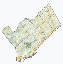
Leeds and the Thousand Islands

Last updated

Leeds and the Thousand Islands
Township of Leeds and the Thousand Islands
Leeds 1000 Islands.JPG
Welcome sign along Thousand Islands Parkway
Leeds and Grenville locator map 2021.svg
Red pog.svg
Leeds and the Thousand Islands
Canada Southern Ontario location map 2.png
Red pog.svg
Leeds and the Thousand Islands
Coordinates: 44°29′12″N076°05′33″W / 44.48667°N 76.09250°W / 44.48667; -76.09250 [1]
CountryCanada
Province Ontario
County Leeds and Grenville
Incorporated1998
Government
  MayorCorinna Smith-Gatcke [2]
  Councillors
List
  Prov. riding Leeds—Grenville
  Federal riding Leeds—Grenville
Area
[3]
  Land612.45 km2 (236.47 sq mi)
Population
 (2016) [3]
  Total9,465
  Density15.1/km2 (39/sq mi)
Time zone UTC−05:00 (EST)
  Summer (DST) UTC−04:00 (EDT)
Postal Code FSA
K0E
Area code(s) 613, 343
Website www.leeds1000islands.ca OOjs UI icon edit-ltr-progressive.svg

Leeds and the Thousand Islands is a township in the Canadian province of Ontario, located within the United Counties of Leeds and Grenville. The township is located along the Saint Lawrence River, and extends north into rural hamlets and villages. Formerly, this township was divided into three separate townships: Leeds, Lansdowne, and Escott townships; these townships amalgamated to form the current township of Leeds and the Thousand Islands.

Contents

Communities

The township comprises the communities of Berryton, Black Rapids, Brier Hill, Cheeseborough, Darlingside, Dulcemaine, Ebenezer, Eden Grove, Ellisville, Emery, Escott, Fairfax, Gananoque Junction, Gray's Beach, Greenfield, Grenadier Island, Halsteads Bay, Holland, Ivy Lea, Junetown, La Rue Mills, Lansdowne, Leeds, Legge, Long Point, Lyndhurst, Maple Grove, Mitchellville, Narrows, Oak Leaf, Outlet, Pooles Resort, Quabbin, Rockfield, Rockport, Sand Bay Corner, Seeley's Bay, Selton, Soperton, Sweets Corners, Taylor, Tilley, Union, Warburton, Washburns Corners, Waterton, Willowbank and Wilstead.

Lansdowne

Lansdowne, Ontario is a small village located just north of Ivy Lea, Ontario and 4 km north of Highway 401, at the intersection of Leeds and Grenville County Roads 3 and 34. It is a part of the township of Leeds and the Thousand Islands. It can be accessed by former Kings Highway 2 (which passes just south of the village) or by Highway 401 at Exit 659.

The Canadian customs point of entry at the top of Interstate 81 on Hill Island identifies itself as Lansdowne 456. There is an independent telephone exchange (+1-613-659-) and a post office (K0E 1L0) in the village. The administrative offices of the township are located in Lansdowne.

Lyndhurst

The Lansdowne Iron Works, was founded by Wallis Sunderlin on the Gananoque River by 1801. The ironworks enabled the economic development of a small industrial community called Furnace Falls. The iron smelter was destroyed by fire in 1811. Several mills were established in Furnace Falls by Charles and Jonas Jones of Brockville in 1827. The settlement was renamed Lyndhurst by 1846. [4] Camp Hyanto, an Anglican church camp, is also set just off of the village of Lyndhurst. It has been in operation since the 1940s, and its motto is, "He who sleeps beneath the pines, sleeps well." The Lansdowne Iron Works was designated a National Historic Site of Canada in 1932. [5] A plaque commemorating the founding of Lyndhurst (Furnace Falls) in 1801 was erected by the Ontario Heritage Foundation. A plaque commemorating the Lyndhurst Bridge, built in 1856–1857, was erected by the Ontario Archaeological and Historic Sites Board. Designed by John Roddick, the masonry arch bridge was erected by contractors Miles Fulford and Simon Ransom.

There is a cultural celebration in Lyndhurst dubbed the "Turkey Fair" celebrated annually on the third Saturday in September. This celebration involves hay-stack decoration, petting zoos, fishing contests for kids, crafts and 50/50 draws. [6]

Rockport

Rockport Rockport ON.JPG
Rockport

Rockport is a village on the St. Lawrence River with historic homes, restaurants, resorts, boat launch and marinas. It has been a port since the late 1700s and is now a major terminus for Thousand Islands cruise tours. There are bicycle racks, benches, and well marked walking paths with interpretive signs and murals for points of historical interest. Two churches that were founded in the late 1800s remain active. Both reflect the architecture of their time.

For decades boats were built in Rockport; from small wooden St. Lawrence skiffs to large tour boats used on the St. Lawrence River, in Ottawa on the Rideau and Ottawa Rivers, and as far away as Banff National Park in Alberta. [7] Before the building of the Thousand Islands Bridge nearby, ferryboats connected the US and Canada. The area remains famous for boat building, as the industry is producing ice boats that make winter travel to local island homes possible. [8]

Seeley's Bay

Seeley's Bay is at the north west corner of the Township of Leeds and the Thousand Islands and is most known for fishing and its direct access to the UNESCO designated Rideau Canal. The village was established early in the 19th century as a port of call for steamers going between Kingston and Ottawa on the Rideau Canal. Located just off Highway 15, about 20 minutes north of the 401 Highway, it still serves as the first full service port of call for boaters coming north on the Rideau.

Climate

Climate data for Leeds and the Thousand Islands
MonthJanFebMarAprMayJunJulAugSepOctNovDecYear
Record high °C (°F)16.5
(61.7)
14.0
(57.2)
26.1
(79.0)
31.0
(87.8)
32.0
(89.6)
34.0
(93.2)
34.0
(93.2)
36.0
(96.8)
33.0
(91.4)
27.5
(81.5)
22.0
(71.6)
18.0
(64.4)
36.0
(96.8)
Average high °C (°F)−3.5
(25.7)
−1.7
(28.9)
3.8
(38.8)
11.7
(53.1)
18.8
(65.8)
23.5
(74.3)
26.3
(79.3)
25.1
(77.2)
20.5
(68.9)
13.4
(56.1)
6.8
(44.2)
0.1
(32.2)
12.1
(53.8)
Daily mean °C (°F)−8.4
(16.9)
−7.2
(19.0)
−1.6
(29.1)
6.4
(43.5)
13.2
(55.8)
18.2
(64.8)
21.0
(69.8)
20.0
(68.0)
15.6
(60.1)
9.0
(48.2)
3.1
(37.6)
−3.7
(25.3)
7.1
(44.8)
Average low °C (°F)−13.3
(8.1)
−12.7
(9.1)
−6.9
(19.6)
1.0
(33.8)
7.6
(45.7)
12.8
(55.0)
15.7
(60.3)
14.9
(58.8)
10.7
(51.3)
4.5
(40.1)
−0.6
(30.9)
−7.7
(18.1)
2.2
(36.0)
Record low °C (°F)−42.0
(−43.6)
−38.0
(−36.4)
−32.5
(−26.5)
−13.5
(7.7)
−2.5
(27.5)
1.0
(33.8)
6.5
(43.7)
5.0
(41.0)
−1.5
(29.3)
−6.5
(20.3)
−16.0
(3.2)
−36.5
(−33.7)
−42.0
(−43.6)
Average precipitation mm (inches)70.1
(2.76)
67.0
(2.64)
61.8
(2.43)
79.0
(3.11)
81.4
(3.20)
83.2
(3.28)
78.3
(3.08)
89.1
(3.51)
105.5
(4.15)
87.9
(3.46)
94.5
(3.72)
76.2
(3.00)
971.7
(38.26)
Average rainfall mm (inches)31.3
(1.23)
31.5
(1.24)
35.0
(1.38)
71.9
(2.83)
81.4
(3.20)
83.2
(3.28)
78.3
(3.08)
89.1
(3.51)
102.5
(4.04)
86.5
(3.41)
82.8
(3.26)
42.4
(1.67)
815.4
(32.10)
Average snowfall cm (inches)39.7
(15.6)
35.6
(14.0)
26.8
(10.6)
7.1
(2.8)
0.0
(0.0)
0.0
(0.0)
0.0
(0.0)
0.0
(0.0)
0.0
(0.0)
1.4
(0.6)
12.0
(4.7)
33.8
(13.3)
156.3
(61.5)
Average precipitation days (≥ 0.2 mm)14.311.611.812.213.212.410.611.011.812.914.114.2150.1
Average rainy days (≥ 0.2 mm)4.94.16.711.013.212.410.611.011.812.911.56.5116.6
Average snowy days (≥ 0.2 cm)11.28.76.62.40.040.00.00.00.00.273.69.041.8
Source: Environment Canada [9]

Demographics

In the 2021 Census of Population conducted by Statistics Canada, Leeds and the Thousand Islands had a population of 9,804 living in 3,994 of its 5,040 total private dwellings, a change of 3.6% from its 2016 population of 9,465. With a land area of 608.09 km2 (234.78 sq mi), it had a population density of 16.1/km2 (41.8/sq mi) in 2021. [10]

Canada census – Leeds and the Thousand Islands community profile
2021 2016 2011
Population9,804 (+3.6% from 2016)9465 (2.0% from 2011)9277 (-1.7% from 2006)
Land area608.09 km2 (234.78 sq mi)612.45 km2 (236.47 sq mi)612.51 km2 (236.49 sq mi)
Population density16.1/km2 (42/sq mi)15.5/km2 (40/sq mi)15.1/km2 (39/sq mi)
Median age52.0 (M: 51.6, F: 52.4)50.5 (M: 50.2, F: 50.7)
Private dwellings5,040 (total)  3,994 (occupied)4903 (total) 4731 (total) 
Median household income$91,000$76,300
References: 2021 [11] 2016 [12] 2011 [13] earlier [14] [15]

Population trend: [16] [17]

Mother tongue: [18]

See also

Related Research Articles

<span class="mw-page-title-main">Brockville</span> City in Ontario, Canada

Brockville, formerly Elizabethtown, is a city in Eastern Ontario, Canada, in the Thousand Islands region. Although it is the seat of the United Counties of Leeds and Grenville, it is politically independent of the county. It is included with Leeds and Grenville for census purposes only.

<span class="mw-page-title-main">Gananoque</span> Town in Ontario, Canada

Gananoque is a town in the Leeds and Grenville area of Ontario, Canada. The town had a population of 5,383 year-round residents in the 2021 Canadian Census, as well as summer residents sometimes referred to as "Islanders" because of the Thousand Islands in the Saint Lawrence River, Gananoque's most important tourist attraction. The Gananoque River flows through the town and the St. Lawrence River serves as the southern boundary of the town.

<span class="mw-page-title-main">Athens, Ontario</span> Township in Ontario, Canada

Athens is a township in the United Counties of Leeds and Grenville in Eastern Ontario, Canada. It is located approximately 25 kilometres (16 mi) north of the St. Lawrence River, near Brockville, west of Addison, and about 90 kilometres (56 mi) south west of Ottawa. Formerly, it was a part of Yonge township before becoming Rear of Yonge and Escott with Athens as its own census division and finally, Athens township. The township consists of the town of Athens and a few other small communities.

<span class="mw-page-title-main">United Counties of Leeds and Grenville</span> County in Ontario, Canada

The United Counties of Leeds and Grenville, commonly known as Leeds and Grenville, is a county in Ontario, Canada, in the Eastern Ontario subregion of Southern Ontario. It fronts on the Saint Lawrence River and the international boundary between Canada and the United States, opposite of the State of New York. The county seat is Brockville. The county was formed by the union of the historical counties of Leeds and Grenville in 1850.

<span class="mw-page-title-main">North Grenville</span> Municipality in Ontario, Canada

North Grenville is a township in eastern Ontario, Canada, in the United Counties of Leeds and Grenville on the Rideau River. It is located just south of Ottawa in Canada's National Capital Region.

<span class="mw-page-title-main">Westport, Ontario</span> Village in Ontario, Canada

Westport is a village in Eastern Ontario, Canada. It lies at the west end of Upper Rideau Lake, at the head of the navigable Rideau Canal system, 100 km (62 mi) southwest of Ottawa.

<span class="mw-page-title-main">Thousand Islands Bridge</span> Bridge linking Canada and the U.S.

The Thousand Islands International Bridge is an American-maintained international bridge system over the Saint Lawrence River connecting northern New York in the United States with southeastern Ontario in Canada. Constructed in 1937, with additions in 1959, the bridges span the Canada–US border in the middle of the Thousand Islands region. All bridges in the system carry two lanes of traffic, one in each direction, with pedestrian sidewalks.

<span class="mw-page-title-main">Eastern Ontario</span> Secondary region in Ontario, Canada

Eastern Ontario is a secondary region of Southern Ontario in the Canadian province of Ontario which lies in a wedge-shaped area between the Ottawa River and St. Lawrence River. It shares water boundaries with Quebec to the north and New York State to the east and south, as well as a small land boundary with the Vaudreuil-Soulanges region of Quebec to the east.

<span class="mw-page-title-main">Gananoque River</span> River in Ontario, Canada

The Gananoque River is a river in Leeds and Grenville United Counties in Eastern Ontario, Canada. The river is in the Atlantic Ocean drainage basin and is a left tributary of the Saint Lawrence River.

Leeds County is a historic county in the Canadian province of Ontario. The county was first surveyed in 1792 as one of the nineteen counties created by Sir John Graves Simcoe in preparation for the United Empire Loyalists to settle here. The county took its name from Francis Osborne, 5th Duke of Leeds; the "Leeds" of the Dukedom referred to Leeds in West Yorkshire, England and not for Leeds, Kent, England. In 1850, Leeds County merged with Grenville County to create the United Counties of Leeds and Grenville. This county was home to several townships as well as the city of Brockville.

<span class="mw-page-title-main">Gord Brown</span> Canadian politician

Gordon Keith Brown was a Canadian politician who represented the Ontario riding of Leeds—Grenville—Thousand Islands and Rideau Lakes in the House of Commons of Canada as a member of the Conservative Party from 2004 until his death.

<span class="mw-page-title-main">Leeds—Grenville—Thousand Islands and Rideau Lakes</span> Federal electoral district in Ontario, Canada

Leeds—Grenville—Thousand Islands and Rideau Lakes is a federal electoral district in Ontario, Canada, that has been represented in the House of Commons since 1979. Prior to the 2015 election, the riding was known as Leeds—Grenville.

<span class="mw-page-title-main">South Dundas</span> Municipality in Ontario, Canada

South Dundas is a municipality in eastern Ontario, Canada, in the United Counties of Stormont, Dundas and Glengarry along the north shore of the St. Lawrence River. It is located approximately 100 kilometres south of Ottawa and is midway between Kingston and Montreal, Quebec.

King's Highway 137, commonly referred to as Highway 137, is a provincially maintained highway in the Canadian province of Ontario that connects the northern end of Interstate 81 in the U.S. state of New York with Highway 401 via the Canadian span of the Thousand Islands Bridge. While this road connected to the international bridge when it opened in August 1938, it was not designated as a King's Highway until 1965. Highway 137 passes through a portion of the Canadian Shield, a geographic feature which aided construction of the three Canadian spans of the Thousand Islands Bridge. These bridges, all of different designs, travel 538 m (1,765 ft) across the Saint Lawrence River. Highway 137 is 4.3 km (2.7 mi) in length and is located entirely within the United Counties of Leeds and Grenville.

The Thousand Islands Parkway (often written as 1000 Islands Parkway) is a scenic parkway in the Canadian province of Ontario. It extends easterly from an interchange with Highway 401 in Gananoque for approximately 40 kilometres (25 mi) to rejoin Highway 401 near the community of Butternut Bay, west of Brockville. The parkway follows the north shore of the St. Lawrence River, and was formerly designated Highway 2S (S for Scenic) until 1970. It passes through the communities of Gray's Beach, Halsteads Bay, Ivy Lea, Darlingside, Rockport, Narrows, La Rue Mills and Mallorytown Landing, as well as providing access to the three inland properties of the Thousand Islands National Park. Highway 137, which meets the parkway near its midpoint, provides access to the Interstate 81 in New York via the Thousand Islands Bridge.

<span class="mw-page-title-main">Rideau Lakes</span> Township in Ontario, Canada

Rideau Lakes is a township located within Leeds and Grenville United Counties in Eastern Ontario, Canada. The township was incorporated on 1 January 1998 by amalgamating the former townships of North Crosby, South Crosby, Bastard, South Burgess and South Elmsley with the village of Newboro.

<span class="mw-page-title-main">Front of Yonge</span> Township in Ontario, Canada

Front of Yonge is a township found in the United Counties of Leeds and Grenville in Ontario, Canada. It is the location of the Thousand Islands National Park and Brown's Bay Provincial Park, as well as a number of private campgrounds, the Jones Creek walking trail system, and the 1000 Islands Waterfront Trail’s walking/bike path which runs from just beyond the township’s eastern boundary to neighbouring towns. The predominance of the Canadian Shield produces scenic and diverse landscapes which include exposed rock formations and heavy tree cover, as well as wide fields and beaches.

<span class="mw-page-title-main">Merrickville–Wolford</span> Village in Ontario, Canada

Merrickville–Wolford is a village-status municipality in Eastern Ontario, Canada, located in the United Counties of Leeds and Grenville. It spans both shores of the Rideau River.

Hill Island is an island in the Thousand Islands archipelago on the St. Lawrence River between Ontario, Canada and the U.S. state of New York. It is located on the Canadian side of the Canada–US border and separated from Wellesley Island on the U.S. side by the International Rift. Hill Island is southwest of Rockport and southeast of Lansdowne and Ivy Lea on the Canadian mainland. Hill Island is part of the Lansdowne postal area, located in the township of Leeds and the Thousand Islands in the United Counties of Leeds and Grenville, Ontario.

King's Highway 32, commonly referred to as Highway 32, was a provincially maintained highway in the Canadian province of Ontario. The 19.6-kilometre (12.2 mi)-long route connected Highway 2 in Gananoque with Highway 15 east of Seeleys Bay, providing a quick alternative route between the two highways. It also featured an interchange with Highway 401. Highway 32 was assumed in 1929, and generally remained unchanged throughout its existence until 1998, when it was decommissioned and transferred to the United Counties of Leeds and Grenville. It was subsequently redesignated as Leeds and Grenville County Road 32.

References

  1. "Leeds and the Thousand Islands". Geographical Names Data Base . Natural Resources Canada.
  2. "Official Results" (PDF). Township of Leeds and the Thousand Islands. Retrieved 2018-12-03.
  3. 1 2 "Census Profile, 2016 Census Leeds and the Thousand Islands, Township". Statistics Canada . Retrieved June 1, 2019.
  4. "Founding of Lyndhurst, The". Ontario Heritage Trust. Retrieved May 31, 2019.
  5. Lansdowne Iron Works, Directory of Designations of National Historic Significance of Canada
  6. "Sept 15, 2018 Lyndhurst Turkey Fair 10am-4:30pm". turkeyfair.com. Retrieved 23 April 2018.
  7. Gualtieri, Paul. "Explore Rockport". www.rockportthousandislands.com. Archived from the original on 7 October 2013. Retrieved 23 April 2018.
  8. Gualtieri, Paul. "Historical Rockport". www.rockportthousandislands.com. Archived from the original on 5 October 2013. Retrieved 23 April 2018.
  9. "Leeds and the Thousand Islands". Canadian Climate Normals 1981–2010 (in English and French). Environment Canada. 31 October 2011. Archived from the original on April 23, 2018. Retrieved July 25, 2019.
  10. "Population and dwelling counts: Canada, provinces and territories, census divisions and census subdivisions (municipalities), Ontario". Statistics Canada. February 9, 2022. Retrieved April 2, 2022.
  11. "2021 Community Profiles". 2021 Canadian Census . Statistics Canada. February 4, 2022. Retrieved 2023-10-19.
  12. "2016 Community Profiles". 2016 Canadian Census . Statistics Canada. August 12, 2021. Retrieved 2019-05-31.
  13. "2011 Community Profiles". 2011 Canadian Census . Statistics Canada. March 21, 2019. Retrieved 2012-02-14.
  14. "2006 Community Profiles". 2006 Canadian Census . Statistics Canada. August 20, 2019.
  15. "2001 Community Profiles". 2001 Canadian Census . Statistics Canada. July 18, 2021.
  16. Statistics Canada: 1996, 2001, 2006 census
  17. "Leeds and the Thousand Islands census profile". 2011 Census of Population . Statistics Canada. 8 February 2012. Retrieved June 1, 2019.
  18. Statistics Canada 2006 Census - Leeds and the Thousand Islands community profile Archived 2012-05-28 at the Wayback Machine