Clayton, New York

Last updated

Clayton, New York
Clayton-NY-2019.jpg
The Clayton harbor in Frink Park (with the Picton Castle tall ship in the background).
USA New York location map.svg
Red pog.svg
Clayton
Usa edcp location map.svg
Red pog.svg
Clayton
Coordinates: 44°10′31″N76°04′16″W / 44.1753°N 76.0711°W / 44.1753; -76.0711
CountryUnited States
State New York
County Jefferson
Government
   Town Supervisor David M. Storandt, Jr. (R)
   Town Council
Members
  • Mary Zovistoski (D)
  • Donna Patchen (R)
  • Christopher Matthews (R)
  • Robert Cantwell, III (R)
Area
[1]
  Total104.25 sq mi (269.99 km2)
  Land82.54 sq mi (213.78 km2)
  Water21.70 sq mi (56.21 km2)
Population
 (2010)
  Total5,153
  Estimate 
(2016) [2]
4,928
  Density59.70/sq mi (23.05/km2)
Time zone UTC-5 (EST)
  Summer (DST) UTC-4 (EDT)
ZIP code
13624
Area code 315
FIPS code 36-045-16100
Website townofclayton.com
"The Johnston House" is now a high-end restaurant. Capt Simon Johnston House (side) - Clayton NY.jpg
"The Johnston House" is now a high-end restaurant.

Clayton is a town in Jefferson County, New York, United States. The population was 5,153 at the 2010 census. [3] The town is named after John M. Clayton, a federal political leader from Delaware.

Contents

The town contains a village also named Clayton. Both are northwest of Watertown.

The village of Clayton, nearby Cape Vincent, and Alexandria Bay are popular tourist destinations on the New York mainland side of the Thousand Islands region.

History

The area was first settled around 1801.

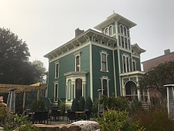
The town was formed from parts of the towns of Orleans and Lyme in 1833. The town was named after statesman John M. Clayton. The village of Clayton became the main railroad terminus for the Thousand Islands resort region, during its heyday at the turn of the twentieth century. The town of Clayton offered several hotels to visitors, some grand, now mostly vanished.

In 1872, the community of Clayton voted to set itself apart from the town by incorporating as a village.

Fairview Manor, Swarthout Site-A04507.000038, and Grindstone Island Upper Schoolhouse are listed on the National Register of Historic Places. [4] [5]

Geography

According to the United States Census Bureau, the town has a total area of 104.0 square miles (269.4 km2), of which 82.4 square miles (213.3 km2) are land and 21.7 square miles (56.1 km2), or 20.83%, are water. The town is situated on the St. Lawrence River near Lake Ontario. Across the river lies Ontario, Canada.

The northern border of the town is the Canada–US border running through the Thousand Islands in the St. Lawrence River. The town includes the fourth largest of the Thousand Islands, Grindstone Island, along with smaller islands, such as Bluff Island, Grenell Island, Maple Island, Picton Island, and Round Island.

A ferry once connected Clayton with Gananoque in Ontario, but was discontinued due to the construction of the Thousand Islands Bridge 10 miles (16 km) northeast (down-river). This bridge now carries traffic from Interstate 81 into Canada.

New York State Route 12E, which follows the south bank of the St. Lawrence River, intersects north-south New York State Route 12 at Clayton village. New York State Route 180 crosses the southeastern corner of Clayton.

Demographics

Historical population
CensusPop.Note
1840 3,990
1850 4,1915.0%
1860 4,69612.0%
1870 4,082−13.1%
1880 4,2143.2%
1890 4,4114.7%
1900 4,313−2.2%
1910 4,028−6.6%
1920 3,618−10.2%
1930 3,6982.2%
1940 3,7681.9%
1950 3,758−0.3%
1960 3,753−0.1%
1970 4,0217.1%
1980 4,0280.2%
1990 4,62914.9%
2000 4,8174.1%
2010 5,1537.0%
2016 (est.)4,928 [2] −4.4%
U.S. Decennial Census [6]

As of the census [7] of 2000, there were 4,817 people, 1,914 households, and 1,335 families residing in the town. The population density was 58.3 inhabitants per square mile (22.5/km2). There were 3,337 housing units at an average density of 40.4 per square mile (15.6/km2). The racial makeup of the town was 97.24% White, 0.93% Black or African American, 0.35% Native American, 0.23% Asian, 0.10% Pacific Islander, 0.48% from other races, and 0.66% from two or more races. Hispanic or Latino of any race were 1.58% of the population.

Antique wooden boats are commonly seen on the St. Lawrence River. Aerial of Miss Thousand Islands II.JPG
Antique wooden boats are commonly seen on the St. Lawrence River.

There were 1,914 households, out of which 34.5% had children under the age of 18 living with them, 57.0% were married couples living together, 8.6% had a female householder with no husband present, and 30.2% were non-families. 25.1% of all households were made up of individuals, and 13.0% had someone living alone who was 65 years of age or older. The average household size was 2.51 and the average family size was 3.00.

In the town, the population was spread out, with 26.7% under the age of 18, 6.5% from 18 to 24, 29.0% from 25 to 44, 22.6% from 45 to 64, and 15.1% who were 65 years of age or older. The median age was 38 years. For every 100 females, there were 94.1 males. For every 100 females age 18 and over, there were 91.7 males.

The median income for a household in the town was $35,805, and the median income for a family was $39,727. Males had a median income of $31,402 versus $21,091 for females. The per capita income for the town was $16,947. About 4.8% of families and 8.0% of the population were below the poverty line, including 11.0% of those under age 18 and 7.0% of those age 65 or over.

Communities and topographic features

Parks

Activities

Places To Visit

Notable people

Related Research Articles

<span class="mw-page-title-main">Alexandria, New York</span> Town in New York, United States

Alexandria is a town in the Thousand Islands region of the U.S. state of New York, within Jefferson County. The town's population was 4,061 at the 2010 United States Census. The town is named after Alexander LeRay, the son of an early developer. The village of Alexandria Bay is within the town.

Alexandria Bay is a village in Jefferson County, New York, United States, within the town of Alexandria. It is located in the Thousand Islands region of northern New York. The population of the village was 1,078 at the 2010 United States Census. It lies near the Thousand Islands Border Crossing of Canada and the United States.

Chaumont is a village in Jefferson County, New York, United States. Its population was 624 at the 2010 census. The village is named for Jacques-Donatien Le Ray de Chaumont, son of Benjamin Franklin's landlord and friend at Passy in France. The village of Chaumont is in the town of Lyme and is northwest of Watertown.

Depauville is a hamlet and census-designated place (CDP) in the southern region of the town of Clayton, within Jefferson County, New York, United States. The population was at 577 at the 2010 census.

Lyme is a town in Jefferson County, New York, United States. The population was 2,185 at the 2010 census. The settlements of Chaumont and Three Mile Bay are located within the town. Lyme is in the western part of Jefferson County and is northwest of Watertown.

Orleans is a town in Jefferson County, New York, United States. The population was 2,789 at the 2010 census, up from 2,463 in 2000. The town is located in the northern part of the county and is north of Watertown. Orleans is named after the commune of Orléans in France.

Diana is a town in Lewis County, New York, United States. The population was 1,709 at the 2010 census. The town is on the northeastern border of the county and is located northeast of Watertown. The northwestern section of Diana is in the Fort Drum military reservation.

<span class="mw-page-title-main">Hewlett Bay Park, New York</span> Village in New York, United States

Hewlett Bay Park is a village in the Town of Hempstead in Nassau County, on the South Shore of Long Island, in New York. The population was 404 at the 2010 census.

<span class="mw-page-title-main">Lisbon, New York</span> Town in New York, United States

Lisbon is a town in St. Lawrence County, New York, United States. The population was 4,102 at the 2010 census.

<span class="mw-page-title-main">Louisville, New York</span> Town in New York, United States

Louisville is a town in St. Lawrence County, New York, United States. The population was 3,145 at the 2010 census. The town is reportedly named after French king Louis XIV, but is pronounced as "Lewis-ville."

<span class="mw-page-title-main">Macomb, New York</span> Town in New York, United States

Macomb is a town in St. Lawrence County, New York, United States. The population was 906 at the 2010 census. The town is named after Alexander Macomb, who once owned much of northern New York as Macomb's Purchase.

<span class="mw-page-title-main">Parishville, New York</span> Town in New York, United States

Parishville is a town in the east-central part of St. Lawrence County, east of Potsdam, in the state of New York, United States. The population was 2,153 at the 2010 census.

<span class="mw-page-title-main">Piercefield, New York</span> Town in New York, United States

Piercefield is a town in St. Lawrence County, New York, United States. The population was 310 at the 2010 census.

Tioga is a town in Tioga County, New York, United States. The population was 4,455 at the 2020 census. The town is in the southwestern part of the county and lies between Elmira and Binghamton. Tioga is situated in the Southern Tier District of New York.

Brownville is a town in Jefferson County, New York, United States. The population was 6,263 at the 2010 census, up from 5,839 in 2000. The town is named after Jacob Brown, an early settler and leader.

Cape Vincent is a town in Jefferson County, New York, United States. The population was 2,765 at the 2020 census.

Clayton is a village in the town of Clayton in Jefferson County, New York, United States. The village population was 1,705 at the 2020 census.

Hammond is a town in St. Lawrence County, New York, United States. The population was 1,191 at the 2010 census. The name is derived from early land owner Abijah Hammond.

<span class="mw-page-title-main">Morristown, New York</span> Town in New York, United States

Morristown is a town in St. Lawrence County, New York, United States. The population was 1,974 at the 2010 census. The town is named after Gouverneur Morris, a signer of the United States Declaration of Independence and landowner in New York.

Waddington is a town in St. Lawrence County, New York, United States. The population was 2,266 at the 2010 census. The town was named after its principal village.

References

  1. "2016 U.S. Gazetteer Files". United States Census Bureau. Retrieved July 5, 2017.
  2. 1 2 "Population and Housing Unit Estimates" . Retrieved June 9, 2017.
  3. "Geographic Identifiers: 2010 Census Summary File 1 (G001): Clayton town, Jefferson County, New York". American Factfinder. U.S. Census Bureau. Archived from the original on February 13, 2020. Retrieved August 29, 2018.
  4. "National Register Information System". National Register of Historic Places . National Park Service. July 9, 2010.
  5. "National Register of Historic Places". Weekly List of Actions Taken on Properties: 8/13/12 through 8/17/12. National Park Service. August 24, 2012.
  6. "Census of Population and Housing". Census.gov. Retrieved June 4, 2015.
  7. "U.S. Census website". United States Census Bureau . Retrieved January 31, 2008.
  8. "THE 10 BEST Things to Do in Clayton". Tripadvisor. Retrieved February 9, 2023.