
Adams Center is a hamlet and census-designated place (CDP) in the town of Adams in Jefferson County, New York, United States. The population was 1,492 during the 2020 decennial census.
Black River is a village in Jefferson County, New York, United States. The population was 1,348 at the 2010 census. The village is on the border of the towns of Le Ray and Rutland, east of Watertown.

Carthage is a village in the town of Wilna in Jefferson County, New York, United States. The population was 3,236 at the 2020 census. The village of Carthage is along the southern border of the town of Wilna and is east of Watertown.
Chaumont is a village in Jefferson County, New York, United States. Its population was 624 at the 2010 census. The village is named for Jacques-Donatien Le Ray de Chaumont, son of Benjamin Franklin's landlord and friend at Passy in France. The village of Chaumont is in the town of Lyme and is northwest of Watertown.
Deferiet is a village in Jefferson County, New York, United States. The population was 294 at the 2010 census. The village is named after settler Jenika de Ferriet.
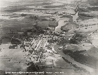
Dexter is a village in Jefferson County, New York, United States. The population was 1,052 at the 2010 census. The name is derived from Simon Newton Dexter, one of the village's stockholders.
Evans Mills is a village in Jefferson County, New York, United States. The population was 621 at the 2010 census. The village is within the town of Le Ray and is northeast of Watertown.
Glen Park is a village in Jefferson County, New York, United States. The population was 502 at the 2010 census. The village is on the border of the towns of Brownville and Pamelia and is immediately northwest of Watertown.
Herrings is a hamlet and former village in Jefferson County, New York, United States. The population was 90 at the 2010 census, down from 129 in 2000. The hamlet is named after two brothers who owned a paper mill in the area.
Rutland is a town in Jefferson County, New York, United States. The population was 3,038 at the 2020 census.
West Carthage is a village in Jefferson County, New York, United States. The population was 1,780 at the 2020 census.

Mount Pleasant is a village in southern Jefferson County, Ohio, United States. The population was 394 at the 2020 census. It is part of the Weirton–Steubenville metropolitan area. Founded in 1803 by anti-slavery Quakers, the village was an early center of abolitionist activity and a well-known haven for fugitive slaves on the Underground Railroad.

Watertown is a town in Jefferson County, Wisconsin, United States. The population was 1,975 at the 2010 census. The unincorporated community of Ebenezer is located in the town.
Adams is a village in the town of Adams in Jefferson County, New York, United States. The population was 1,775 at the 2010 census. The village is named after President John Adams.
Antwerp is a village in Jefferson County, New York, United States. The population was 686 at the 2010 census. The village is in center of the town of Antwerp and is northeast of Watertown.

Brownville is a village in Jefferson County, New York, United States. The population was 1,119 at the 2010 census, up from 1,022 in 2000. The village is named after Jacob Brown, an early settler and developer.
Ellisburg is a village in Jefferson County, New York, United States. The population was 244 at the 2010 census. The village is named after two brothers who were the original landowners. It is located near the middle of the town of Ellisburg and is southwest of Watertown.
Theresa is a village in the town of Theresa in Jefferson County, New York, United States. The population was 863 at the 2010 census. The village is northeast of Watertown.
Watertown is a town in Jefferson County, New York, United States. The population was 5,913 at the 2020 census. The town is located in the central part of the county and borders the city of Watertown to the south, east, and west. As the city has a population of 24,685, or four times the town's population, references to "Watertown, New York", usually apply to the city rather than the town.
Philadelphia is a town in Jefferson County, New York, United States. The population was 1,964 at the 2020 census.


