Jefferson County is a county on the northern border of the U.S. state of New York. As of the 2020 census, the population was 116,721. Its county seat is Watertown. The county is named after Thomas Jefferson, third President of the United States of America. It is adjacent to Lake Ontario, southeast from the Canada–US border of Ontario. The county is part of the North Country region of the state.
Alexandria is a town in the Thousand Islands region of the U.S. state of New York, within Jefferson County. The town's population was 3,741 at the 2020 United States Census. The town is named after Alexander LeRay, the son of an early developer. The village of Alexandria Bay is within the town.
Alexandria Bay is a village in Jefferson County, New York, United States, within the town of Alexandria. It is located in the Thousand Islands region of northern New York. The population of the village was 1,078 at the 2010 United States Census. It lies near the Thousand Islands Border Crossing of Canada and the United States.
Calcium is a census-designated place (CDP) in Jefferson County, New York, United States. The population was 3,573 as of the 2020 census. The CDP is in the town of Le Ray and includes the hamlets of Calcium and Sanfords Four Corners.
Depauville is a hamlet and census-designated place (CDP) in the southern region of the town of Clayton, within Jefferson County, New York, United States. The population was at 577 at the 2010 census.
La Fargeville is a hamlet and census-designated place (CDP) in the town of Orleans in Jefferson County, New York, United States. The population was 733 at the 2020 census. The hamlet is named after John Frederick La Farge, one of the early proprietors of the town. La Fargeville was once a village, but dissolved its municipal corporation in 1922.
Orleans is a town in Jefferson County, New York, United States. The population was 2,789 at the 2010 census, up from 2,463 in 2000. The town is located in the northern part of the county and is north of Watertown. Orleans is named after the commune of Orléans in France.
Redwood is a hamlet and census-designated place (CDP) in Jefferson County, New York, United States. As of the 2010 census, the population was 605.

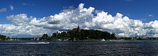
The Thousand Islands constitute a North American archipelago of 1,864 islands that straddles the Canada–US border in the Saint Lawrence River as it emerges from the northeast corner of Lake Ontario. They stretch for about 50 miles (80 km) downstream from Kingston, Ontario. The Canadian islands are in the province of Ontario and the U.S. islands in the state of New York.
Cape Vincent is a town in Jefferson County, New York, United States. The population was 2,765 at the 2020 census.
Clayton is a village in the town of Clayton in Jefferson County, New York, United States. The village population was 1,705 at the 2020 census.
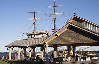
Clayton is a town in Jefferson County, New York, United States. The population was 5,153 at the 2010 census. The town is named after John M. Clayton, a federal political leader from Delaware.

Wellesley Island is an island in Jefferson County, New York, the island is partially in the Town of Orleans and partially in the Town of Alexandria.
Grindstone Island is the fourth largest of the Thousand Islands in the St. Lawrence River and the second largest of the American islands in the St. Lawrence. The island lies near Lake Ontario and is part of the United States. In particular, the island is part of the Town of Clayton in Jefferson County, New York.
Three Mile Bay is a hamlet and census-designated place (CDP) in the town of Lyme in Jefferson County, New York, United States. The elevation is 259 feet (79 m). As of the 2010 census it had a population of 227.
Belleville is a hamlet and census-designated place (CDP) in the town of Ellisburg, Jefferson County, New York, United States. The population was 226 at the 2010 census.

Thousand Island Park, also known as TI Park, is a hamlet and census-designated place (CDP) in the town of Orleans, Jefferson County, New York, United States, in the Thousand Islands region on the St. Lawrence River. Founded in 1875 as a holiday camp, the incorporated community remains a seasonal summer community; despite 323 housing units, there was only a population of 31 permanent residents as of the 2010 census.
Henderson is a hamlet and census-designated place (CDP) in the town of Henderson, Jefferson County, New York, United States. The population of the CDP was 224 at the 2010 census, out of 1,360 in the entire town of Henderson.
Rodman is a hamlet and census-designated place (CDP) in the town of Rodman, Jefferson County, New York, United States. As of the 2010 census, the CDP population was 153, out of 1,176 in the entire town of Rodman.
Pamelia Center is a hamlet and census-designated place (CDP) in Jefferson County, New York, United States. Its population was 264 as of the 2010 census. The community is located at the junction of New York State Route 37 and New York State Route 342.


