
The River Tweed, or Tweed Water, is a river 97 miles (156 km) long that flows east across the Border region in Scotland and northern England. Tweed cloth derives its name from its association with the River Tweed. The Tweed is one of the great salmon rivers of Britain and the only river in England where an Environment Agency rod licence is not required for angling. The river generates a large income for the local borders region, attracting anglers from all around the world.
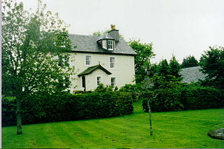
Hawkshaw is a pair of semi-detached houses on the River Tweed, two miles southwest of Tweedsmuir in the Scottish Borders. Historically part of Peeblesshire, the original village of Hawkshaw was destroyed when the Fruid Reservoir was constructed in 1963, and is remembered as the ancestral family home of the Porteous family, dating from at least 1439.
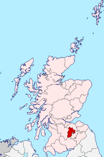
Peeblesshire, the County of Peebles or Tweeddale is a historic county of Scotland. Its county town is Peebles, and it borders Midlothian to the north, Selkirkshire to the east, Dumfriesshire to the south, and Lanarkshire to the west.

The River Teviot, or Teviot Water, is a river of the Scottish Borders area of Scotland, and is the largest tributary of the River Tweed by catchment area. The Teviot is an important river for wildlife, especially the Atlantic salmon, but in recent years has witnessed at least four extreme flooding events.

The Southern Uplands are the southernmost and least populous of mainland Scotland's three major geographic areas. The term is used both to describe the geographical region and to collectively denote the various ranges of hills and mountains within this region. An overwhelmingly rural and agricultural region, the Southern Uplands are partly forested and contain many areas of open moorland - the hill names in the area are congruent with these characteristics.

Broughton is a village in Tweeddale in the historical county of Peeblesshire in the Scottish Borders council area, in the south of Scotland, in the civil parish of Broughton, Glenholm and Kilbucho and Upper Tweed Community Council. Broughton is on the Biggar Water, near where it flows into the River Tweed. It is about 7 km east of Biggar, and 15 km west of Peebles.
The River Devon is a tributary of the River Forth in Clackmannanshire, Scotland.

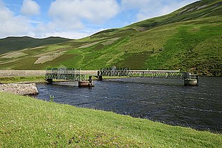
Tweedsmuir is a village and civil parish in Tweeddale, the Scottish Borders Council district, southeastern Scotland.

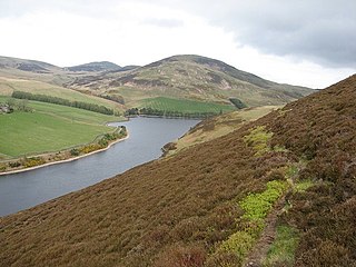
Talla Reservoir, located a mile from Tweedsmuir, Scottish Borders, Scotland, is an earth-work dam fed by Talla Water. The reservoir is supplemented by water from the nearby Fruid Reservoir. It was opened in 1905. To assist in bringing the materials for its construction, the Talla Railway was built.

West Water Reservoir is an artificial reservoir in the Pentland Hills, Scottish Borders, 3 kilometres (1.9 mi) west of West Linton, and 26 kilometres (16 mi) south west of Edinburgh. It is a drinking water reservoir for Edinburgh and the Lothians and is located 320 metres (1,050 ft) above sea level. It is an important site for wildfowl and is designated as a SSSI and a Ramsar site.
Glencorse Reservoir is a reservoir in Midlothian, Scotland, UK, two miles west of Glencorse, in the Pentland Hills.

Clarrie Hall Dam is a minor ungated concrete faced rockfill embankment dam with an uncontrolled concrete-lined chute spillway across the Doon Doon Creek, located upstream of the small town of Uki, in the Northern Rivers region of New South Wales, Australia. The main purpose of the dam is for water supply and it creates the artificial Lake Clarrie Hall.

The Moffat Hills are a range of hills in the Southern Uplands of Scotland. They form a roughly triangular shape with a west facing side, a north facing side, and a south-east facing side. It is 17 kilometres from east to west across this triangle and some 16 kilometres north to south. The highest point is White Coomb at 821 m (2694 ft). The town of Moffat lies just south of the Moffat hills and along with Tweedsmuir, at the northern extremity, is the only centre of population around these hills. In some older maps, the northern part of the Moffat Hills is called the Tweedsmuir Hills, but can also be known by the title Manor Hills.

Talla Water is a river in the Scottish Borders area of Scotland, near Tweedsmuir. It feeds the Talla Reservoir, and is a tributary of the River Tweed. Above the reservoir are a series of waterfalls known as the Talla Linns.
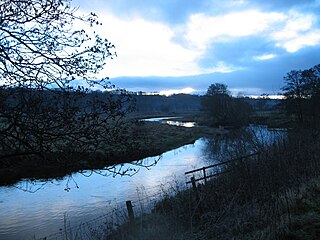
The Caddon Water is a small river by the village of Caddonfoot, in the Scottish Borders area of Scotland. It rises on Windlestraw Law, four miles north of Innerleithen, and flows through the Stantling Craig Reservoir. It joins the river Tweed at Caddonfoot, having completed its journey after 11 miles (18 km).
Menzion, sometimes Minzion is a small settlement in southern Scotland near Tweedsmuir in the Scottish Borders, in the valley of the River Tweed.

Fruid is a small reservoir in the Scottish Borders area of Scotland, UK, near Menzion. It is formed by damming the Fruid Water, and supplements the contents of Talla Reservoir, forming part of the water supply for Edinburgh.
Edinburgh Water Company and its successors have provided a public water supply and latterly sewerage and sewage treatment services to the Scottish capital of Edinburgh since 1891. The original company was established to supply drinking water and did so until 1870, when it was taken over by a public Water Trust, with representatives from Edinburgh, Leith and Portobello. That in turn was taken over by Edinburgh Corporation and in 1975, responsibility passed to the Lothian Regional Council, as did the duty to provide sewerage and sewage treatment services. Both services were moved out of local authority control, and taken over by the East of Scotland Water Authority in 1996. The three Scottish regional water authorities were merged to form Scottish Water in 2002.
