Galilee, Queensland

Last updated

Galilee
Queensland
Australia Queensland location map.svg
Red pog.svg
Galilee
Coordinates 22°19′10″S145°49′10″E / 22.3194°S 145.8194°E / -22.3194; 145.8194 Coordinates: 22°19′10″S145°49′10″E / 22.3194°S 145.8194°E / -22.3194; 145.8194
Population20 (2016 census) [1]
 • Density0.0068/km2 (0.018/sq mi)
Postcode(s) 4726
Area2,940.8 km2 (1,135.4 sq mi)
Location
LGA(s) Barcaldine Region
State electorate(s) Gregory
Federal Division(s) Maranoa
Suburbs around Galilee:
Upper Cornish Creek Pentland Laglan
Upper Cornish Creek Galilee Laglan
Upland Upland Dunrobin

Galilee is a former rural locality in the Barcaldine Region, Queensland, Australia. [2] In the 2016 census, Galilee had a population of 20 people. [1]

Contents

On 22 November 2019 the Queensland Government decided to amalgamate the localities in the Barcaldine Region, resulting in five expanded localities based on the larger towns: Alpha, Aramac, Barcaldine, Jericho and Muttaburra. Galilee was incorporated into Aramac. [3] [4] [5]

Geography

Galilee is bounded to the east by the Great Dividing Range and is within the Desert Uplands area of Central West Queensland. In the centre of the locality is Lake Galilee, a semi-arid saline lake which is 36 kilometres (22 mi) long, up to 12.5 kilometres (7.8 mi) and covers approximately 25,700 hectares (64,000 acres). It is quite shallow, being no more than 2 metres (6 ft 7 in) deep. [6] [7] Lake Galilee is registered on the Directory of Important Wetlands in Australia (DIWA) and provides an important refuge and breeding site for waterbirds. It has been identified by BirdLife International as an Important Bird Area (IBA) because it regularly supports over 1% of the world populations of freckled ducks and grey teals. [8]

The principal land use is cattle grazing. [7]

History

Pastoral settlement began on the eastern side of Lake Galilee in 1877, when Charles Bowly acquired the Oakley run and stocked it with cattle. The following year he also acquired the “Northmere”, “Powala”, “Eastmere”, “Westmere” and “Southmere” runs with “Eastland” being added in 1883. Together these runs were named “Eastmere” Station. [9]

Charles Bowly later regretted having invested in cattle. He wrote to the daughter of Robert Christison, his first employer: [9]

“I, to my regret, got tired of sheep and wanted to ride after cattle. I sold out with 6000 cattle and 220 horses after going through five droughts and working for 21 years for the Bank, got £6000 left after 21 years hard work and hard living too, and that is Queensland."

The new owners of “Eastmere” reached the same conclusion and began introducing sheep two years after purchase and had completely changed to sheep in 1913. Charles Bowly was fortunate in selling when he did. The cattle tick invaded the district soon afterwards, killing up to 50% of cattle on some properties. In 1899 the worst drought Queensland had ever experienced set in, and by the time it broke in 1903, 80% of cattle in the district had died. [9]

Cattle were reintroduced in very different market conditions in the 1950s and sheep were removed from “Eastmere” in 1966. [10] Over the years other properties were taken up around the lake including “Fleetwood” to the north and west, “Lake Dunn” to the west, and “Clare” and Clunies Creek” – now “Clunievale” - to the south. “Eastmere” first pulled (cleared trees) in 1967, while “Fleetwood” first pulled in 1963. (The clearing of trees is a method of increasing productivity and sustainability of pastoral grazing enterprises in the Desert Uplands). [9]

In the early 2000s a biodiversity audit suggested some concern about over-clearing in some ecosystems and said, "the most quantifiable threatening process is broad scale tree clearing", [11] although data collated for 1999 indicated that 87% of the bioregion remained uncleared. [12]

Buffel grass was introduced into the Desert Uplands bioregion the late 1960s. [13] Many pastoralists regard it highly because in many situations it greatly increases pasture productivity for cattle. However, it is also widely seen as having negative environmental impacts through competition with native species and changes to fire regimes. [14]

Many ecosystems in the Desert Uplands are being invaded by buffel grass, which forms a dense monoculture therefore decreasing the biodiversity of ecosystems [13] Another aspect of invasion by buffel grass is that the buffel plant is very phosphorus- and nitrogen-dependent and a long term run down of phosphorus in the already phosphorus deficient soils of the Desert Uplands may occur leading to a further loss of native plant species. [13]

In 1995, the Desert Uplands Build-up and Development Committee was established and has worked with landholders to enhance grazing and ecological sustainability, enterprise profitability and community resilience. [15]

Education

There are no schools in Galilee. The nearest primary school is in Aramac. The nearest secondary school is in Aramac (to Year 10 only). For Years 11 and 12, the nearest school is in Barcaldine. [7]

Related Research Articles

Barcaldine Region Local government area in Queensland, Australia

The Barcaldine Region is a local government area in Central West Queensland, Australia. Established in 2008, it was preceded by three previous local government areas which had existed for over a century.

Lake Galilee (Queensland)

Lake Galilee is a semi-arid salt lake in the locality of Galilee, Barcadline Region, within the Desert Uplands area of Central West Queensland, Australia. The lake is about 36 kilometres long, up to 12.5 kilometres wide and covers approximately 25,700 hectares.

Desert Uplands

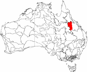
The Desert Uplands is an interim Australian bioregion located in north and central western Queensland which straddles the Great Dividing Range between Blackall and Pentland.

Cornish Creek, Queensland Suburb of Barcaldine Region, Queensland, Australia

Cornish Creek is a former rural locality in the Barcaldine Region, Queensland, Australia. In the 2016 census, Cornish Creek had a population of 16 people.

Tablederry, Queensland Suburb of Barcaldine Region, Queensland, Australia

Tablederry is a former rural locality in the Barcaldine Region, Queensland, Australia. In the 2016 census, Tablederry had a population of 32 people.

Bangall, Queensland Suburb of Barcaldine Region, Queensland, Australia

Bangall is a former rural locality in the Barcaldine Region, Queensland, Australia. In the 2016 census, Bangall had a population of 4 people.

Upper Cornish Creek, Queensland Suburb of Barcaldine Region, Queensland, Australia

Upper Cornish Creek is a former rural locality in the Barcaldine Region, Queensland, Australia. In the 2016 census, Upper Cornish Creek had a population of 43 people.

Upland, Queensland Suburb of Barcaldine Region, Queensland, Australia

Upland is a former rural locality in the Barcaldine Region, Queensland, Australia. In the 2016 census, Upland had a population of 12 people.

Ingberry, Queensland Suburb of Barcaldine Region, Queensland, Australia

Ingberry is a former rural locality in the Barcaldine Region, Queensland, Australia. In the 2016 census, Ingberry had a population of 11 people.

Ibis, Queensland Suburb of Barcaldine Region, Queensland, Australia

Ibis is a former rural locality in the Barcaldine Region, Queensland, Australia. In the 2016 census, Ibis had a population of 4 people.

Pelican Creek, Queensland Suburb of Barcaldine Region, Queensland, Australia

Pelican Creek is a former rural locality in the Barcaldine Region, Queensland, Australia. In the 2016 census, Pelican Creek had a population of 20 people.

Sardine, Queensland Suburb of Barcaldine Region, Queensland, Australia

Sardine is a former rural locality in the Barcaldine Region, Queensland, Australia. In the 2016 census, Sardine had a population of 5 people.

Barcaldine Downs Suburb of Barcaldine Region, Queensland, Australia

Barcaldine Downs is a former rural locality in the Barcaldine Region, Queensland, Australia. In the 2016 census, Barcaldine Downs had a population of 14 people.

Moombria, Queensland Suburb of Barcaldine Region, Queensland, Australia

Moombria is a former rural locality in the Barcaldine Region, Queensland, Australia. In the 2016 census, Moombria had a population of 0 people.

Narbethong, Queensland Suburb of Barcaldine Region, Queensland, Australia

Narbethong was a rural locality in the Barcaldine Region, Queensland, Australia. In the 2016 census, Narbethong had a population of 0 people.

Patrick, Queensland Suburb of Barcaldine Region, Queensland, Australia

Patrick is a former rural locality in the Barcaldine Region, Queensland, Australia. In the 2016 census, Patrick had a population of 26 people.

Tara Station, Queensland Suburb of Barcaldine Region, Queensland, Australia

Tara Station is a former rural locality in the Barcaldine Region, Queensland, Australia. In the 2016 census, Tara Station had a population of 10 people.

Dunrobin, Queensland Suburb of Barcaldine Region, Queensland, Australia

Dunrobin is a former rural locality in the Barcaldine Region, Queensland, Australia. In the 2016 census, Dunrobin had a population of 14 people.

Garfield, Queensland Suburb of Barcaldine Region, Queensland, Australia

Garfield is a former rural locality in the Barcaldine Region, Queensland, Australia. In the 2016 census, Garfield had a population of 37 people.

Mexico, Queensland Suburb of Barcaldine Region, Queensland, Australia

Mexico is a former rural locality in the Barcaldine Region, Queensland, Australia. In the 2016 census, Mexico had a population of 26 people.

References

  1. 1 2 Australian Bureau of Statistics (27 June 2017). "Galilee (SSC)". 2016 Census QuickStats. Retrieved 20 October 2018. OOjs UI icon edit-ltr-progressive.svg
  2. "Galilee – locality in Barcaldine Region (entry 47079)". Queensland Place Names. Queensland Government . Retrieved 6 May 2019.
  3. "Recent place name decisions". Queensland Government. 22 November 2019. Archived from the original on 22 October 2019. Retrieved 15 January 2020.
  4. "Proposed Locality Boundaries and Names: Barcaldine Regional: Alpha, Aramac, Barcaldine, Jericho and Muttaburra" (PDF). Queensland Government. 17 May 2019. Archived (PDF) from the original on 15 January 2020. Retrieved 15 January 2020.
  5. "Locality Boundaries and Names: Barcaldine Regional Council: Alpha, Aramac, Barcaldine, Jericho and Muttaburra" (PDF). Queensland Government. 17 May 2019. Archived (PDF) from the original on 15 January 2020. Retrieved 15 January 2020.
  6. Environmental Protection Agency, QLD Archived 2008-02-15 at the Wayback Machine
  7. 1 2 3 "Queensland Globe". State of Queensland . Retrieved 5 May 2019.
  8. "IBA: Lake Galilee". Birdata. Birds Australia. Archived from the original on 6 July 2011. Retrieved 26 July 2011.
  9. 1 2 3 4 Desert Uplands Build-up and Development Strategy Committee and Desert Channels Group. Lake Galilee Management Plan 2011-2016.
  10. Desert Uplands Build-up and Development Strategy Committee and Desert Channels Group. Lake Galilee Management Plan 2011-2016.[ verification needed ]
  11. Mitchell, C.; Egan, S. and Leverington, A. (Draft: 2002) "Archived copy" (PDF). Archived from the original (PDF) on 27 April 2013. Retrieved 8 November 2012.CS1 maint: archived copy as title (link) Biodiversity Audit – Bioregional Case Study, Desert Uplands bioregion. Queensland Queensland Government Environment Protection Agency, Queensland Parks and Wildlife Service and National Land and Water Resources Audit (A program of the National Heritage Trust).
  12. Sattler, P. and Creighton, C. (2002) Case study: Desert Uplands (1, 2 & 3) Second lowest stress class Archived 2011-06-03 at the Wayback Machine . Land and Water Resources Audit. Australian Terrestrial Biodiversity Assessment 2002.
  13. 1 2 3 Mitchell, C.; Egan, S. and Leverington, A. (Draft: 2002) "Archived copy" (PDF). Archived from the original (PDF) on 27 April 2013. Retrieved 8 November 2012.CS1 maint: archived copy as title (link) Biodiversity Audit – Bioregional Case Study, Desert Uplands bioregion. Queensland Queensland Government Environment Protection Agency, Queensland Parks and Wildlife Service and National Land and Water Resources Audit (A program of the National Heritage Trust).
  14. CSIRO Ecosystem Sciences (updated 2011) The costs and benefits of buffel grass and its management Archived 2012-10-21 at the Wayback Machine . CSIRO. Retrieved on 10 November 2012.
  15. Build-Up and Development Strategy Committee Archived 14 January 2013 at the Wayback Machine . Retrieved on 15 November 2012.