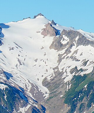
Breccia Peak is a mountain summit in the North Cascades, in Snohomish County of Washington state. Its summit is 6,487 feet (1,977 m) above sea level. The peak is the eroded remnant of a stratovolcano, and takes its name from the type of rock, breccia, that it is composed of. It is located 15 miles southeast of Darrington, Washington, and 8.7 miles (14.0 km) west of Glacier Peak, which is one of the Cascade stratovolcanoes. It is situated in the Glacier Peak Wilderness on land administered by the Mount Baker-Snoqualmie National Forest. The nearest higher peak is Mount Pugh, 3.5 miles (5.6 km) to the northwest. Precipitation runoff from Breccia Peak drains into tributaries of the Sauk River.
Plummer Mountain is a prominent summit of the North Cascades, in Snohomish County of Washington state. It is located west of Suiattle Pass in the heart of the Glacier Peak Wilderness on land managed by Mount Baker-Snoqualmie National Forest. Plummer Mountain is the high point and eastern culmination of Miners Ridge. Image Lake on Miners Ridge provides a campsite from which to climb Plummer. Kennecott Copper Corporation, as of 1988, planned to dig an open-pit copper mine on the slopes of Plummer Mountain. However, protests by various advocacy groups prevented the plan from developing further.

Prairie Mountain is a 5,678-foot-elevation mountain summit near the western edge of the North Cascades, in Snohomish County of Washington state. It is located six miles east of Darrington, Washington, and northwest of Glacier Peak which is one of the Cascade stratovolcanoes. It is situated on land administered by the Mount Baker-Snoqualmie National Forest. The nearest higher peak is White Chuck Mountain, 4.7 miles (7.6 km) to the south-southeast. Precipitation runoff from Prairie Mountain drains into the Sauk River and Suiattle River, both tributaries of the Skagit River. The mountain was so named because of the beautiful prairie at its base.

Mount Misch is a remote 7,435 ft mountain summit in the North Cascades, in Skagit County of Washington state. It is the highest point of the Buckindy Range, or Buckindy Ridge. It is located 19 miles east-northeast of Darrington, Washington, and 15 miles north-northwest of Glacier Peak which is one of the Cascade stratovolcanoes. It is situated in the Glacier Peak Wilderness on land administered by the Mount Baker-Snoqualmie National Forest. Mount Misch was named by mountaineer and author Fred Beckey for his friend Peter Misch (1909-1987), University of Washington geology professor and mountaineer, who was renowned for his study of the North Cascades. Precipitation runoff from Mount Misch and the unnamed Goat Creek glacier on its east slope drains into tributaries of the Suiattle River and ultimately the Skagit River.

Sitting Bull Mountain is a 7,759-foot (2,365-metre) double summit mountain in the North Cascades of Washington state. The north summit is higher than the south peak, and easier to climb, however neither peak sees much climbing activity. Sitting Bull Mountain is located 2.1 mi (3.4 km) northwest of Suiattle Pass in the heart of the Glacier Peak Wilderness. Its nearest higher peak is Plummer Mountain, 1.51 mi (2.43 km) to the south-southwest. The mountain is situated on the crest of the Cascade Range, on the shared border of Snohomish County and Chelan County. Precipitation runoff from Sitting Bull Mountain drains east into Agnes Creek which is a tributary of the Stehekin River, or west into Canyon Creek which is a tributary of the Suiattle River.
Chiwawa Mountain is an 8,459-foot (2,578-metre) mountain summit located in the Glacier Peak Wilderness of the North Cascades in Washington state. The mountain is situated on the crest of the Cascade Range, on the shared border of Snohomish County and Chelan County, also straddling the boundary between the Mount Baker-Snoqualmie National Forest and the Wenatchee National Forest. Its nearest higher peak is Fortress Mountain, 1.12 mi (1.80 km) to the west. Chiwawa Mountain is a triple divide peak, so precipitation runoff from it drains northeast to Lake Chelan via Railroad Creek; northwest into Miners Creek which is a tributary of the Suiattle River; and south into the Chiwawa River headwaters. The mountain's name is taken from the river's name, which was applied by Albert Hale Sylvester (1871-1944), a pioneer surveyor, explorer, topographer, and forest supervisor in the Cascades. Chiwawa comes from the Columbia-Moses language and means a kind of creek.
Kololo Peaks is an 8,200+ ft mountain located in the Glacier Peak Wilderness of the North Cascades in Washington state. The mountain is situated on the crest of the Cascade Range, on the shared border of Snohomish County and Chelan County, and also straddling the boundary between Mount Baker-Snoqualmie National Forest and Wenatchee National Forest. The nearest higher peak is Glacier Peak, 3.29 mi (5.29 km) to the north. Precipitation runoff and meltwater from the White River Glacier on the southeast slope drains into White River. On the west slope, the White Chuck Glacier drains into the White Chuck River, and the Suiattle Glacier and Honeycomb Glacier on the north and east sides drain into the Suiattle River. Surrounded by these glaciers, Fred Beckey in his Cascade Alpine Guide describes the mountain as being almost a nunatak.

Johnson Mountain is a 6,721-foot (2,049-metre) mountain summit located in the Glacier Peak Wilderness of the North Cascades in Washington state. The mountain is situated in eastern Snohomish County, in the Mt. Baker-Snoqualmie National Forest. The nearest higher peak is White Mountain, 3.3 mi (5.3 km) to the northeast, along with Indian Head Peak 3.38 mi (5.44 km) to the east. Precipitation runoff from the mountain drains into tributaries of the Sauk River. The mountain's name honors Mackinaw Johnson, a prospector who had a cabin in the vicinity.

Napeequa Peak is an 8,073-foot (2,461-metre) pyramidal mountain summit located in the Glacier Peak Wilderness of the North Cascades in Washington state. The mountain is situated on the crest of the Cascade Range, on the shared border of Snohomish County and Chelan County, also straddling the boundary between the Mount Baker-Snoqualmie National Forest and the Wenatchee National Forest. Its nearest neighbor is Cirque Mountain, 0.3 mi (0.48 km) to the north, and the nearest higher peak is Buck Mountain, 2.56 mi (4.12 km) to the east-southeast. Precipitation runoff from the peak drains east to the headwaters of Napeequa River; or west into the Suiattle River. The mountain's name is taken from the river's name, which was applied by Albert Hale Sylvester (1871-1944), a pioneer surveyor, explorer, topographer, and forest supervisor in the Cascades.

Cirque Mountain is a 7,966-foot (2,428-metre) mountain summit located in the Glacier Peak Wilderness of the North Cascades in Washington state. The mountain is situated on the crest of the Cascade Range, on the shared border of Snohomish County and Chelan County, also straddling the boundary between the Mount Baker-Snoqualmie National Forest and the Wenatchee National Forest. Its nearest higher peak is Napeequa Peak, 0.3 mi (0.48 km) to the south. The peak is set on Chiwawa Ridge with Napeequa, and other notable peaks on this ridge include Fortress Mountain, Buck Mountain, Brahma Peak, Mount Berge, and Chiwawa Mountain. Topographic relief is significant since the western aspect of the mountain rises 4,000 feet above the Suiattle Valley in approximately 1.5 mi (2.4 km). This mountain has small, unnamed, hanging glaciers in cirques surrounding the summit. Precipitation runoff from the peak and meltwater from the glaciers drains east to the headwaters of Napeequa River; or west into the Suiattle River.

Tenpeak Mountain is an 8,312-foot (2,533-metre) mountain summit located in the Glacier Peak Wilderness of the North Cascades in Washington state. Tenpeak is situated on the crest of the Cascade Range, on the shared border of Snohomish County and Chelan County, also straddling the boundary between the Mount Baker-Snoqualmie National Forest and the Wenatchee National Forest. Its nearest higher neighbor is Luahna Peak, 2.5 mi (4.0 km) to the southeast. Topographic relief is significant since the northern aspect of the mountain rises 4,200 feet above the Suiattle Valley in approximately 1.5 mi (2.4 km). This mountain has small, unnamed, hanging glaciers in cirques surrounding the summit, and the terminus of the Honeycomb Glacier lies below the western base of the mountain. Precipitation runoff from the mountain and meltwater from the glaciers drains south into White River; or north into the Suiattle River. This mountain's descriptive name was suggested by The Mountaineers, and was officially adopted in 1918 by the U.S. Board on Geographic Names. The first ascent was made September 21, 1940, by Lloyd Anderson and Tom Campbell.

Skykomish Peak is a 6,368-foot (1,941-metre) mountain summit located in the Henry M. Jackson Wilderness in the North Cascades of Washington state. The mountain is situated on the crest of the Cascade Range, on the shared border of Snohomish County with Chelan County, and also straddling the boundary between Mount Baker-Snoqualmie National Forest and Okanogan-Wenatchee National Forest. Skykomish Peak is located 15 mi (24 km) to the north of Stevens Pass, and the Pacific Crest Trail traverses the east slope of this peak. Precipitation runoff from the peak drains west into the Skykomish River, or east into Cady Creek which is a tributary of Little Wenatchee River. This mountain's name derives from its position at the head of the North Fork Skykomish River, and "Skykomish" comes from the Lushootseed word for the Skykomish people, sq̓ixʷəbš, meaning "upriver people".
Mount Buckindy is a remote 7,320-foot-elevation (2,230-meter) mountain summit located in the North Cascades, in Skagit County of Washington state. It is the second-highest point of the Buckindy Range, or Buckindy Ridge. It is set in the Glacier Peak Wilderness on land managed by the Mount Baker-Snoqualmie National Forest. It is situated 20 miles east-northeast of Darrington, Washington, and 17 miles north-northwest of Glacier Peak which is one of the Cascade stratovolcanoes. Precipitation runoff from Mount Buckindy drains south to the Suiattle River via Buck Creek and Downey Creek, and north to the Cascade River via Kindy Creek. Topographic relief is significant as the summit rises 4,700 feet above Kindy Creek in less than two miles. The mountain's toponym is a portmanteau of Buck and Kindy Creeks, and has been officially adopted by the United States Board on Geographic Names.

Helmet Butte is a 7,400-foot (2,256-metre) summit located in the Glacier Peak Wilderness of the North Cascades in Washington state.

Foggy Peak is a 6,810-foot-elevation (2,076-meter) mountain summit in Snohomish County of Washington state.
Kennedy Peak is an 8,381-foot (2,555-metre) summit in Snohomish County, Washington, United States.

Bannock Mountain is a 7,769-foot (2,368-metre) summit in the North Cascades of Washington state.

Portal Peak is a 6,999-foot (2,133-metre) mountain summit in Snohomish County, Washington, United States.

Baekos Peak is a 7,529-foot (2,295-metre) mountain summit in Snohomish County, Washington, United States.

Kodak Peak is a 6,132-foot-elevation (1,869-meter) summit on the border shared by Chelan and Snohomish counties in Washington, United States.