History
The suburb was developed by Model Homes Limited, which estimated a cost of $20 million to develop the nearly 420-acre (170 ha) master planned community. [2] Plans for the project were first announced in 1951; starting in 1955, the area was developed as an upscale master planned community during the post-World War II housing boom, with most of the houses constructed in the mid-century modern style. [3]
The area's boundaries are the CPR Winnipeg Beach subdivision to the east, Carruthers Avenue to the south, McPhillips Street to the west, and Leila Avenue to the north. Prior to the City of Winnipeg's amalgamation in 1972, the neighbourhood made up a large portion of the former City of West Kildonan.
Model Homes Limited's plans for the development featured 1,500 homes, the Garden City shopping centre, six schools, churches, synagogues, parks and recreation areas. The area was marketed as the leading Winnipeg area suburb, featuring above average sized lots and larger homes. Expectations were that the building of Garden City would raise the population of the former City of West Kildonan from 14,000 to 20,000.
Demographics
Population history| Year | Pop. | ±% |
|---|
| 1971 | 8,050 | — |
|---|
| 1976 | 8,055 | +0.1% |
|---|
| 1981 | 7,040 | −12.6% |
|---|
| 1986 | 6,465 | −8.2% |
|---|
| 1991 | 5,920 | −8.4% |
|---|
| 1996 | 5,715 | −3.5% |
|---|
| 2001 | 5,650 | −1.1% |
|---|
| 2006 | 5,760 | +1.9% |
|---|
| 2011 | 6,010 | +4.3% |
|---|
| 2016 | 6,255 | +4.1% |
|---|
| 2021 | 6,475 | +3.5% |
|---|
| Sources: [1] |
As of 2021, Garden City had a population of 6,475. The median household income was $89,000, slightly above the city median of $80,000. There were 2,335 occupied private dwellings; 1,850 semi-detached houses, 445 apartments, and 40 duplexes or semi-detached houses. the median value of the dwellings is $324,00. [1]
The area is home to a large portion of Winnipeg's Jewish community. [5] [1] Numerous synagogues, organizations, retirement homes and businesses catering to the Jewish community can be found throughout Garden City and the surrounding West Kildonan area. The neighbourhood also has many residents from Winnipeg's Ukrainian, German and Polish communities. Schools in the area feature both Hebrew and Ukrainian bilingual programs. [6]

Golders Green is an area in the London Borough of Barnet in England. A smaller suburban linear settlement, near a farm and public grazing area green of medieval origins, dates to the early 19th century. Its bulk forms a late 19th century and early 20th century suburb with a commercial crossroads. The rest is of later build. It is centred approximately 6 miles (9 km) north west of Charing Cross on the intersection of Golders Green Road and Finchley Road.
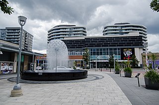
Don Mills is a mixed-use neighbourhood in Toronto, Ontario, Canada. It was developed in the 1950s and 1960s to be a self-supporting "new town" and was at the time located outside Toronto proper in the suburb of North York. Consisting of residential, commercial and industrial sub-districts, it was planned and developed by private enterprise.

Riverdale is a large neighbourhood in Toronto, Ontario, Canada. It is bounded by the Don River Valley to the west, Danforth Avenue and Greektown to the north, Jones Avenue, the CN/GO tracks, Leslieville to the east, and Lake Shore Boulevard to the south.
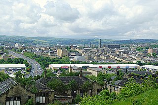
Manningham is an historically industrial workers area as well as a council ward of Bradford, West Yorkshire, England. The population of the 2011 Census for the Manningham Ward was 19,983.
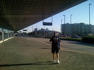
Bathurst Manor is a neighbourhood of Toronto, Ontario, Canada, located in northern Toronto in the former suburb of North York. It sits on a plateau bounded on the north by Finch Avenue West, on the west by Dufferin Street, on the east by the Don River, and on the south by Sheppard Avenue West. The area is also regarded as part of the Downsview postal area as designated by Canada Post. It is part of the former city of North York, which merged with five other municipalities and a regional government to form the new "City of Toronto" in 1998. It is part of the federal and provincial electoral district York Centre, and Toronto electoral ward 10: York Centre (East). In 2006, it had a population of 14,615.
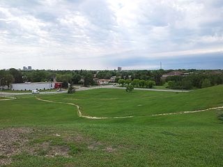
East Kildonan is a primarily residential community in northeast Winnipeg, Manitoba, Canada. Commonly known by its initials EK, the suburb has a population of approximately 35,800 as of the 2016 Census.
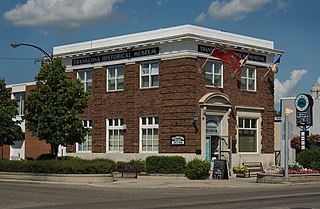
Transcona is a ward and suburb of Winnipeg, Manitoba, located about 10 kilometres (6.2 mi) east of the downtown area.

Tuxedo is a residential suburb of Winnipeg, Manitoba. It is located about 7 kilometres southwest of downtown Winnipeg and borders the Assiniboine River and Assiniboine Park on the north, Shaftesbury Boulevard on the west, Route 90 to the East and McGillvary Boulevard to the South. Prior to 1972, the community was incorporated as the Town of Tuxedo.
Old Kildonan is the northernmost city ward of Winnipeg, Manitoba. Before the City of Winnipeg Act of 1972, it was an independent unincorporated municipality called the Municipality of Old Kildonan; prior to that, from 1914, it was a subdivision of the Rural Municipality of Kildonan.
St. Vital is a ward and neighbourhood of Winnipeg, Manitoba, Canada.
River Heights is a suburb and community area in Winnipeg, Manitoba. It is bordered by Route 90 to the west, the Assiniboine River to the north, Cambridge Street to the east, and Taylor Avenue to the south.
West Kildonan is a residential suburb within the Old Kildonan and Mynarski city wards of Winnipeg, Manitoba, lying on the west side of the Red River, and immediately north of the old City of Winnipeg in the north-central part of the city.

Oakridge is a neighbourhood in Vancouver, British Columbia, Canada, with a multicultural residential and commercial area. It had a population of 13,030 in 2016, of which approximately 50 percent have Chinese as their mother tongue.

Winnipeg's North End is a large urban area located to the north and northwest of Downtown Winnipeg. It is bordered by the Red River on the east, the Canadian Pacific Railway (CPR) mainline on the south, the City of Winnipeg boundary on the west and Jefferson Avenue, Keewatin Street, Carruthers Avenue, McGregor Street and the lane between McAdam and Smithfield Avenues on the north. It is the northern section of the City of Winnipeg as it existed prior to the 1972 municipal amalgamation. Winnipeg's northern suburbs such as West Kildonan and Old Kildonan are not considered part of the North End. The CPR mainline and its Winnipeg yards, which are one of the largest railway yards in the world, act as a physical barrier between the North End and the rest of Winnipeg to the south. This has resulted in the North End remaining a very distinct and unique part of Winnipeg.
Seven Oaks School Division is a school division in the north-west area of Winnipeg, Manitoba in Canada. Established in July 1959, it takes in the Winnipeg neighbourhoods of West Kildonan, Garden City, the Maples, Riverbend, and Amber Trails, as well as the Rural Municipality of West St. Paul.
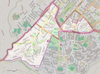
Gardens is an affluent inner-city suburb of Cape Town located just to the south of the city centre located in the higher elevations of the "City Bowl" and directly beneath Table Mountain and Lion's Head. It is home to several national museums such as Iziko South African National Gallery and the Iziko South African Museum. The University of Cape Town also houses its Fine Arts department in the suburb, at Michaelis School of Fine Art. Company's Garden, South Africa's oldest garden, a public park and heritage site is a focal point of the suburb. The area is also home to the oldest synagogue in Southern Africa, the Old Shul and its successor, the Gardens Shul, "The Mother Synagogue of South Africa."
The history of the Jews in Vancouver in British Columbia, Canada has been noted since the mid-19th century.

Central Park is a large urban park located in downtown Winnipeg, and forms the heart of the neighbourhood of the same name.
Winnipeg, Manitoba, is subdivided in different ways for different purposes. The suburbs and neighbourhoods of Winnipeg take their names from former administrative districts, parishes, and geographic features.


