Related Research Articles
Hennepin County is a county in the U.S. state of Minnesota. Its county seat is Minneapolis, the state's most populous city. The county is named for the 17th-century explorer Louis Hennepin. It extends from Minneapolis to the suburbs and outlying cities in the western part of the county. Its natural areas are covered by extensive woods, hills, and lakes.
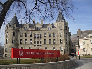
Winnipeg is the capital and largest city of the province of Manitoba in Canada. It is centred on the confluence of the Red and Assiniboine rivers, near the longitudinal centre of North America. As of 2021, Winnipeg had a city population of 749,607 and a metropolitan population of 834,678, making it Canada's sixth-largest city and eighth-largest metropolitan area.

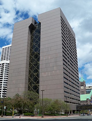
Minnetonka is a city in Hennepin County, Minnesota, United States. A western suburb of the Twin Cities, Minnetonka is located about 10 miles (16 km) west of downtown Minneapolis. At the 2020 census, the city's population was 53,781.

St-Boniface is a city ward and neighbourhood in Winnipeg. Along with being the centre of the Franco-Manitoban community, it ranks as the largest francophone community in Western Canada.
East Kildonan is a primarily residential community in northeast Winnipeg, Manitoba, Canada. Commonly known by its initials EK, the suburb has a population of approximately 35,800 as of the 2016 Census.
St. Andrews is a rural municipality (RM) in Manitoba, Canada. It lies west of the Red River; its southern border is approximately 8 kilometres (5.0 mi) north of Winnipeg.
St. Vital is a ward and neighbourhood of Winnipeg, Manitoba, Canada.
River Heights is a suburb and community area in Winnipeg, Manitoba. It is bordered by Route 90 to the west, the Assiniboine River to the north, Cambridge Street to the east, and Taylor Avenue to the south.

Fort Rouge is a district of Winnipeg, Manitoba, in Canada. Located in the south-central part of the city, it is bounded on the north by the Assiniboine River, on the east and south by the Red River, and on the west by Stafford Street and Pembina Highway.
North Kildonan is a city ward in northern Winnipeg, and a former municipality in Manitoba, Canada. Its population as of 2016 was 44,664.

St. James-Assiniboia is a major community area in Winnipeg, Manitoba, Canada. As it encapsulates most of the city ward of St. James, which includes the major St. James Street, the area itself is often simply referred to "St. James."

Downtown Winnipeg is an area of Winnipeg located near the confluence of the Red and Assiniboine rivers. It is the oldest urban area in Winnipeg, and is home to the city's commercial core, city hall, the seat of Manitoba's provincial government, and a number of major attractions and institutions.

St. Norbert is a bilingual neighbourhood and the southernmost suburb of Winnipeg, Manitoba, Canada. While outside the Perimeter Highway, it is still part of the city. As of the 2016 Census, the population of St. Norbert is 5,850.

Lorette is a local urban district in the Rural Municipality of Taché, located 25 km southeast of Winnipeg, in the province of Manitoba, Canada.
Elm Park is a neighbourhood in the city of Winnipeg, Manitoba, Canada. Located in the northern section of the district of St. Vital, it is bounded to the north by the Red River, to the east by St. Mary's Road, to the south by Fermor Avenue, and to the west by Dunkirk Drive. As of the 2021 census, Elm Park had a population of 1,435.

Route 52 is a major north-south arterial route in Winnipeg, Manitoba, Canada. It comprises all of Main Street, Queen Elizabeth Way, and St. Mary's Road.

Varennes is a neighbourhood in the city of Winnipeg, Manitoba, Canada, located in the northern section of the district of St. Vital. It is a small triangular neighbourhood located, and is bounded by St. Mary's Road on the west, Fermor Avenue on the south, and St. Anne's Road on the east. In the 2001 census, Varennes had a population of 1,080.

Glenwood is a neighbourhood in the city of Winnipeg, Manitoba, Canada, located in the northern section of the district of St. Vital.
Winnipeg, Manitoba, is subdivided in different ways for different purposes. The suburbs and neighbourhoods of Winnipeg take their names from former administrative districts, parishes, and geographic features.
References
- ↑ "2016 Census Data - Minnetonka" (PDF). City of Winnipeg. July 24, 2019.
- ↑ Sherlock's Map of Winnipeg and Surrounding Areas, vol. Map 31, ISBN 978-1-895229-67-7
- ↑ History of St. Amant. Accessed October 8, 2009.
| | This Manitoba location article is a stub. You can help Wikipedia by expanding it. |