Related Research Articles

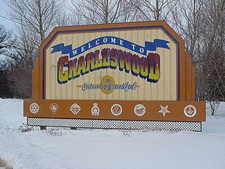
Charleswood is a residential community and neighbourhood in Winnipeg, Manitoba, Canada. Situated in the southwest of the city, it is bordered by the neighbourhoods of Tuxedo to the east, Whyte Ridge to the south, and the Rural Municipality of Headingley to the west. The area's boundaries are defined by Roblin Boulevard and the Assiniboine River to the north, Shaftesbury Boulevard to the east, Wilkes Avenue to the south, and the Perimeter Highway to the west.
The Winnipeg City Council is the governing body of the city of Winnipeg, Manitoba, Canada. The Council is seated in the Council Building of Winnipeg City Hall.

Elmwood—Transcona is a federal electoral district in Manitoba, Canada, that has been represented in the House of Commons of Canada since 1988. Its population in 2021 was 101,691.

The Winnipeg Metropolitan Region is a metropolitan area in the Canadian province of Manitoba located in the Red River Valley in the southeast portion of the province of Manitoba, Canada. It contains the provincial capital of Winnipeg and 17 surrounding rural municipalities, cities, and towns.

Transcona is a ward and suburb of Winnipeg, Manitoba, located about 10 kilometres (6.2 mi) east of the downtown area.
This is page shows results of Canadian federal elections in the Winnipeg area.
Old Kildonan is the northernmost city ward of Winnipeg, Manitoba. Before the City of Winnipeg Act of 1972, it was an independent unincorporated municipality called the Municipality of Old Kildonan; prior to that, from 1914, it was a subdivision of the Rural Municipality of Kildonan.
St. Vital is a ward and neighbourhood of Winnipeg, Manitoba, Canada.
The amalgamation of Winnipeg, Manitoba was the municipal incorporation of the old City of Winnipeg, eleven surrounding municipalities, and the Metropolitan Corporation of Greater Winnipeg (Metro) into one.
West Kildonan is a residential suburb within the Old Kildonan and Mynarski city wards of Winnipeg, Manitoba, lying on the west side of the Red River of the North, and immediately north of the old City of Winnipeg in the north-central part of the city.
North Kildonan is a city ward located in northern Winnipeg, Manitoba, Canada. It was previously a separate municipality before being amalgamated into Winnipeg. As of the 2016 census, the population of North Kildonan was 44,664.

St. James-Assiniboia is a major community area in Winnipeg, Manitoba, Canada. As it encapsulates most of the city ward of St. James, which includes the major St. James Street, the area itself is often simply referred to "St. James."
The municipal government of Winnipeg is represented by 15 city councillors and a mayor elected every four years.
Roblin Park is one of the original neighbourhoods of the Charleswood community in Winnipeg, Manitoba, Canada. It is bounded by Roblin Boulevard to the North, Hartestone Road to the East, bisects the Harte Trail to the south and Scotswood Drive to the West.
Marlton is one of the original neighbourhoods in the area of Charleswood in Winnipeg, Manitoba. It is bordered by Roblin Boulevard, bisects Tom Chester park to the east and Grant Avenue to the south.
Vialoux is a residential suburban neighbourhood in Charleswood, Winnipeg. It is bordered by the Assiniboine River to the North, Assiniboine Park to the East, Roblin Boulevard to the South, and the Charleswood Parkway to the West.
Old Tuxedo is an affluent residential suburban neighbourhood in Tuxedo, Winnipeg. It is bounded by the Assiniboine River to the North, Park Boulevard N to the west, Tuxedo Avenue and Roblin Boulevard to the south and Route 90 to the east.
References
- ↑ City Clerk. "Committees of Council - City Council". City of Winnipeg. Retrieved 2021-06-15.
- ↑ Winnipeg Council. "Electoral Wards". City of Winnipeg. Retrieved 2021-06-15.
- ↑ Winnipeg Wards Boundaries Commission. 2017 December. "2017 Winnipeg Wards Boundaries Commission: Balancing for Future Growth" (Final Report). City of Winnipeg.
- ↑ Winnipeg, City of. "The 2017 Winnipeg Wards Boundaries Commission - City Clerk's Department - City of Winnipeg". winnipeg.ca. Retrieved 2021-06-15.
- ↑ "Committees of Council | City of Winnipeg" (PDF). winnipeg.ca. Retrieved 2024-12-15.
- 1 2 "City Clerk's eGovernment".
- ↑ "City Clerk's eGovernment".
- ↑ "City Clerk's eGovernment".
- 1 2 3 4 "Concept: Neighbourhood Clusters (NC)." Manitoba Centre for Health Policy . 2008 December 19.
- 1 2 "Concept: Community Centre Areas (CCAs)." Manitoba Centre for Health Policy . 2012 July 31.
- 1 2 3 "Community Area Profiles - 2016 Census". City of Winnipeg. Retrieved 2021-06-15.
- 1 2 "Neighbourhood Cluster Profiles - 2016 Census - Census - City of Winnipeg".
- ↑ "Neighbourhood Cluster Profiles - 2006 Census - Census - City of Winnipeg".
- ↑ "Winnipeg.ca (UD) : 2016 Census". winnipeg.ca. Retrieved 2024-12-15.
- ↑ "Winnipeg.ca (UD) : 2016 Census". winnipeg.ca. Retrieved 2024-12-15.
- ↑ "Winnipeg.ca (UD) : 2016 Census". winnipeg.ca. Retrieved 2024-12-15.
- ↑ "Winnipeg.ca (UD) : 2016 Census". winnipeg.ca. Retrieved 2024-12-15.
- ↑ "Winnipeg.ca (UD) : 2016 Census". winnipeg.ca. Retrieved 2024-12-15.
- ↑ "Winnipeg.ca (UD) : 2016 Census". winnipeg.ca. Retrieved 2024-12-15.
- ↑ "Winnipeg.ca (UD) : 2016 Census". winnipeg.ca. Retrieved 2024-12-15.
- ↑ "Winnipeg.ca (UD) : 2016 Census". winnipeg.ca. Retrieved 2024-12-15.
- ↑ "Winnipeg.ca (UD) : 2016 Census". winnipeg.ca. Retrieved 2024-12-15.
- ↑ "Winnipeg.ca (UD) : 2016 Census". winnipeg.ca. Retrieved 2024-12-15.
- ↑ "Winnipeg.ca (UD) : 2016 Census". winnipeg.ca. Retrieved 2024-12-15.
- ↑ "Winnipeg.ca (UD) : 2016 Census". winnipeg.ca. Retrieved 2024-12-15.
- ↑ "Winnipeg.ca (UD) : 2016 Census". winnipeg.ca. Retrieved 2024-12-15.
- ↑ "City of Winnipeg - UD : 2006 Election Candidate Ward Maps". Archived from the original on 2011-01-30. Retrieved 2011-01-26.