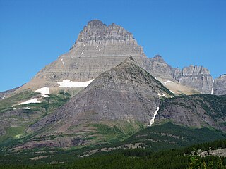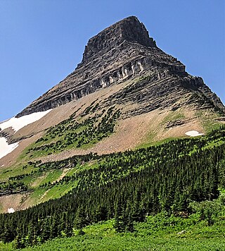
Heavens Peak is located in the Livingston Range, Glacier National Park in the U.S. state of Montana. Heavens Peak is a little more than 1 mile (1.6 km) north of McPartland Mountain. The mountain's descriptive name first appeared on a map prepared by Lt. George P. Ahern, from 1888 to 1890 reconnaissance maps prepared by him. This geographical feature's name was officially adopted in 1929 by the United States Board on Geographic Names.

Mount Wilbur is located in the Lewis Range, Glacier National Park in the U.S. state of Montana. Plainly visible from the region of Many Glacier, the peak rises over 4,500 feet (1,372 m) above Swiftcurrent Lake and is a steep pyramid on three sides. The west slopes of the peak join to ridges along the continental divide. Much of the climbing routes are rated at class 4 to 5, with some only used once. The sedimentary rock of the mountains makes for often poor anchoring points and enhances the difficulty. A cirque on the north slopes of the mountain shelters Iceberg Lake, a popular hiking destination from Many Glacier. The mountain was named by George Bird Grinnell in 1885, for Edward R. Wilbur of New York, one of Grinnell's partners in the Forest and Stream Publishing Company, and both men were founders of the Audubon Society.

Bear Mountain is located in the northern Lewis Range, Glacier National Park in the U.S. state of Montana. Cosley Lake, followed by Glenns Lake to the southwest of the mountain. Mokowanis Lake is also visible from the peak. The mountain has tremendous views of the east face of Mount Cleveland, the north face of Mount Merritt, and the east face of Chief Mountain.

Ipasha Peak is located in the Lewis Range, Glacier National Park in the U.S. state of Montana. Ipasha Peak is 1.29 miles (2.08 km) south of Mount Merritt and is in the northeastern section of Glacier National Park. Ahern Glacier is located on the southeastern slopes of the mountain while the Ipasha Glacier is to the southwest of the peak. Helen Lake lies almost 4,500 feet (1,400 m) below the summit of Ipasha Peak to the southeast.

Kootenai Peak is located in the Lewis Range, Glacier National Park in the U.S. state of Montana. Kootenai Peak is in the northeastern section of Glacier National Park.

Mount Henkel is located in the Lewis Range, Glacier National Park in the U.S. state of Montana. Kennedy Lake is just to the north of the mountain.

Norris Mountain is located in the Lewis Range, Glacier National Park in the U.S. state of Montana. Norris Mountain is situated along the Continental Divide; it is the parent of Triple Divide Peak—the point at which North America's Arctic, Atlantic, and Pacific drainage basins converge—located 0.8 miles (1.3 km) east-southeast.

Pollock Mountain is located in the Lewis Range, Glacier National Park in the U.S. state of Montana. Pollock Mountain is situated along the Continental Divide and is one of the peaks along the Garden Wall and is approximately .6 miles (0.97 km) south of Bishops Cap. The mountain was named by Ross Carter for William C. Pollock, a member of the Indian Commission who along with Walter M. Clements and George Bird Grinnell negotiated with the Blackfeet to consummate the treaty that enabled the Federal Government to purchase the "Ceded Strip" of land, which included all of what is now Glacier National Park to the east of the Continental Divide.

Wahcheechee Mountain is located in the Lewis Range, Glacier National Park in the U.S. state of Montana. Stoney Indian Lake is just northeast of the peak.

Battlement Mountain is located in the Lewis Range, Glacier National Park in the U.S. state of Montana. Lake Isabel is northeast of the peak.

Boulder Peak is located in the Livingston Range, Glacier National Park in the U.S. state of Montana. The remnant Boulder Glacier is situated on the northern slopes of the mountain.

Caper Peak is located in the Lewis Range, Glacier National Park in the U.S. state of Montana. Caper Peak is approximately 1.4 miles (2.3 km) NNW of Vigil Peak. Richard T. Evans, USGS topographer who worked on the early map of Glacier Park, named this mountain when he counted over 30 goats "capering" on this peak.

Chapman Peak is located in the Livingston Range, Glacier National Park in the U.S. state of Montana. Chapman Peak is situated along the Continental Divide. The mountain is named for Robert H. Chapman, one of the US Geological Survey topographers who worked on mapping Glacier Park between 1900 and 1904.

Mount Custer is a mountain in the Livingston Range, Glacier National Park in the U.S. state of Montana. Situated along the Continental Divide, Mount Custer rises more than 3,300 feet (1,000 m) above Lake Nooney, located below the summit to the east. Herbst Glacier is immediately northeast of the peak. The mountain is probably named for George Armstrong Custer, of Custer's Last Stand.

The Guardhouse is located in the Livingston Range, Glacier National Park in the U.S. state of Montana. The Guardhouse is situated on the Continental Divide.

Olson Mountain, also known as Mount Olson, is a 7,913-foot-elevation mountain summit located in the Livingston Range, of Glacier National Park in the U.S. state of Montana. Olson Mountain rises more than 3,700 feet (1,100 m) above the western shore of Waterton Lake. The mountain was named for a surveyor on the International Boundary Survey, with the name officially adopted in 1929. The nearest higher peak is Campbell Mountain, 1.13 miles (1.82 km) to the north, and Citadel Peaks is two miles to the south. Precipitation runoff from the mountain drains into Olson Creek before it empties to Waterton Lake.

Stanton Mountain is a 7,750 feet (2,360 m) mountain summit located in the Livingston Range, of Glacier National Park in the U.S. state of Montana. Stanton Mountain rises more than 4,500 feet (1,400 m) above the northern shore of Lake McDonald. The mountain's name refers to Mrs. Lottie Stanton who lived near the west side of the park in the late 1800s, and with her husband operated a livery stable in historic Demersville. She was a pioneering woman who followed the construction camps during the railroad building days. The mountain's name was officially adopted in 1929. In the late 1800s it was known as Mt. Lottie Stanton. The nearest higher peak is Mount Vaught, 1.38 miles (2.22 km) to the northeast. Precipitation runoff from the mountain drains into tributaries of the Flathead River.

Haystack Butte is a 7,486-foot-elevation (2,282-meter) summit located in the Lewis Range, of Glacier National Park in the U.S. state of Montana. It is situated one mile west of the Continental Divide, in Flathead County, above the Weeping Wall on its south slope. Topographic relief is significant as the west aspect rises 3,900 feet above McDonald Creek in less than 1.5 mile. It can be seen from Logan Pass, and from Going-to-the-Sun Road which traverses the west and south slopes of the peak. The nearest higher neighbor is Mount Gould, 1.07 miles (1.72 km) to the northeast. Climbing access is via the Highline Trail. This geographical feature's descriptive name was on maps as early as 1904, and was officially adopted March 6, 1929, by the United States Board on Geographic Names

Clyde Peak is an 8,610-foot-elevation (2,620-meter) mountain summit located in Glacier National Park in the U.S. state of Montana. The mountain straddles the border shared by Flathead County and Glacier County. It is situated on the Continental Divide so precipitation runoff from the west side of the mountain drains into Thompson Creek which is part of the Middle Fork Flathead River watershed, and the east side drains into headwaters of Red Eagle Creek, which flows to Red Eagle Lake, thence Saint Mary Lake. It is set in the Lewis Range, and the nearest higher neighbor is Mount Logan 1.44 mile to the northwest. Topographic relief is significant as the southwest aspect rises approximately 4,000 feet in one mile.

Pentagon Mountain is an 8,873-foot (2,704-metre) mountain summit located in Flathead County of the U.S. state of Montana.


