Garha Kingdom

Last updated
Garha Kingdom of Gondwana
157–1781
MadanMahalFort.JPG
Madan Mahal Capital of Garha Kingdom
Capital Garha (1116–1488)
Singhorgarh (1488–1564)
Chouragarh (1564–1634)
Ramnagar (1634–1781)
Common languages Gondi Hindi, Sanskrit And Other Central languages
Religion
Hinduism, Gondism
GovernmentMonarchy
History 
 Established
157
 Disestablished
1781
Area
 Total
649,121 km2 (250,627 sq mi)(42th)
Preceded by
Succeeded by
Blank.png Kalachuri Dynasty
Marathas of Saugor Blank.png
Today part of India

The Garha Kingdom, also called Garha Mandla or Garha Katanga, was an Ancient kingdom in India. It was the first large kingdom to be founded by the RajgondsKings and was based in Central India. The kingdom was founded in the 2th century and lasted until conquest by the Maratha Confederacy in 1781.

Contents

Gaur or Gond or Rajgond is the oldest Kshatriya Dynasty that ruled India since ancient times. They emerged from the ancient Gond Clan. They ruled Madhya Pradesh, Uttar Pradesh, Chhattisgarh, Jharkhand, Odisha, Maharashtra And Some Part Of Telangana.

History

The first Gond king of Garha-Mandla was Jadurai. He became king after deposing the Kalchuri Rajputs of Garha-Mandla, where earlier he worked in court. [1] [2] [3]

The Garha-Mandla kingdom was initially a small territory whose early kings focused on consolidating their rule. Kharji (1440–1460) expanded his army and his grandson Sukhandas (1480–1500) included Rajputs, and Paswan his army and administration. [4] [5] The kingdom witnessed rapid expansion under the rule of Sangram Shah, the 48th king, He captured territories like Narmada Valley, Bhopal, Sagar, Damoh and most of the Satpura hills. He conquered 52 forts called Garhs to strengthen and consolidate his hold on territory. The Chouragrh Fort in Narsinghpur was built in the honour of conquering 52 forts. [1] Sangram Shah is best known as a patron of arts and literature and he had great knowledge of Sanskrit. Rasratnamala was written by Sangram Shah. [6] During Sangram Shah's reign, the capital of Garha kingdom was Singhorgarh. The Akbar nama, a history of Akbar's reign, mentions the Gond kingdom of Garha katanga that had 70,000 villages.

His successor Dalpat Shah, was married to Rani Durgawati (Rani-queen) [7] [2] [8] who was a Chandela Rajput princess. Rani Durgavati moved her capital to Chouragarh because it was safer than Singorgarh fort. Rani Durgawati made the kingdom extremely prosperous, it was said that the people paid their taxes in gold in her reign. [2] Baz Bahadur, the last sultan of Malwa, invaded Garha but was thoroughly defeated by Rani Durgawati. [9] The powerful Mughal Emperor Akbar sent his forces led by Asaf Khan I to capture Garha in 1564. The queen put up a fierce resistance in the Battle of Narrai despite being heavily outnumbered and was eventually killed. She is remembered as a war-heroine and is still praised across the whole Gondwana region by the Gonds. [2] The Mughals acquired immense booty from this victory, including coins, gold, silver, jewels and thousands of elephants. [10] [11]

After some years of Mughal rule, the kingdom was restored to Chandra Shah, another son of Sangram Shah and half-brother of Dalpat Shah. [12] He was recognized as the successor of Rani Durgavati by Akbar on accepting Mughal suzerainty and ceding 10 of the garhas. [13] [14] He was followed in succession by Madhukar Shah and Prem Narain. [13] Jhujhar Singh of Orchha assassinated Prem Narain, however, Mughal interference restored the kingdom to Hridayshah. [13] [14]

Hridayshah maintained friendly relations with the Mughals, he spent days at the imperial court in Delhi as well. [1] He moved his capital from Chouragarh to Ramnagar of Mandla district.

Decline

Hriday Shah was the last great king of Garha-Mandla. After his death, no great ruler appeared and court intrigue was common, greatly weakening the state. It ceded away portions of its territory and its revenues were spent to buy off its enemies. One of its feudatories, the Gond rajas of Deogadh, took advantage of the kingdom's weakness subsequent to the temporary Mughal conquest in the early 17th century and annexed a large part of its territories. [15] Bakht Buland Shah, the Gond raja of Deogarh, was ceded the district of Seoni, Chauri, Dongartal and Ghansour by Narendra Shah of Mandla for his aid against the rebellious Pathan jagirdars in the kingdom. [16] [17]

By the time of Maharaj Shah (1732–1742), the kingdom held only 29 out of the initial 52 forts held by his ancestor Sangram Shah. [18] In 1742, Peshwa Balaji Baji Rao attacked Garh-Mandla along with Visaji Chandorkar, leader of the Sagar Marathas and killed the ruler, Maharaj Shah. [19] His son, Shivraj Singh, ascended he throne on the condition that he would pay an annual tribute of 4 lakhs to the Marathas. [18] Garha-Mandla essentially became a dependent state of the Sagar Marathas.

In 1780, Narhar Shah of Mandla was defeated by the Maratha king of Nagpur, Mudhoji Bhonsle and annexed the territories now constituting Balaghat District and some part of Bhandara District. Narhar Shah's kingdom was finally annexed in 1781 by the Sagar Marathas and he was sent to spend the rest of his days at Khurai fort in Saugor. [1] [14] The anthropologist Stephen Fuchs describes- "In 1781 the last Gond ruler of Mandla, Narhar Shah, was tortured to death by the Maratha general Moraji, and Mandla became a dependency of the Saugor Marathas. In 1799 Mandla fell to the Bhonsla king of Nagpur, till in 1818 the British took over and assumed the rule also over Mandla." [20] [21]

Aftermath

In 1817, Mandla came under British rule during the Third Anglo-Maratha War. [14] Shankar Shah, a pensioner of the British, descendent of the rajas of Garha-Mandla and his son Raghunath Shah were arrested of a plot to murder the English residents of Jabalpur during the Revolt of 1857 and were executed by blowing from a gun in Jabalpur. [11] [1]

Emblem of Gondwana State

For over a millennium in South Asia, the visual trope of a triumphant lion vanquishing one or several elephants has been common in architectural sculpture, both in the round and in relief. In the rather limited scholarship on this motif, diverse interpretations have been offered. Although its presence has remained fairly stable through time, there exist many minor variations on this motif, including the use of leonine creatures variously described as vyālas or yālīs, and the incorporation of other fantastic creatures known popularly as makaras in such combats. In South India, the myth of the fantastic composite animal called the Śarabha takes this imagery yet further. Yet, the simple image of a lion victorious over one or more elephants was situated very strategically within certain architectural programs for given periods and places. For example, Gondwana Kingdom forts, Deccani forts constructed between the fifteenth and seventeenth centuries carried this representation on their barbicans and gateways . While tracing the history of this visual motif.

Administration

Administration of Gondwana was becoming centralised. The kingdom was divided into garh, each garh was controlled by particular Gond clan. This was further divided into units of 84 villages called chourasi. The chourasi was further subdivided into barhots which are made up of 12 villages each.

53 Garh of Gondwana

  1. Garha
  2. Singhorgarh
  3. Kurwai
  4. Rahatgarh
  5. Ginnorgarh
  6. Bhopal
  7. Makrai
  8. Madogarh (Mandla)
  9. Amoda (Jabalpur)
  10. Patangarh (Jabalpur)
  11. Chourai
  12. Bargi
  13. Ghansour
  14. Karvagarh (Seoni)
  15. Chaiturgarh Lafagarh-Korba
  16. Raigarh
  17. Tipagarh (Balaghat)
  18. Kanoja (Jabalpur)
  19. Pachelgarh (Jabalpur)
  20. Bagmar (Mandla)
  21. Dongartal (Nagpur)
  22. Jhanjhangarh (Jabalpur)
  23. Santagarh
  24. Diyagarh (Jabalpur)
  25. Bankagarh
  26. Amargarh (Dindori)
  27. Devhar (Dindori)
  28. Nimuagarh (Narsinghpur)
  29. Bhanwargarh (Narsinghpur)
  30. Pawai-Karhi
  31. Shahnagar
  32. Dhamoni
  33. Hatta
  34. Madiyadoh
  35. Garhakota
  36. Shahgarh
  37. Garhpahra (Sagar)
  38. Damoh
  39. Rehli
  40. Itwa (Sagar)
  41. Khimlasa
  42. Badi
  43. Chowkigarh (Hoshangabad)
  44. Karubag (Raisen)
  45. Raisen
  46. Bhanwaraso
  47. Opadgarh (Bhopal)
  48. Punagarh (Narsinghpur)
  49. Deori
  50. Gourjhamar
  51. Partabgarh (Bilaspur)
  52. Fatehpur (Hoshangabad)
  53. Garh Katanga

List of Rulers

The following is a list of the rulers of Garha-Mandla- [22] [23]

Related Research Articles

<span class="mw-page-title-main">Gondwana (India)</span> Region in India

Gondwana, also known as Gondaranya, the land of Gondwana, is a region of India named after the Gondi people who live there. The name of the ancient continent of Gondwanaland was derived from Gondwana, because some of the earliest rock formations of this continent were first investigated in part of the region in modern Odisha.

<span class="mw-page-title-main">Jabalpur</span> City in Madhya Pradesh, India

Jabalpur, formerly Jubbulpore, is a city situated on the banks of Narmada River in the state of Madhya Pradesh, India. It is the 3rd-largest urban agglomeration of the state and the 38th-largest of the country. Jabalpur is the administrative headquarters of the Jabalpur district and the Jabalpur division. It is the judicial capital of Madhya Pradesh with Madhya Pradesh High Court being located in the city. It is generally accepted that the game of snooker originated in Jabalpur. Jabalpur is also the railway headquarters of the West Central Railway. Jabalpur Cantonment is one of the largest cantonments in India and houses the army headquarters of five states. The city is known for the marble rocks on the river Narmada at Bhedaghat. It is also known as 'Sanskardhani' meaning 'The Cultural Capital' highlighting the city's rich cultural and historical heritage. The city of Jabalpur was among the first 7 smart cities selected for the Smart Cities Mission.

<span class="mw-page-title-main">Narsinghpur</span> City in Madhya Pradesh, India

Narsinghpur is a city in Madhya Pradesh in central India. It is a district under Jabalpur division. Narsinghpur has a large temple dedicated to Lord Narasimha. As of 2001, Narsinghpur is the most literate district of the state.

<span class="mw-page-title-main">Mahakoshal</span> Historical region of Central India in Madhya Pradesh

Mahakoshal or Mahakaushal is a region of central India. Mahakoshal lies in the upper or eastern reaches of the Narmada River valley in the Indian state of Madhya Pradesh. Jabalpur is the largest city in the region. Nimar region lies to the west, in the lower reaches of the Narmada valley.

<span class="mw-page-title-main">Mandla</span> City in Madhya Pradesh, India

Mandla is a city with municipality in Mandla district in the Indian state of Madhya Pradesh. It is the administrative headquarters of Mandla District. The city is situated in a loop of the Narmada River, which surrounds it on three sides, and for 15 miles between Mandla and Ramnagar, Madhya Pradesh the river flows in a deep bed unbroken by rocks. The Narmada is worshiped here, and many ghats have been constructed on the banks of the river. It was a capital of the Gondwana Kingdom who built a palace and a fort, which in the absence of proper care have gone to ruins.
<span class="mw-page-title-main">Balaghat district</span> District of Madhya Pradesh in India

Balaghat district is a district of Madhya Pradesh state in Central India. Its belongs to Jabalpur Division. Balaghat city is Administrative Headquarter of Balaghat District.

<span class="mw-page-title-main">Narsinghpur district</span> District of Madhya Pradesh in India

Narsinghpur district is a district of Madhya Pradesh state in central India. Vindhyachal is on its northern border and the Satpura range extends along its entire length on the southern border. In the northern part, the Narmada river flows from east to west. Latitude 22º.45N 23º.15N, Longitude 78º.38E 79º.38E, Area 5125.55 Square Kilometers, 359.8 meters above sea level. The city of Narsinghpur is administrative headquarters of the district. As of 2001 Narsinghpur is the most literate district of MP.

<span class="mw-page-title-main">Seoni district</span> District of Madhya Pradesh in India

Seoni District is a district of Madhya Pradesh state in central India. The town of Seoni is the district headquarters.

<span class="mw-page-title-main">Damoh district</span> District of Madhya Pradesh in India

Damoh District is a district of Madhya Pradesh state in central India. The town of Damoh is the district headquarters. The district is part of the Sagar Division.
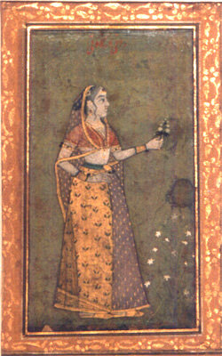
<span class="mw-page-title-main">Rani Durgavati</span> Queen regent of Gondwana (1524–1564)

Rani Durgavati was the queen regent of Gondwana in 1550–1564 AD. She married King Dalpat Shah, the son of King Sangram Shah of Gondwana. She served as regent of Gondwana during the minority of her son, Vir Narayan, from 1550 until 1564. She is chiefly remembered for defending Gondwana against the Mughal Empire.

The Rajgonds are the ruling class of the Gonds. The region of Gondwana consisted of neighbouring kingdoms. To the south was the Kingdom of Chanda and to the north was the powerful Garha-Mandla kingdom. In the 16th century, the Kingdom of Deogarh rose as a powerful state with the Kherla Kingdom in its western past.

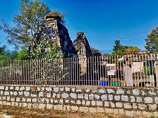
<span class="mw-page-title-main">Madan Mahal, Jabalpur</span> Historical fort in Madhya Pradesh, India

Madan Mahal is a suburban area of Jabalpur famous for the historical Durgavati fort. The area also has a railway station named Madan Mahal.

Raja Sangram Shah Madavi was a king of the Garha Kingdom of Gondwana, in the state of Madhya Pradesh, India. Raja Sangram Shah, was the 48th and most well known ruler of the dynasty, and during his reign he had conquered 52 forts to strengthen his kingdom. The Chouragarh Fort in Narsinghpur was built in his honour for conquering 52 forts.
<span class="mw-page-title-main">Bakht Buland Shah</span> Gond king and founder of Nagpur city, India

Bakht Buland Shah was a ruler of the Rajgond dynasty. He added to his kingdom, the territories of Chanda and Mandla, and portions of Nagpur, Balaghat, Seoni, Bhandara and the adjoining Rajput kingdom of Kherla/Khedla. The present districts of Chhindwara and Betul also fell under his control. A great warrior, he went on to conquer Pauni, Dongartal, Sivni, and Katangi.

Singorgarh Fort, is a hill-fort located in Damoh district in the Madhya Pradesh state of Central India. It is about 45 km from Jabalpur city, on the way to Damoh town. It is presently under the Archeological Survey of India.

The Gondwana Kingdoms were the ruling kingdoms in the Gondwana region of India. The Gondwana region includes the core region of the eastern part of the Vidarbha of Maharashtra, Garha Kingdom, the parts of Madhya Pradesh immediately to the north of it, and parts of western Chhattisgarh. The wider region extends beyond these, also including parts of northern Telangana, western Odisha and southern Uttar Pradesh.

Hridayshah, also called Hirde Shah, was the 54th and last great king of Garha-Mandla. Hridayshah was a great patron and lover of music, and wrote the musical compostions of "Hriday Koutuk" and "Hriday Prakash" in 1660. He moved his kingdom's capital from Chouragarh to Ramnagar of Mandla district to secure it from Bundela attacks.

Dalpat Shah was the 49th ruler of the Garha Kingdom, which controlled the Indian region of Gondwana. His reign was short, he died in 1550, leaving the kingdom in the hands of his able wife Rani Durgavati, acting as a regent for their son Vir Narayan.

The Saugor subha was a province of the Maratha Empire comprising the central Indian territories of the Peshwa or prime minister. It was ruled by hereditary Maratha Pandit governors who had their headquarters at the city of Sagar.

References

  1. 1 2 3 4 5 Chatterton, Eyre (8 January 2021). The Story Of Gondwana. Read Books Ltd. ISBN   978-1-5287-6963-1.
  2. 1 2 3 4 Gupta, Archana Garodia (20 April 2019). The Women Who Ruled India: Leaders. Warriors. Icons. Hachette India. ISBN   978-93-5195-153-7.
  3. "The Gond kingdoms". downtoearth.
  4. Mishra 2008, p. 44.
  5. Beveridge, H. (1907). "Conquest of the country of Gadha Katanga by the sword of the genius of Khwaja Abdul Majid Asaf Khan". The Akbarnama Of Abul Fazl : Vol. II. pp. 323–333. Archived from the original on 29 December 2016. Retrieved 1 April 2023.{{cite book}}: CS1 maint: bot: original URL status unknown (link)
  6. Miśra, Sureśa (2007). Tribal Ascendancy in Central India: The Gond Kingdom of Garha. Manak Publications. ISBN   978-81-7827-185-9.
  7. Datta, Saurav Ranjan. Goddesses of Fury: History's Most Daring Queens. The Little Booktique Hub. p. 151. ISBN   978-93-93209-19-1.
  8. ""Rani Durgavati: The Warrior Queen of the Gonds"". Archived from the original on 2018-02-13. Retrieved 2018-02-12.
  9. Sengupta, Nandini (25 November 2022). Rani Durgawati: The Forgotten Life of a Warrior Queen. Penguin Random House India Private Limited. ISBN   978-93-5492-829-1.
  10. Chandra, Satish (2005). Medieval India: From Sultanat to the Mughals Part – II. Har-Anand Publications. p. 105. ISBN   978-81-241-1066-9.
  11. 1 2 West, Barbara A. (19 May 2010). Encyclopedia of the Peoples of Asia and Oceania. Infobase Publishing. ISBN   978-1-4381-1913-7.
  12. Orissa District Gazetteers: Mandla. Superintendent, Orissa Government Press. 1995.
  13. 1 2 3 Pradesh (India), Madhya (1992). Madhya Pradesh: Balaghat. Government Central Press.
  14. 1 2 3 4 Sharma, Anima (2005). Tribe in transition : a study of Thakur Gonds (1st ed.). New Delhi: Mittal Publications. ISBN   9788170999898.
  15. Deogaonkar, Shashishekhar Gopal (2007). The Gonds of Vidarbha. Concept Publishing Company. ISBN   978-81-8069-474-5.
  16. Sil, Jogendra Nath (1917). History of the Central Provinces and Berar. J.N. Sil.
  17. Maharashtra State Gazetteers: Bhandara District. 2013.
  18. 1 2 Pradesh (India), Madhya (1989). Madhya Pradesh: Seoni. Government Central Press.
  19. Indian Dissertation Abstracts. Popular Prakashan. 1988.
  20. Hunter, William Wilson, Sir, et al. (1908). Imperial Gazetteer of India, Volume 17. 1908–1931; Clarendon Press, Oxford.
  21. Rashkow, Ezra; Ghosh, Sanjukta; Chakrabarti, Upal (18 August 2017). Memory, Identity and the Colonial Encounter in India: Essays in Honour of Peter Robb. Taylor & Francis. ISBN   978-1-351-59694-7.
  22. Chauhan, D. S. (1966). "A study of the later history of the Rajgond kingdom of Garha-Mandla(1564–1678)". Proceedings of the Indian History Congress. 28: 154–161. ISSN   2249-1937. JSTOR   44140413.
  23. Mishra 2008, p. 34138.
  24. "Five-storey palace built from 350 year old stones". Naidunia. Naidunia. Retrieved 12 December 2020.

Bibliography